PHOTOGRAMMETRIC ENGINEERING & REMOTE SENSING
September 2014
829
It is a rainy weekend afternoon in an urban city. Rain showers
are forecasted to end within the hour. The county 911 center
receives a call about security alarms activated at multiple
locations throughout the corporate campus on the edge of the
city. Additional calls are received by 911 and the incident
elevates to a need for SWAT to deploy to the campus.
The SWAT personnel carrier has a safe drive for the seven
mile transit from the City Emergency Management Center to
the campus as it is utilizing the latest in LiDAR technology.
This tactical vehicle has 3 Quanergy (twitter: @quanergy) 3D
time-of-flight LiDAR sensors mounted on the rear and on top
of the A pillars (or alternatively near each headlight). The
Quanergy system in use will be helping the driver to stay
focused as it will provide a continuous situational awareness
for 300 meters around the vehicle.
The future is here for 21st century LiDAR appl icat ions
In a recent conversation with Louay Eldada (CEO and co-
founder of Quanergy), he explained their LiDAR sensors were
developed to create a smaller footprint on the vehicle at an
affordable cost while providing great performance for the end
user. They feature an accuracy of 1.5cm (at 1 sigma) at 100
meters. With a 360 degree field of view, the sensor captures 30 full
frames per second, collecting a LiDAR point cloud of one million
points per second. In this tactical vehicle deployment scenario,
the Quanergy high speed sensors allow the driver to stay aware
of the rapidly changing terrain with unknown obstacles.
The sensors used on the SWAT vehicle communicate with a
Phase 2 Active System. This is an advanced driver assistance
system (ADAS) that uses both passive analysis and driver
assistance. This means that if the driver does not respond by
steering/braking/accelerating based on the type of situation
alarm, then the vehicle will perform the required action.
As the three sensors are continuously collecting full waveform
laser pulse returns during travel, the on-board vehicle software
by Quanergy is analyzing the data in real-time. Algorithms
identify objects by shape and size. The algorithms further
analyze the envelope of the object and make decisions about
its physical nature. The full waveform type of sensor provides
the software the ability to decipher the object, whether it is
a solid or an aerosol. In the case
of the tactical officer driving in
the rain, the software will ignore
rain drops as they will translate
as a broadening or dispersion
signature in reflected pulses.
In
our
tactical
team
deployment
scenario,
the
onboard software will review
the surroundings by performing
object detection, tracking and
feature classification. The results
will provide the scenario analysis
algorithms with information
about whether the feature is a
car or a truck, a building, a curb
or some type of vegetation, like a
tree or bush, as well as bicyclists
or pedestrian traffic. The sensors
are also detecting all traffic
signage. With this constant and
massive ingest of features, the
scenario analysis process predicts
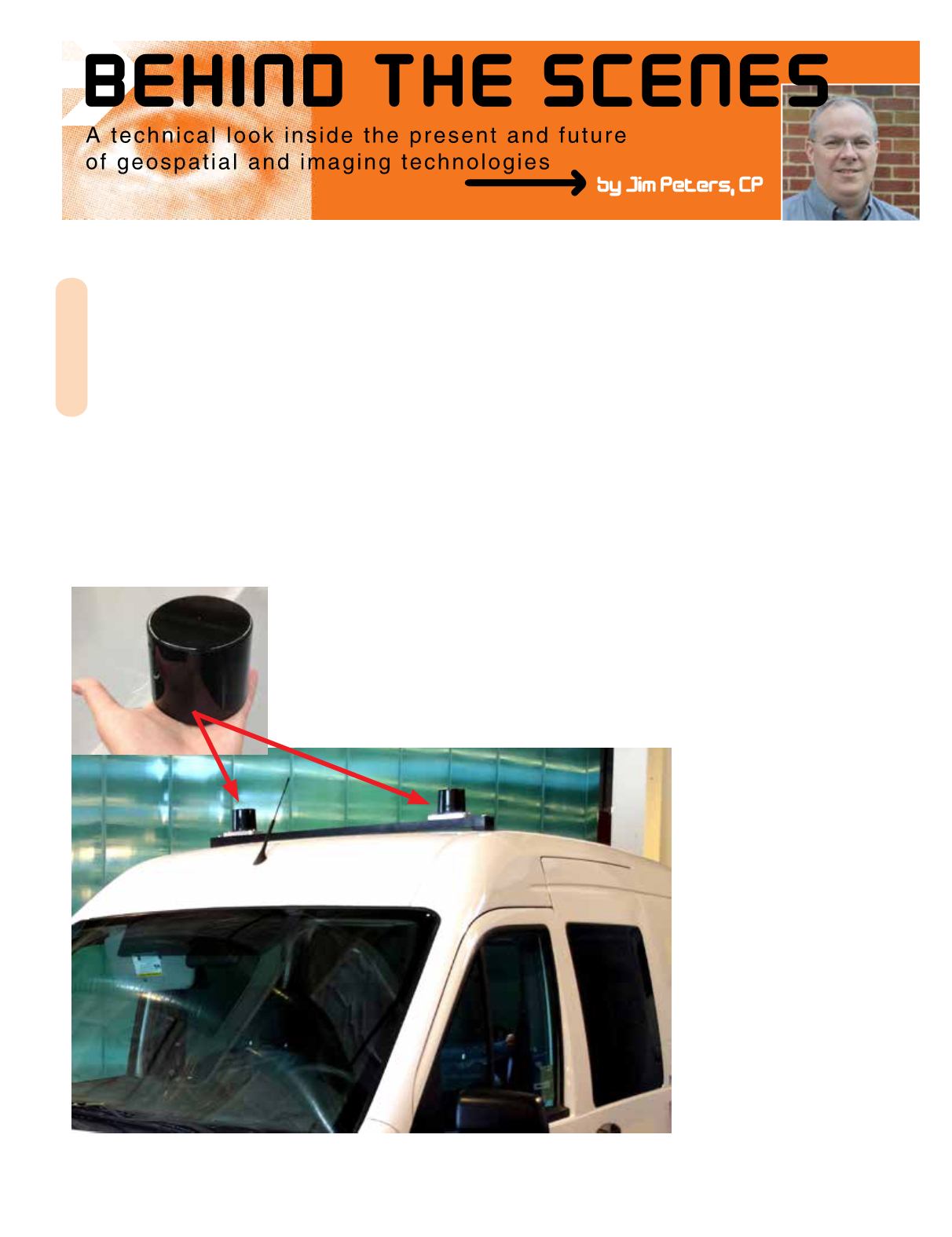
Figure 1. The small size of the
Quanergy Mark VIII LiDAR
Sensor, thus providing less
weight addition to the vehicle.
Figure 2. Two sensors mounted to the top of a van.


