6
January 2014
PHOTOGRAMMETRIC ENGINEERING & REMOTE SENSING
Radar
Traditional radar is essentially a
tracking system that measures: 1.)
the distance to an object based on
the time for a radar pulse traveling
at the speed of light to make a round
trip from the transmitter to the object
and back, and 2.) the object’s velocity
based on the Doppler shift of the
return signal. The distance to the
object, strength of the backscattered
signal, and Doppler shift are three
fundamental parameters measured
by tracking radars. Because of these
capabilities, tracking radars are
indispensable in modern air traffic
control and weather monitoring. For
example, tracking radars provide
meteorologists with the ability to peer
inside thunderstorms and determine
if there is rotation in the cloud, often
a precursor to the development of
tornadoes.
SAR
In the cross-track or range direction,
SARs organize return signals based
on their round-trip travel time.
Returns from near-range scatterers
arrive before returns from far-
range scatterers. In the along-track
or azimuth direction, the Doppler
principle comes into play. Signal
returns from scatterers that are
ahead of the radar as it travels
along its path are shifted to slightly
higher frequencies, and returns
from trailing areas are shifted to
slightly lower frequencies. Imaging
radars use the relationship between
return-signal frequency and relative
velocity between radar and target
to organize return signals in the
azimuth direction. In this way, each
return signal is tagged with specific
range and azimuth coordinates, and
a sequence of signals is assembled
into an image. Both intensity and
phase of the signal backscattered
from each ground resolution element
radar
noun
derived from “radio detection and ranging”. A radar system makes use of the
microwave portion of the electromagnetic spectrum to determine the range,
altitude, direction, or speed of objects.
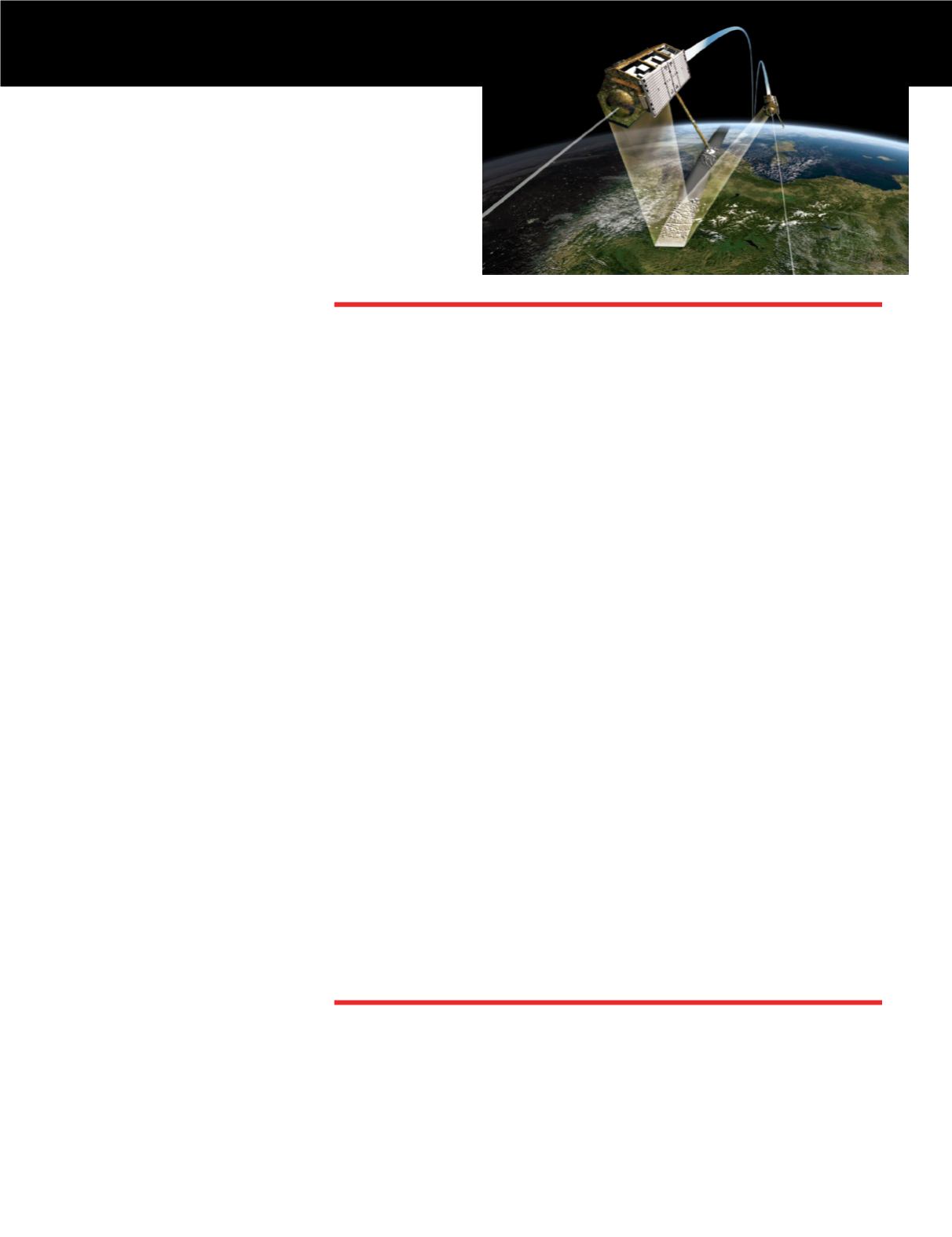
Artist rendition of
TanDEM-X mission
consisting of configu-
rated X-band radar
satellites (source:
DLR).
Synthetic aperture radar (SAR)
noun
that takes advantage of a radar antenna’s motion to simulate the performance
of a much larger antenna. SAR systems exploit long-range propagation
characteristics of radar signals and the complex information processing
capability of modern digital electronics to provide high-resolution imagery.
can be calculated and portrayed as
part of a SAR image. Intensity values
are indicative of the radar reflective
properties of the target (e.g., surface
slope, moisture content) and phase
values provide information about
surface topography.
InSAR
The antennas used to acquire SAR
images can be displaced in the
along-track or cross-track direction
to produce an along-track or across-
track InSAR image. An along-track
interferogram formed from two
SAR images acquired with a short
time lag can be used to measure the
velocity of targets moving toward or
away from the radar. Applications
include sea-ice drift, ocean currents,
river discharge, and ocean wave
parameters (e.g., Romeiser
et al
.,
2013). For cross-track InSAR, two
antennas can be mounted on a single
platform for simultaneous, single-
pass InSAR observation. This is the
ideal configuration for generating
high-resolution, precise digital
elevation models (DEMs) for large
regions. Alternatively, repeat-pass
InSAR images can be formed by using
a single antenna on an airborne or
spaceborne platform moving along
repeating, nearly identical flight
paths. In this case, even though
successive observations of the target
area are separated in time, the SAR
images will be highly correlated if
the backscattering properties of the
surface did not change in the interim.
In this way, InSAR is capable of
imaging ground-surface deformation
with sub-centimeter accuracy at a
spatial resolution of meters to tens of
meters over an image swath width of
a few tens of kilometers to hundreds
of kilometers. This is the typical
implementation for past and present
satellite SAR sensors (Table 1).
Typical InSAR processing
includes precise registration of an
interferometric SAR image pair,


