CityGML Implementation Specifications
for a Countrywide 3D Data Set:
The Case of The Netherlands
Jantien Stoter, George Vosselman, Christian Dahmen, Sander Oude Elberink, and Hugo Ledoux
Abstract
This paper discusses and presents the specifications of a
countrywide 3D data set for The Netherlands and the best
practices to generate 3
D
data accordingly. The specifications
extend the
OGC
3D standard CityGML to align it to national
requirements. Although CityGML offers a solid base for 3D
information modeling, we have met the problems of CityGML
being a generic standard resulting in too much flexibility and
in some cases ambiguity when implementing it at a national
level. Based on experiences and use cases, we refined and
extended the CityGML specifications into implementation
specifications for our Dutch context. We present a workflow
to generate 3D information compliant with specifications,
starting from existing 2D/3D raw data. Also, a 3D validation
tool has been developed to be able to evaluate 3D infor-
mation against the defined specifications. Currently these
specifications have been offered to
OGC
as best practices.
Introduction
While techniques for the production of 3
D
geoinformation
have matured, it is still not straightforward to construct,
from the acquired 3
D
data, geoinformation that can be used
in spatial applications. For use in applications where spatial
analysis is required (and not only for visualization), 3
D
geoin-
formation should be for instance geometrically and topologi-
cally valid, and semantic attributes should be attached to the
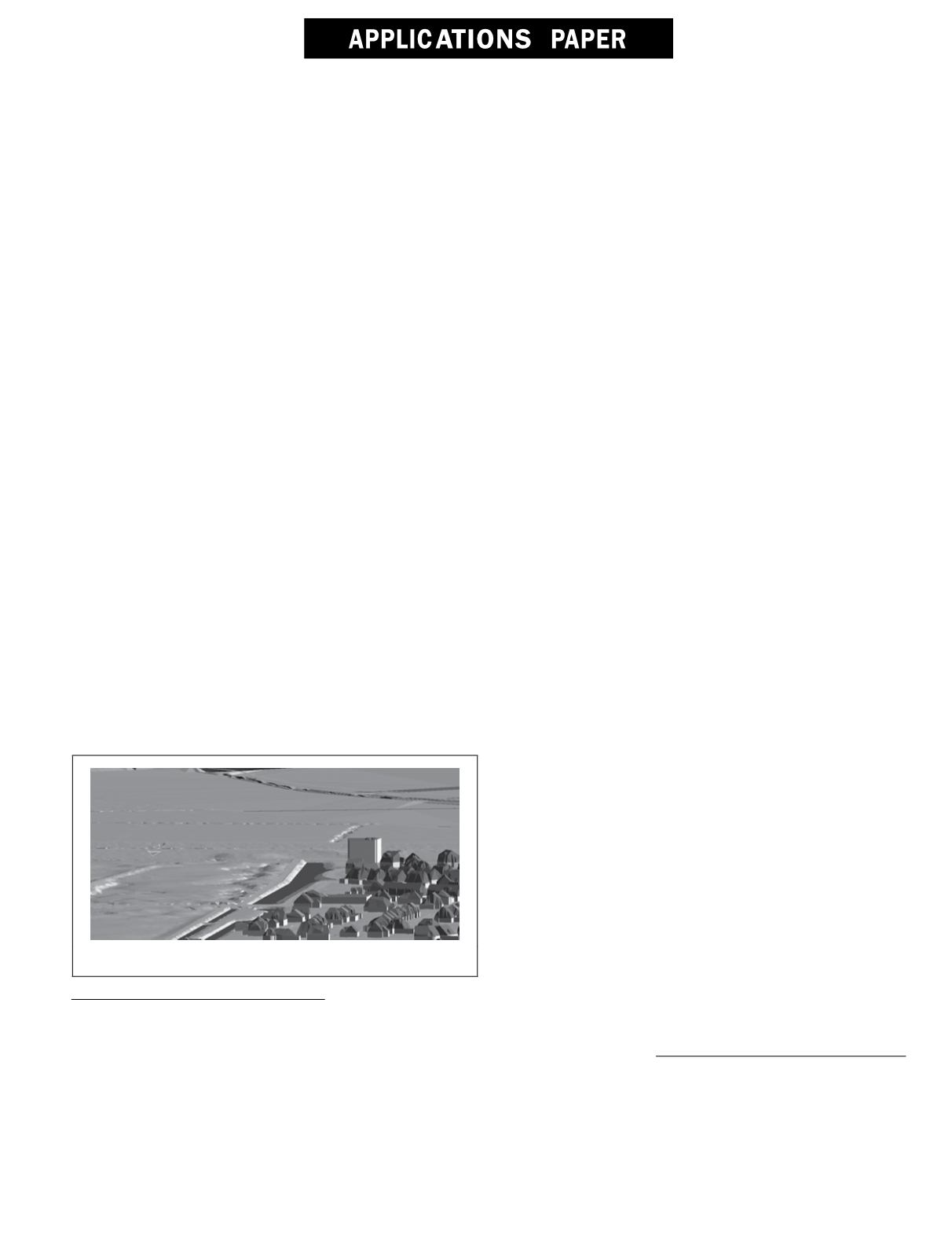
different objects; see Figure 1.
Figure 1. Geometrically and topologically valid 3
d
data.
With the wide adoption of the 3
D
standard “CityGML” (es-
tablished by the Open Geospatial Consortium (
OGC
) in 2008)
as an international standard, the amount of 3
D
datasets has
increased rapidly, in tandem with the range of applications to
which 3
D
is being applied (e.g., solar mapping, noise model-
ing, cadaster, etc.).
The standard CityGML (
OGC
, 2012) is an application-inde-
pendent information model and exchange format for 3
D
city
and landscape models. The standard is meant as a generic
standard for modeling topographic features, e.g., roads, build-
ings, land use. More restrictions to specify 3
D
information
for specific applications can be modeled by the definition
of an extra formal schema based on the CityGML schema
definitions. Such a schema is called a CityGML Application
Domain Extension (
ADE
). Further details about CityGML can
be found in Gröger and Plümer (2012).
The quality of the 3
D
data being used in spatial analyses is
of the utmost importance to the value of the outputs. However,
the evaluation of the quality of CityGML data has not received
the attention it deserves in practice. This is partly because
GML (the basis to model geometric primitives) is a generic
standard and allows an implementation freedom, and also
because CityGML does not offer sufficient guidance on how
to uniformly and unambiguously implement the standard:
while conformance requirements do exist, they do not cover
checking the integrity of CityGML geometries. Furthermore,
implementation specifications do not currently exist for 3
D
primitives, with the exception of the modeling handbook pub-
lished by the German 3
D
Special Interest Group - data quality
working group (See SIG3D, 2013a, and 2013b). In short, CityG-
ML requires further attention to be able to produce consistent
and high-quality 3
D
geoinformation encoded in CityGML.
This application paper presents the implementation spec-
ifications for CityGML that we developed based on obtained
insights from experimenting with CityGML data and use cases
within the “3
D
Pilot NL”, a test pilot ran in The Netherlands
in the last few years.
3D Pilot NL
The 3
D
Pilot NL was initiated in 2010 by four organizations
(Kadaster, Geonovum, the Netherlands Geodetic Commission
and the Ministry of Infrastructure and Environment) to pro-
mote and foster the use of 3
D
geoinformation in the Nether-
lands. In this pilot, over 65 organizations collaborated on the
production of 3
D
geoinformation for a test area, and on the ex-
Jantien Stoter and Hugo Ledoux are with Faculty of Architec-
ture and The Built Environment, Delft University of Technol-
ogy, Jaffalaan 9, 2628 BX Delft, The Netherlands (j.e.stoter@
tudelft.nl).
George Vosselman and Sander Oude Elberink are with Faculty
ITC, University of Twente, Hengelosestraat 99, 7514 AE En-
schede, The Netherlands.
Christian Dahmen is with Con terra, Martin-Luther-King-Weg
24, 48155 Münster, Germany.
Photogrammetric Engineering & Remote Sensing
Vol. 80, No. 11, November 2014, pp. 1069–1077.
0099-1112/14/8011–1069
© 2014 American Society for Photogrammetry
and Remote Sensing
doi: 10.14358/PERS.80.11.1069
PHOTOGRAMMETRIC ENGINEERING & REMOTE SENSING
November 2014
1069


