524
July 2015
PHOTOGRAMMETRIC ENGINEERING & REMOTE SENSING
Calibration of the Visible, Near and Mid IR Bands.
Radiomet-
ric gain and bias coefficients are necessary to derive phys-
ical quantities such as radiance and surface reflectance
(Feng et al., 2012, 2013) “Global, long-term monitoring of
changes in Earth’s land surface requires quantitative com-
parisons of satellite images acquired under widely vary-
ing atmospheric conditions. Although physically based
estimates of surface reflectance (SR. The challenge with
GLS1975 and GLS1990 is the frequency of missing or dif-
ferent calibration coefficients used and reported in the im-
age metadata. Since data were received and processed by
different ground receiving stations distributed around the
globe, different calibration parameters were used. Often
the coefficients were not stored or communicated with the
data themselves, or inappropriate metadata were attached
to images. With the repatriation of the Landsat archive,
USGS recalibrated the entire GLS1990 collection; these
corrected data were then re-downloaded as the GLS+. This
issue was minor in GLS2000 and GLS2005 but needed to
be addressed for 98 Landsat ETM+ scenes as Feng et al.
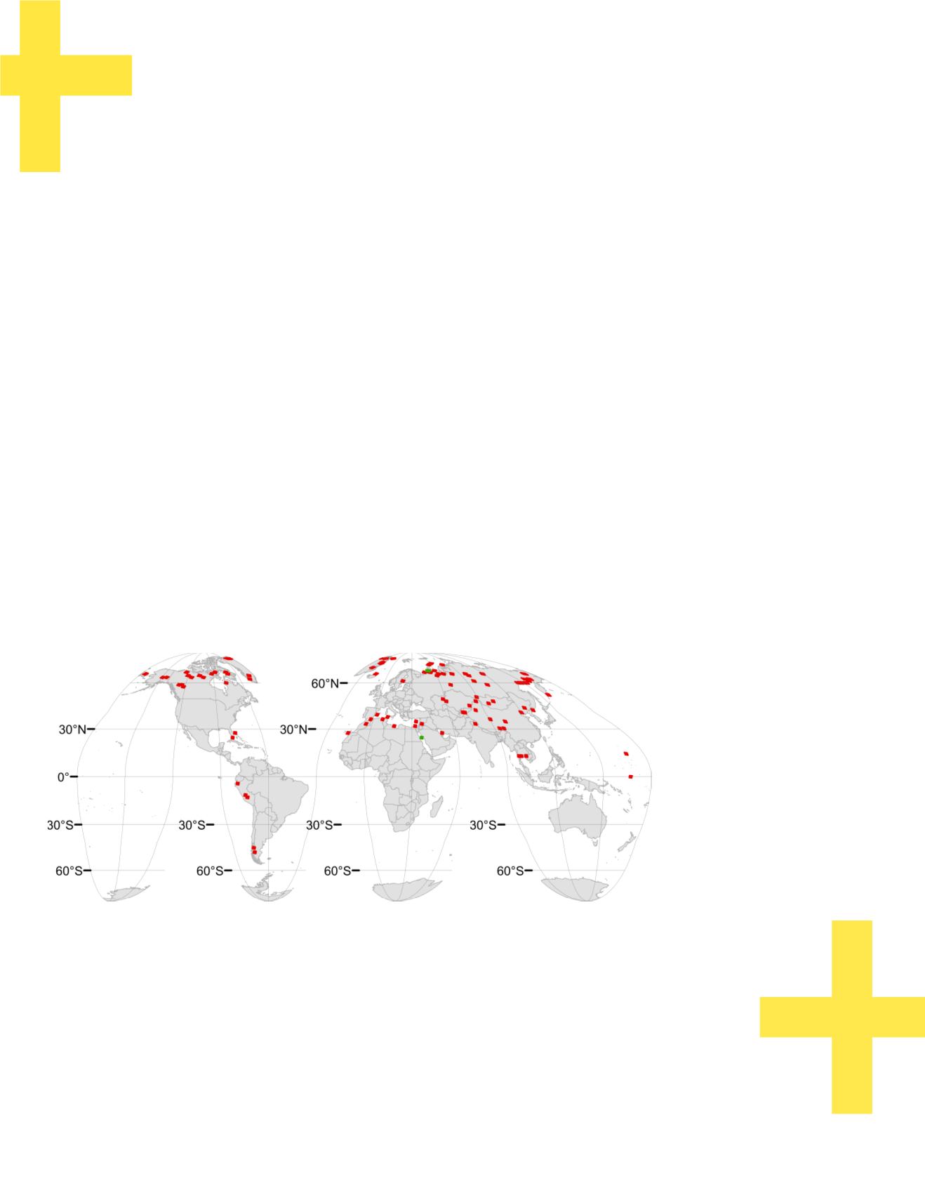
(2013) identified in these collections (Figure 3).
Calibration of the Thermal Band.
The thermal band of Land-
sat-5 TM data was recalibrated in May 2010
. Following retro-
spective recalibration, GLCF re-acquired the entire GLS
1990 image dataset, as well as those images that were down-
loaded to augment the 1990 epoch.
Discussion and Conclusion
Optimized collections of calibrated and terrain-corrected
images such as the GLS offer an excellent representation
of Earth’s entire terrestrial surface over multiple unique
dates. The NASA/USGS Global Land Survey (GLS) has been
among the most widely used and successful efforts to collect
optimal sets of multi-temporal Landsat collections for glob-
al land-cover analysis. However, the first generation of its
use revealed deficiencies in image seasonality, cloud cover,
and sensor radiometry. To mitigate or fully correct these is-
sues, we replaced and added Landsat scenes to each of the
GLS epochs. These steps have improved the consistency of
the dataset and its representation of land cover. Overall,
3,515 scenes were added for the GLS1990, 362 scenes to the
GLS 2000, and 290 scenes to the GLS2005 collection. In the
GLS2010 collection, the main issues will be the replacement
of the SLC-Off scenes. Some areas of the globe are still not
covered. The gaps in Asia in the GLS1990 collection exist
largely because of the decades-long refusal of the Indian
government to share their historic Landsat data, despite
their nominal membership of GEO. However, we are hope-
ful that the gaps over India and elsewhere will eventually
be filled via efforts such as the Landsat Global Archive Con-
solidation Effort (Wulder et al., 2012). The improved data
sets, which we term GLS+, are obtainable at no cost to the
user community through the Global Land Cover Facility at
Optimized collections of calibrated and terrain-
corrected images such as the GLS offer an excellent
representation of Earth’s entire terrestrial surface
over multiple unique dates.
Using the GLS+ collection, we produced the first global,
30-m resolution datasets of surface reflectance, tree
cover, forest cover and change, and inland surface
waters. These products are available for free, public
access via
Figure 3. Distribution of replacement images due to calibration issues. Green and red squares are GLS2000 and
GLS2005 scenes with incorrect gain/bias coefficients, respectively.


