428
June 2015
PHOTOGRAMMETRIC ENGINEERING & REMOTE SENSING
Image-pairs generated by USGS IW and NASA showed
the impact of drought and diversion water from the Dulce
River (Argentina) for irrigation on the surface area of Mar
Chiquita, the world’s largest
naturally occurring saline
lakes; flooding created by
the Samuel Dam in Rondonia
(Brazil), landscape changes
brought about by the con-
struction of dams in western
Mali (Manantali) and Ethiopia
(Tekeze), and expansion of
Lake Basaka (Ethiopia) over
a 35 year period. These im-
ages resulted in a discussion
about the impact of too little
or too much water on agriculture, cities, and humans who
depend on it. These images “seamlessly integrated the many
facets of this [water] topic that we have been studying in
class. Not only did the students gain a wealth of knowledge
from this presentation, they were highly entertained and en-
gaged” commented their teacher.
U
rban
G
rowth
and
its
I
mpact
on
the
E
nvironment
In 2012, LJHS students were learning about urban growth
and its impact on natural resources
such as food and water, energy and
waste generation, and infrastruc-
ture development. They compared
urban growth in the US and from
other regions of the world. These
concepts were then illustrated with
Landsat image-pairs that highlight-
ed urban growth in the US and oth-
er countries (Table 1). Students saw
urban growth patterns in the US
(Denver, San Antonio, and Las Vegas)
and compared them to growth pat-
terns in Mexico (Aguascalientes), Uganda (Kampala) and the
UAE (Dubai). The urban-sprawl associated with population
growth in Las Vegas and the impact on Lake Mead was evi-
dent in the Landsat image-pairs generated by NASA IC. Sim-
ilarly another NASA IC image-pair explained how Kampala’s
expansion (197 square km) led to the deforestation of the
surrounding forested areas used for charcoal production
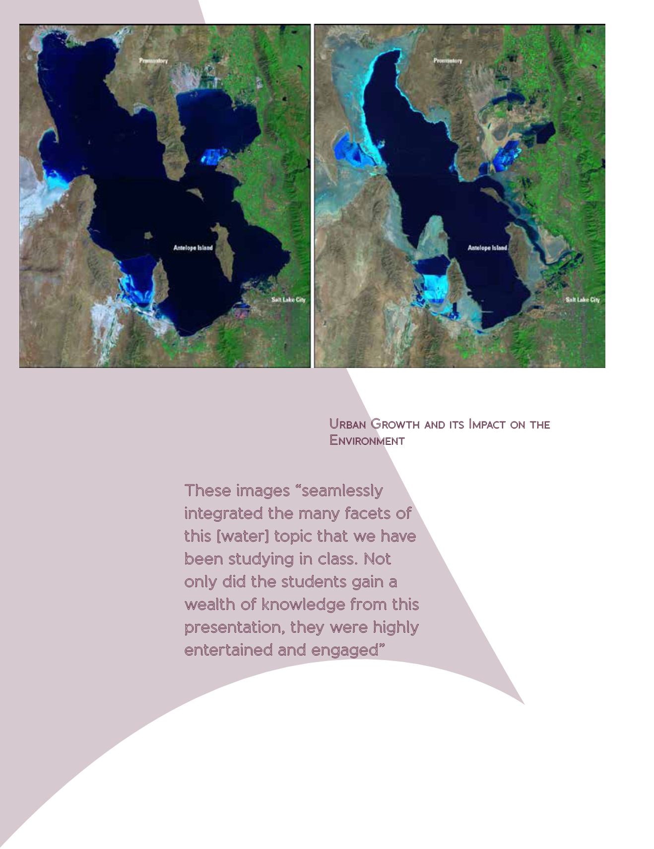
Figure 1 – Landsat image-pair showing dramatic change in the surface area of the Great Salt Lake, Utah, due to snowmelt and heavy rainfall (1985,
left) and drought (2010, right). Source: USGS Image of the Week.
These images “seamlessly
integrated the many facets of
this [water] topic that we have
been studying in class. Not
only did the students gain a
wealth of knowledge from this
presentation, they were highly
entertained and engaged”


