Study Area
Four clusters of cirques have been selected in the State of
Vorarlberg, western Austria (Figure 1). In Vorarlberg, the
glacier network developed in relation to the relative altitude of
feeding areas during glaciations: higher areas became glaciated
first, while lower areas became glaciated in later phases (De
Graaff
et al
., 2007). Moreover during early late-glacial phases,
relatively low-lying cirques became ice-free while higher locat-
ed cirques remained glaciated, a response to the rise in the
ELA
after climatic warming. For low-lying cirques this means that
they have been glacially eroded for a shorter period of time.
This may indicate that the resulting cirques including their
(sub) components are potentially less developed and have been
subject to denudation and accumulation processes, such as
fluvial erosion and fall type mass movements, for longer. The
selected four cirque clusters differ in altitude (see Table 1), and
may therefore hold well to less developed cirque components
which reflect increasing deviation from a “textbook example”
of a cirque. This approach therefore substitutes altitude for
time to represent differing states of cirque development.
Methods
We trained segmentation parameters and classification criteria
of a relatively small area (Area 1: see Figure 1 and Table 1) for
the extraction of the cirque divide, headwall, floor, and cirque
lake. Subsequently, we tested the transferability of the rule
set to the other three areas at different altitudinal zones. The
training area is positioned relatively high and therefore had a
relatively long period of glaciation which resulted in well-de-
veloped cirque components. Details of the training of the rule
set and application to the test areas are further described in
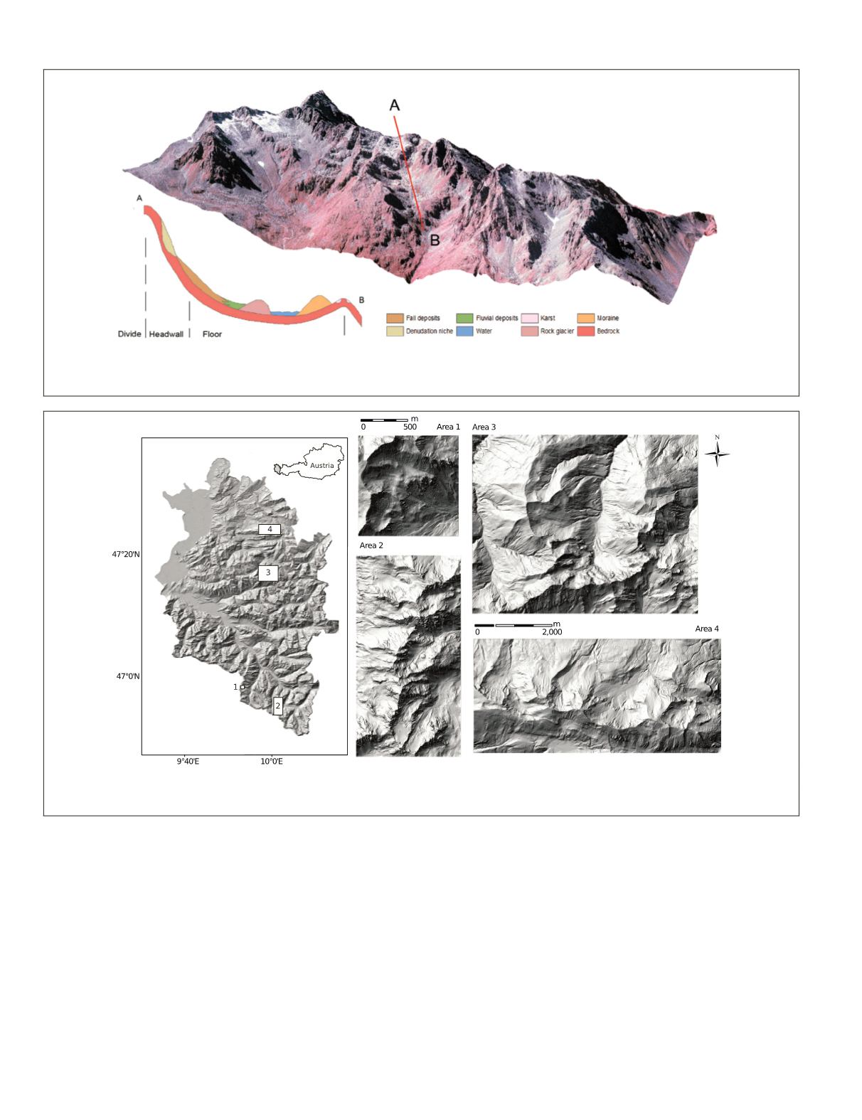
Plate 1. Perspective view of a color-infrared image of a cirque complex (Area 2, see Figure 1). The inset illustrates a hypothetical cross
section of a cirque, including cirque components Divide, Headwall, and Floor, and the potential disguising of glacial components due to
post-glacial landform development.
(a) (b)
Figure 1. (a) The study area, located in the State of Vorarlberg, western Austria. The black rectangles show the location of the four test
areas that are presented by lidar-derived shaded relief images in (b).
508
June 2015
PHOTOGRAMMETRIC ENGINEERING & REMOTE SENSING


