PHOTOGRAMMETRIC ENGINEERING & REMOTE SENSING
May 2015
363
ASPRS
NEWS
User System for Earth Sensing (MUSES) instrument pointing
systemwill host up to 4 separate plug-and-play imaging sensors
in its inertial stabilized frame, enabling survey companies,
humanitarian organizations, and non-spacefaring nations to
send their own instruments into space. From the low-earth
orbit of the ISS, sensors will be able to regularly cover the
majority of the world’s surface, delivering data for projects
as diverse as precision agriculture, disaster relief, and urban/
regional development and planning. Dr. Whorton will provide
historical background on earth imaging from space and some
of the resulting systems and applications, then delve into the
potential commercial, scientific and humanitarian objectives
that can be met using instruments aboard the MUSES facility.
For more information, visit
.
is pleased to announce that long-time client
has acquired a second
to meet the growing demand for high-accu-
racy surveying and geospatial services.
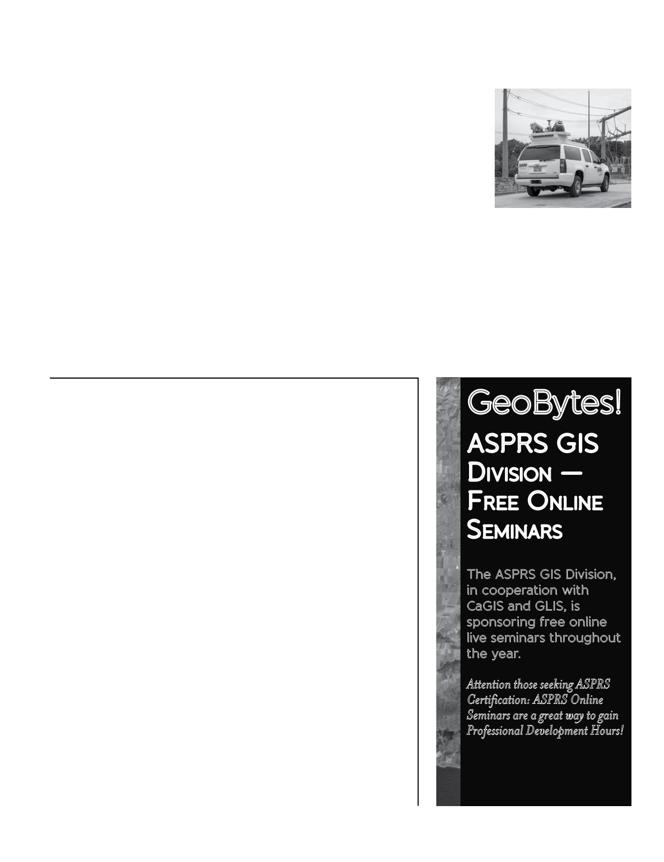
Survey And Mapping, LLC (SAM), a leading provider of
Tampa, as will my appointment of Greg Stensaas as Director and Allen Cook as
Assistant Director of PDAD. I have also been pleased to appoint Karen Schuckman
to head the Memorial Address Committee and Bobbi Lenczowski as Secretary of
the Society, partly to compose the formal record of our Executive Committee and
Board Meetings and partly to provide invaluable support and advice, drawing on
the experiences of a glittering career.
Finally, I decided to take action over my concern about committee meetings!
I convened a Task Force on Streamlining the Governance and Management of
ASPRS and have been humbled by the enthusiasm and dedication of its members,
Ryan Bowe, Ekaterina Fitos, Doug Smith and Michael Hauck. We have submitted
several reports to the Executive Committee and Board of Directors making
extensive recommendations on changes to the Society’s structure. We believe the
result will be a simpler, more effective, intelligible and economical structure, with
volunteers’ energies less thinly spread. For example, following the successful
merger of St. Louis and Central Regions to form Heartland in 2014, Northern
California and Southwest US have merged to form Pacific Southwest and I was
able to attend the inaugural meeting of the new Region in Fresno in February.
A Society with thousands of members and over 100 Sustaining Members,
there’s a lot going on. We are challenged to return membership to a growth
path. Whether we do this by one member at a time attracting a co-worker or
by campaigns and utilization of social media, we must craft a value proposition
that is compelling. We must present our Society as attractive and relevant, in
an age where participation in societies is not as natural as it was when I joined
in 1973. We are positively impacting the profession, but we have to tell others
and draw them into the Society to make their contributions and become part of
our network. If I have helped to provide an environment to help us meet these
daunting challenges, I shall be content.
Stewart Walker
ASPRS President
GeoBytes!
ASPRS GIS
D
ivision
—
F
ree
O
nline
S
eminars
The ASPRS GIS Division,
in cooperation with
CaGIS and GLIS, is
sponsoring free online
live seminars throughout
the year.
Attention those seeking ASPRS
Certification: ASPRS Online
Seminars are a great way to gain
Professional Development Hours!
/
GISD-Division/Online-
Seminars.html
geospatial solutions, has
acquired a second Lynx mobile
mapping system. SAM is
well known for its experience
providing mobile mapping,
terrestrial HDS, and aerial
mapping for clients in several
market sectors, such as Energy
and Transportation. The dual-
sensor Optech unit has the
capability to acquire measurements at a rate of one million
lidar points per second at normal highway speeds. Imagery is
also collected via high-resolution 360-degree digital sensors
synchronized to create high density, survey-grade colorized
point clouds. SAM is a national company with completed projects
across North America. The additional Lynx unit doubles their
mobile mapping capacity and further extends their acquisition
capabilities across a greater geographic range.
For more information about SAM, visit
about
Optech, visit
.
From the President’s Pen
continued from page


