PHOTOGRAMMETRIC ENGINEERING & REMOTE SENSING
November 2016
831
P
rotocols
The Web Map Service standard (WMS) provides
a simple HTTP interface for requesting georefer-
enced map images from one or more distributed
geospatial databases. A WMS request defines
the geographic layer(s) and area of interest to
be processed. The response to the request is one
or more georeferenced map images (returned
as JPEG, PNG, etc.) that can be displayed in a
WMS-enabled GIS application. The WMS proto-
col is an Open Geospatial Consortium standard,
and is nearly universal among GIS applications
and GIS viewers.
The JPIP client/server communication protocol
is defined in Part 9 of the JPEG 2000 suite of
standards (ISO/IEC 15444-9). JPIP progressively
streams the wavelet coefficients for a requested
part of a picture, which saves bandwidth, com-
puter processing on the server, and time. It allows for
speedy viewing of a large image in low resolution or a
higher-resolution part of that same image. Using JPIP, it
is possible to stream large images (even several gigapix-
els in size) to relatively lightweight hardware such as
smartphones and tablets.
C
onclusion
Express Server is a technologically advanced and efficient
method of serving raster imagery and lidar data that have
been compressed to MrSID or other efficient formats. Be-
cause it is designed to take advantage of the multireso-
lution nature of these formats and their support for se-
lective decoding, Express Server delivers imagery faster
than other image servers can, especially as the number of
concurrent requests and size of imagery increase.
As geospatial image data increases both in quality and
in quantity, so does user demand for that imagery, es-
pecially now that applications with geospatial compo-
nents are in the hands of millions of everyday mobile
users. Express Server is one of the fastest and most ef-
ficient methods for ensuring that the imagery will be
there whenever and wherever requested by users.
F
urther
R
eading
For more information about LizardTech Express Serv-
er see the following:
•
The Express Server product page at
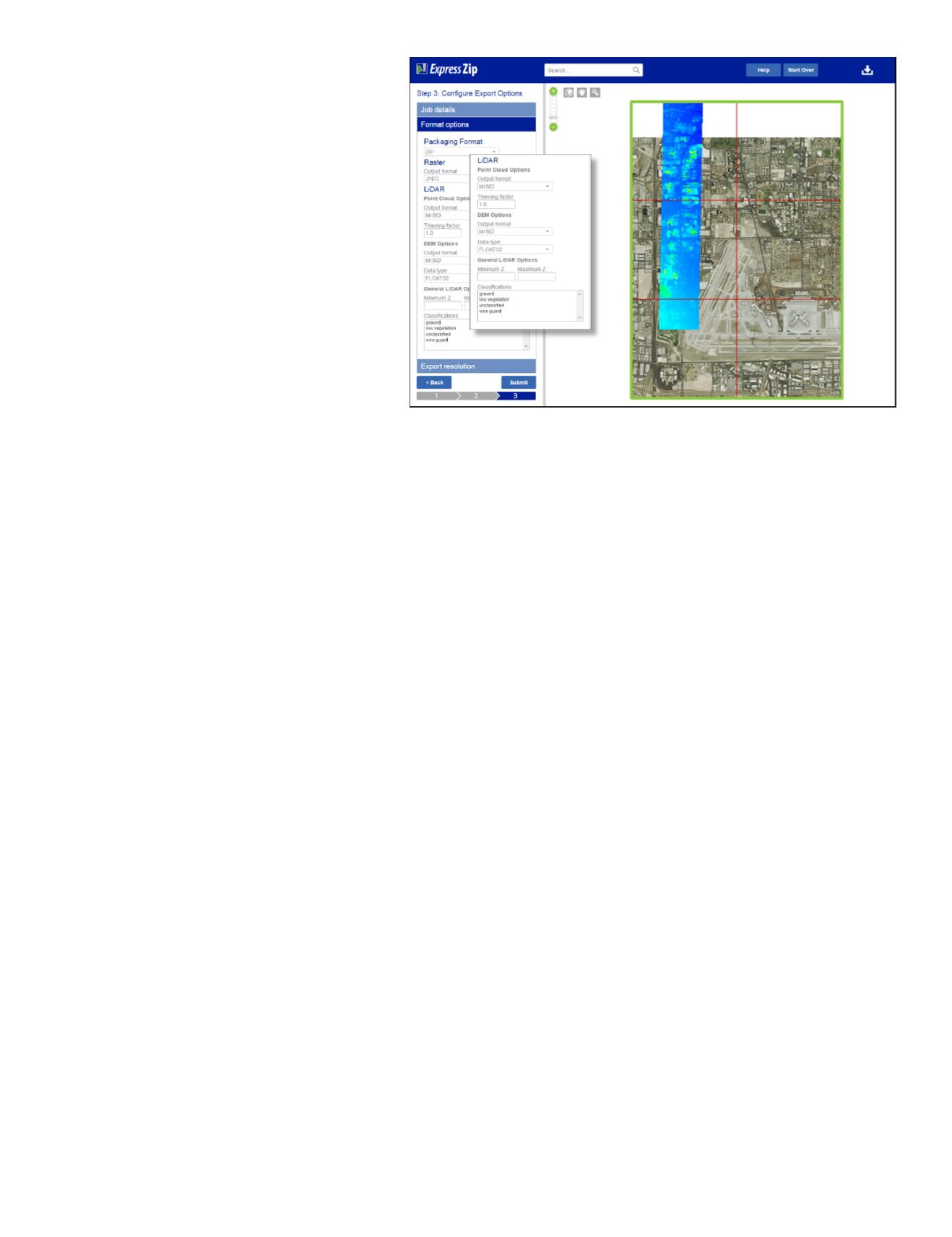
Figure 3: The ExpressZip viewer uses the Express Server API.
For more information about Web Map Service (WMS) see:
•
The WMS specification, available for download on
the Open Geospatial Consortium (OGC) website at
For information about JPIP see the following:
•
Overview of JPEG 2000 (Part 9, JPIP) at
.
•
The JPIP specification, available for download at
the International Telecommunication Union (ITU)
website at
.
A
uthors
Glen Thompson
, Quality Assurance Manager,
Celartem, dba LizardTech
Don Johnson
, Technical Writer, Celartem, dba Extensis
Jeffrey M. Young
, Global Business Development, Cel-
artem, dba LizardTech
For further information on Express Server and other
LizardTech image asset handling software solutions
please contact:
Jeffrey M. Young
Global Business Development, LizardTech
303-815-2254,


