834
November 2016
PHOTOGRAMMETRIC ENGINEERING & REMOTE SENSING
TIP: Several County Property Appraisers’ Offices are digi-
tizing rooftop/footprint polygons for their internal use. Some
make the data available on-line or by-request.
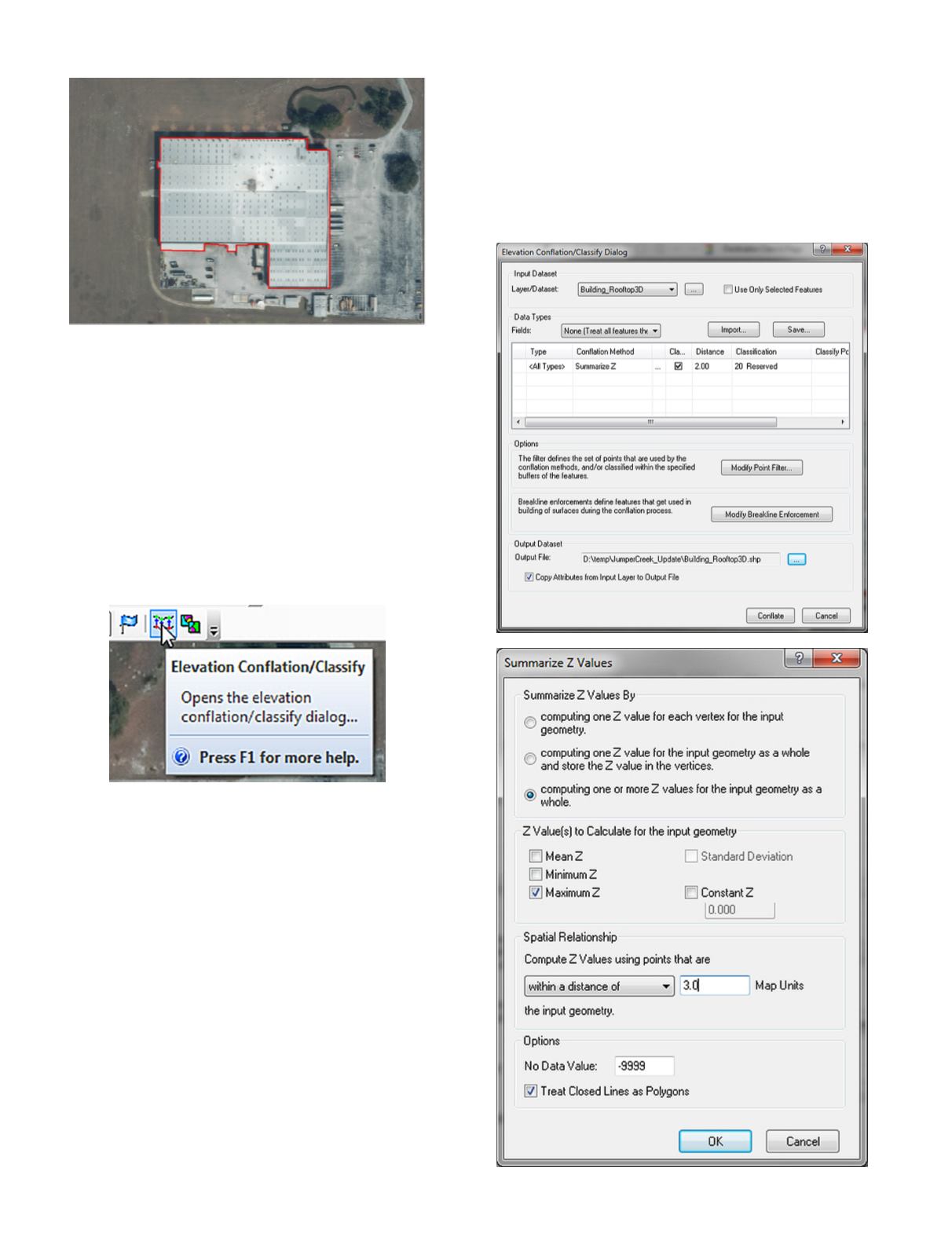
Step 2
Conflate the 2Dshapefile tomake a3Dshapefile
Using an Advanced License of LP360, conflate the 2D build-
ing to the nearest maximum ground elevation within 3’ of the
building, naming the new file “Building_Rooftop3D.shp”
A.
On the LP360 Classify Toolbar, choose the “Elevation
Conflation/Classify” Tool
B.
Fill in the Elevation Conflation/Classification Dialog box
as follows:
Choosing
1. the Building_Rooftop_3D.shp as the Layer/Dataset
2. Summarize Z as the Conflation Method and
3. On the Summarize Z Values Menu, choose
a. Computing one or more Z values for the in-
put geometry as a whole
b. Choose Maximum Z (you may also choose
Minimum Z if desired)
c. Choose “within a distance of 3.00 Map Units”
d. Press OK
4. (back on the Elevation Conflation/Classify
Menu), set the Classification to 20
5. (or if retained on Class 2, set the Withheld flag)
6. Modify the point filter to Class 2 (and/or all
ground classes)
7. Set the output file to “Building_Rooftop_3d.shp”
8. MAKE SURE to check the “Copy Attributes
from Input Layer to Output File” checkbox.
9. Press “Conflate”
This will produce a 3D shapefile that will be used to “Hydro-
Correct” the DEM. The new 3D shapefile will have a MaxZ
field populated with the Z Value of the highest ground point
within 3’ of the building:


