PHOTOGRAMMETRIC ENGINEERING & REMOTE SENSING
November 2016
839
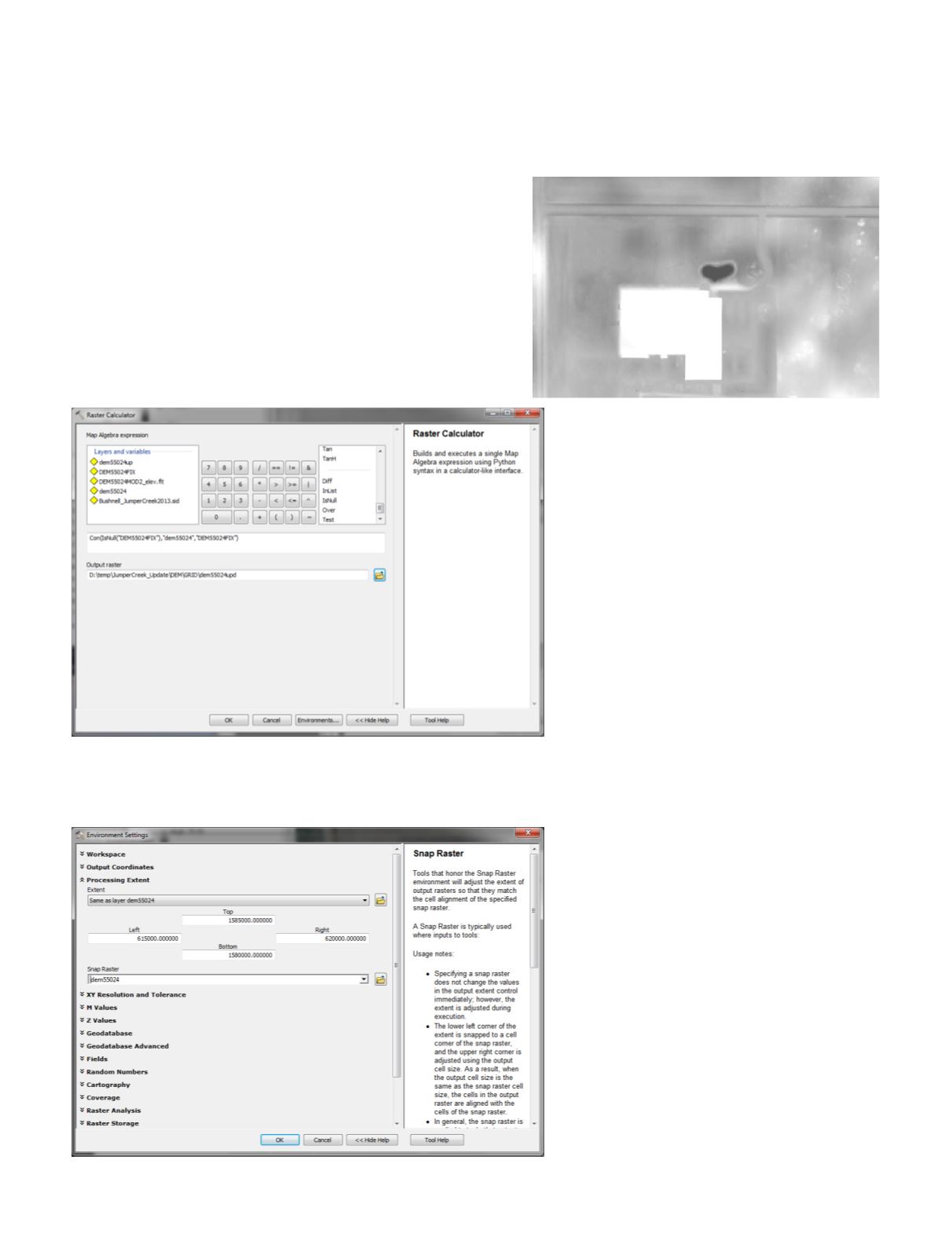
Step 6.
ReplacetheoriginalDTMcellswiththeupdated
cells
This step requires the use of the Esri Raster Calculator and
the Spatial Analyst Extension. So with the Spatial Analyst
Extension turned on,
A.
Open the Raster Calculator (Spatial Analyst Tools | Map
Algebra) and use the Raster Calculator to build an ex-
pression of the following general form:
Con ( I sNu l l ( “Rep l acement _DTM” ) , ”Or i g i na l _
DTM”,”Replacement_DTM”)
And to set the output to a valid grid name and path,
B.
Set the Environments… to the Processing Extent of the
original DTM and specify the Snap Raster as that origi-
nal DTM. Press OK when complete
C.
Press OK on the Raster Calculator to process the expres-
sion
The new cells have been used to replace the older cells in the
DTM.
The workflow described above can easily be modified
and used for related scenarios. For example,
A.
when we want to “HydroCorrect” the entire wa-
tershed for basement sinks, we generally obtain a
copy of the existing building rooftops from the ap-
propriate county Property Appraiser, conflate the
polygons, and use them to fill in the basements
in one operation as we construct the DTM for an
entire LiDAR project or watershed, or
B.
the DTM update/replacement portion of the
workflow can be used to update small portions of
the DTM when new buildings are added or mi-
nor terrain alterations have occurred since the
LiDAR were collected.
As always, the SWFWMD does not endorse
or recommend any of the software used in the
described workflows. While we acknowledge that
there are other software packages available and
other workflows to accomplish similar results, these
tips and tricks are derived from workflows used by
the SWFWMD. I encourage readers who use other
software packages and/or workflows to contribute
their TIPS & TRICKS to this column.


