PHOTOGRAMMETRIC ENGINEERING & REMOTE SENSING
November 2016
865
Robust Multi-Source Image Registration for
Optical Satellite Based on Phase Information
Haichao Li and Yiyun Man
Abstract
Robust image registration is a vital challenging task, especial-
ly for multi-source satellite images that may have significant
different illumination. A coarse-to-fine registration algo-
rithm based on phase information is proposed. The coarse
registration is implemented using Fourier-polar transform
and phase correction based on phase congruency. The fine
registration is first implemented by dividing large images into
blocks. Then, the uniformly distributed corners and Principal
Phase Congruency (
PPC
) images are extracted. After that, the
corresponding points of extracted corners are obtained based
on Phase Correlation of Principal Phase Congruency (
PCPPC
),
followed by a new outlier removal method. Experiment results
revealed the robustness, accuracy, and distribution quality
less than 1.0 of the proposed algorithm. The matching correct
rate is about 94.7 percent for Data Set 2 due to considerable
topography variations, and more than 96.6 percent for data
set 4 despite significant different or inverse intensity, which
can reach 100 percent with our outlier removal method.
Introduction
Image registration is a fundamental task in image processing
used to match two or more images taken from different sensors
at different times or different viewpoints (Djamdji
et al
., 1993).
Image registration is of vital importance for many applications,
such as change detection (Dai and Khorram, 1998), image
fusion (Pohl and Van Genderen, 1998), and vision motion
estimation (Pickering
et al
., 1997), and it is considered as a
challenging subject. During the last few decades, the progress
and development of remote sensing technique makes data
acquisition possible to be multi-sensor, multi-resolution,
multi-spectral, and multi-temporal. Therefore, multi-source
image registration plays an important role in remote sensing
field, which geometrically aligns the reference and sensed
images.
However, the same substance (such as crops, vegetation)
may have different reflectance in different spectral bands,
and it usually performs significant intensity differences in
multi-source satellite images; therefore, the extracted features
in the two images to be registered are often not identical. For
instance, the visible image and the infrared (or near-infrared)
image, and even the infrared images obtained by the same
sensors at different times, often have contrast and illumina-
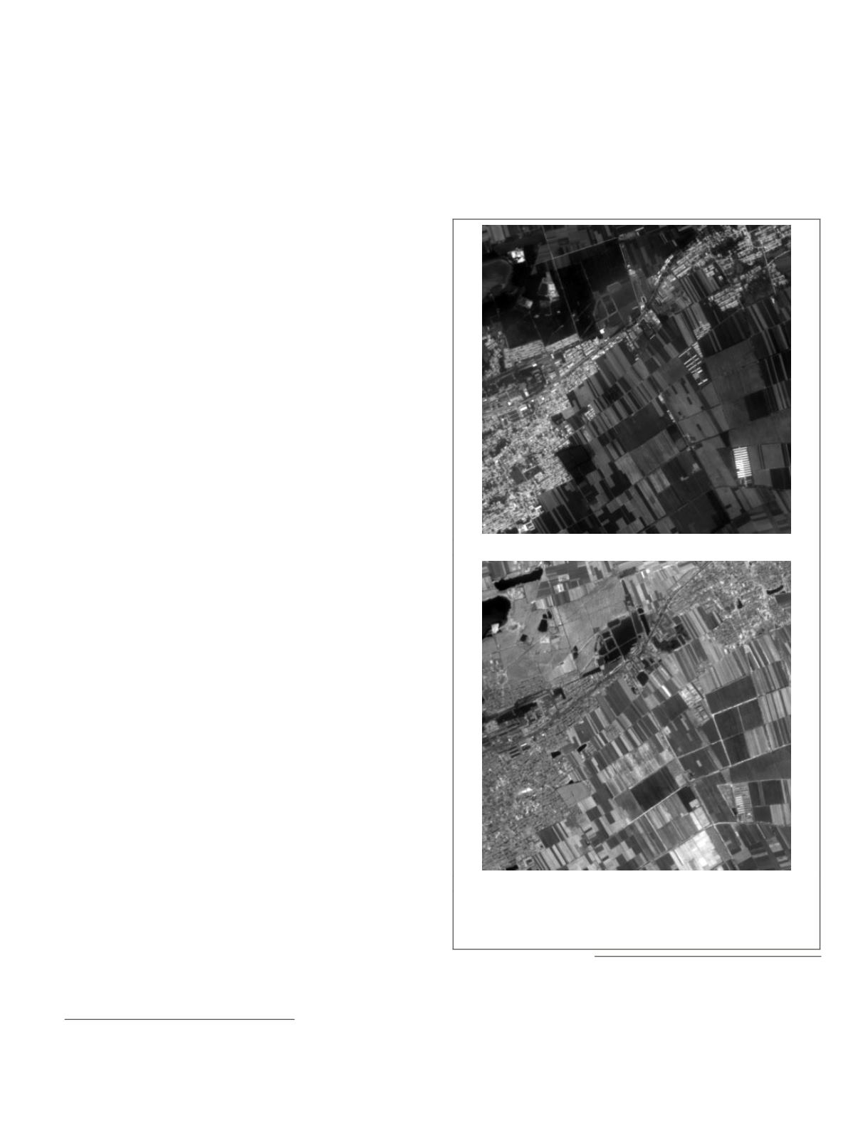
tion variations. Figure 1a and 1b show two multi-spectral
images obtained of the same scene covered with crops in the
suburbs. As can be seen, these two images have significant
different or even inverse intensity in some regions.
The organization of the paper is as follows. In the next section
the related works are introduced. The proposed registration algo-
rithm is then presented. Next, the experimental results are evalu-
ated and analyzed. Conclusions are drawn in the last section.
Qian Xuesen Laboratory of Space Technology, No. 104 Youyi
Street, Haidian, Beijing, 100094, P.R. China
)
Photogrammetric Engineering & Remote Sensing
Vol. 82, No. 11, November 2016, pp. 865–878.
0099-1112/16/865–878
© 2016 American Society for Photogrammetry
and Remote Sensing
doi: 10.14358/PERS.82.11.865
(a)
(b)
Figure 1. Multi-spectral satellite images with significant different
or even inverse intensity caused by the different reflectance of
the crops in different bands: (a) Band 3 image (0.63-0.69µm). (b)
Band 4 image (0.77-0.89µm).


