PHOTOGRAMMETRIC ENGINEERING & REMOTE SENSING
October 2019
707
SECTOR
INSIGHT:
.
com
E
ducation
and
P
rofessional
D
evelopment
in
the
G
eospatial
I
nformation
S
cience
and
T
echnology
C
ommunity
Nagaraja Rao Harshadeep (Harsh), The World Bank Group
Spatial Agent: Reimagining Data & Analytics in an Increasingly Online World
Despite major gains in recent decades, there are pressing de-
velopment challenges around the world that often seem to
only get more intractable and complex with time. This is es-
pecially so when addressing extreme poverty. Most of these
challenges would benefit from the use of emerging technol-
ogies that can “disrupt” traditional incremental ways of ad-
dressing them. Of particular interest is the rapidly changing
world of geospatial data and related analytics. Focusing on a
spatial context – be it a watershed/basin, aquifer, province,
city or even a community – can help integrate traditional “si-
loed” perspectives of sustainable development, helping every-
one quickly see and explore interconnections between issues
of natural resources, transport, markets, and a range of other
environmental, economic, and social factors.
To do this effectively, there is a need to visualize a range
of multi-sectoral data and analyze the geospatial data with
modeling tools. Traditionally, this has been done with the
use of desktop or workstation tools to download appropriate
data, and with the help of specialized (often expensive) GIS
and modeling software installed on these machines, analyze
and visualize the results. This often results in fragmented
geospatial data and insights that are rarely shared, and in-
efficiencies related to time wasted in unnecessary analyses
that have already been done. The biggest challenge is that
few people have the ability to even visualize, let alone ana-
lyze, the data interactively. Furthermore, “users” must make
use of highly trained analysts and their special hardware,
software, and skills to both visualize and present the results,
even when only minor adjustments are made. This accentu-
ates the digital divide. Those from more developed countries
have disproportionately more access to free, publicly-avail-
able data and tools than their less fortunate counterparts in
the developing world.
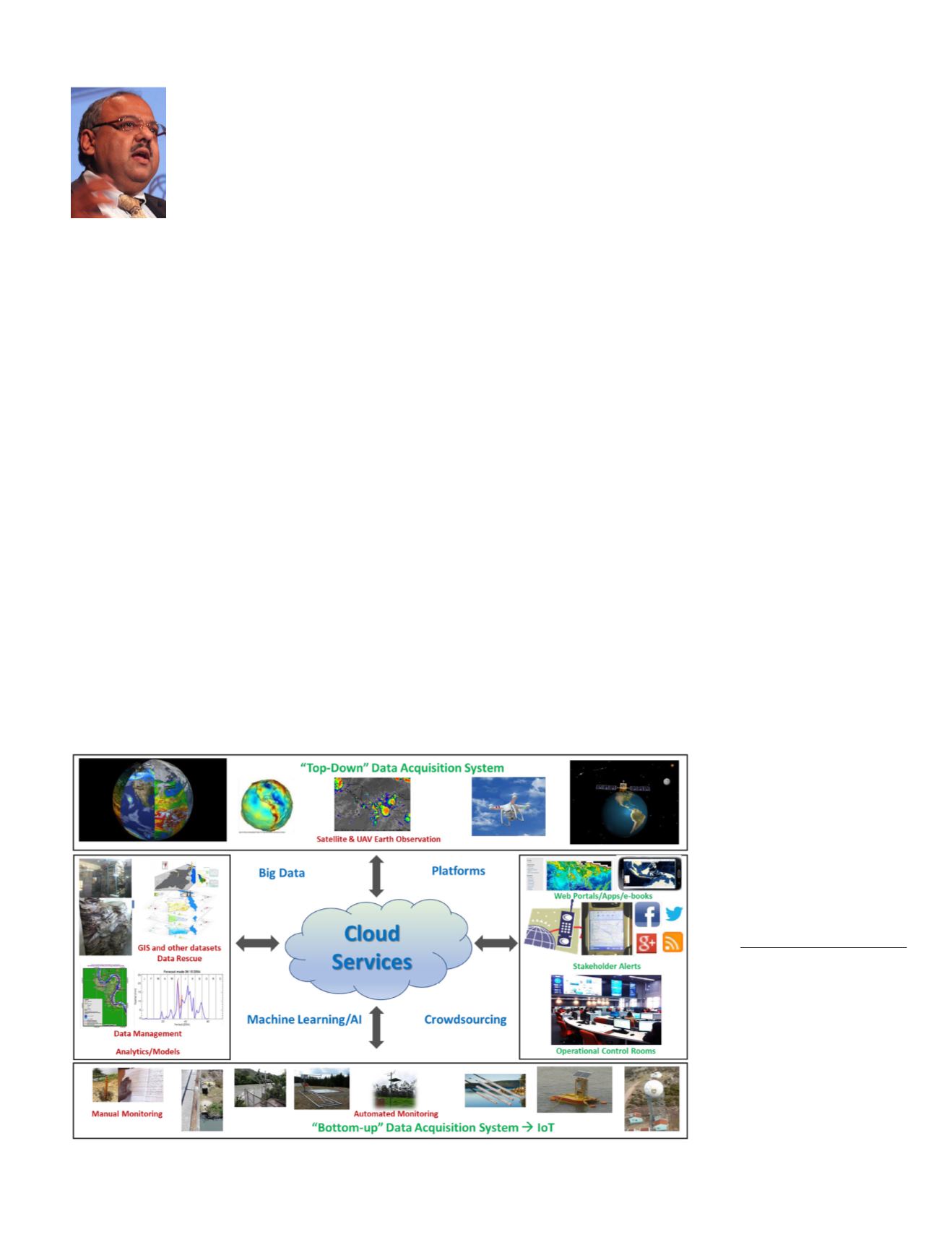
As we look ahead at a more interconnected world with new
technologies, we are rapidly approaching a situation where
most of the data that we need can reside in cloud repositories,
and most of the analytics and visualization can be provided
by cloud services for access in various virtual and physical
platforms, figure 1. Since the heavy lifting is done by cloud
services rather than on a device, the “user” base could be tre-
mendously expanded, with access even from simpler devices
like ubiquitous smartphones, tablets, and low-end comput-
ers. The use of standardized Open Geospatial Consortium
(OGC) standards, open APIs, and a range of both commercial
and open-source software that
can be freely accessed through
browser or native App plat-
forms has increased the poten-
tial for such tools to be widely
used. In addition, many orga-
nizations are embracing open
data initiatives in order to
make their data free, more eas-
ily discoverable and consum-
Figure 1. A Vision of Integrated Data and Analytics.
Photogrammetric Engineering
& Remote Sensing
Vol. 85, No. 10, October 2019,
pp. 707–711.
0099-1112/19/707–711
© 2019 American Society for
Photogrammetry
and Remote Sensing
doi: 10.14358/PERS.85.10.707


