1090
December 2014
PHOTOGRAMMETRIC ENGINEERING & REMOTE SENSING
controlled autonomously, by computer, or under the
remote control of a pilot on the ground. UAS also
come in a variety of shapes, sizes, and configura-
tions to support a wide variety of sensor packages,
which allows them to provide maximum flexibility
for remote sensing data collection. DOI missions
requiring patrol of vast expanses of public lands,
monitoring of natural resources (land, water, and
air), and remote sensing over rugged terrain could
benefit from this technology. In addition to support-
ing safer missions over rugged terrain, operation
of UAS, particularly small UAS (sUAS), have also
proven to be much more cost effective than manned
missions based on initial studies. UAS provide sci-
entists a way to look longer, closer, and more fre-
quently at remote areas where, in the past, it would
be too dangerous or too expensive to monitor and
without disturbing the environment they are ob-
serving. UAS can provide data in real-time and per-
mit data acquisition under marginal weather con-
ditions (acquisition under clouds), which results in
better science, safer acquisition of data and at a sav-
ings over conventional remote sensing techniques.
The flexibility of operations and relatively low-cost
of UAS make them an ideal platform for acquiring
remote sensing data in many situations (OpusTek
International Corporation, 2011).
B
ackground
The DOI first used UAS technology in 2004 to ac-
quire data during a volcanic event on Mount Saint
Helens (Patterson
et al.,
2005). This successful
mission demonstrated that UAS technology had
matured enough for it to possibly become a cost-ef-
fective remote sensing tool for scientific, environ-
mental and land management applications. To fur-
ther investigate this possibility the U.S. Geological
Survey (USGS) Land Remote Sensing Program
sponsored a 2005 emerging technology investiga-
tion of UAS technology, which resulted in findings
that UAS technology was developing at a rapid
rate; many civil agencies were establishing UAS
Program Offices, numerous U.S. universities were
offering UAS programs, and the number of UAS
vendors were quickly increasing. This evaluation
concluded that UAS technology had started to tran-
sition towards a mainstream technology that could
be used as a new remote sensing tool for the DOI.
The USGS National UAS Project Office (NUPO),
located in Denver Colorado, was created on May
2008 as a next step towards evaluating the op-
erational use of UAS technology in the DOI. The
NUPO was designed to lead and coordinate efforts
to implement UAS technology as a cost-effective
option for acquiring remotely sensed data within
the USGS and across the DOI.
The DOI has already made significant progress
towards implementation of a cost-effective UAS
operational capability. One of the first steps was
the establishment of an organizational framework
within the DOI, consisting of the Department’s Of-
fice of Aviation Services (OAS) and the newly cre-
ated USGS NUPO, tasked with focusing on UAS
evaluations and development of an operational
strategy. Early accomplishments included estab-
lishing training requirements, creating a cadre of
certified UAS operators, and a partnership with
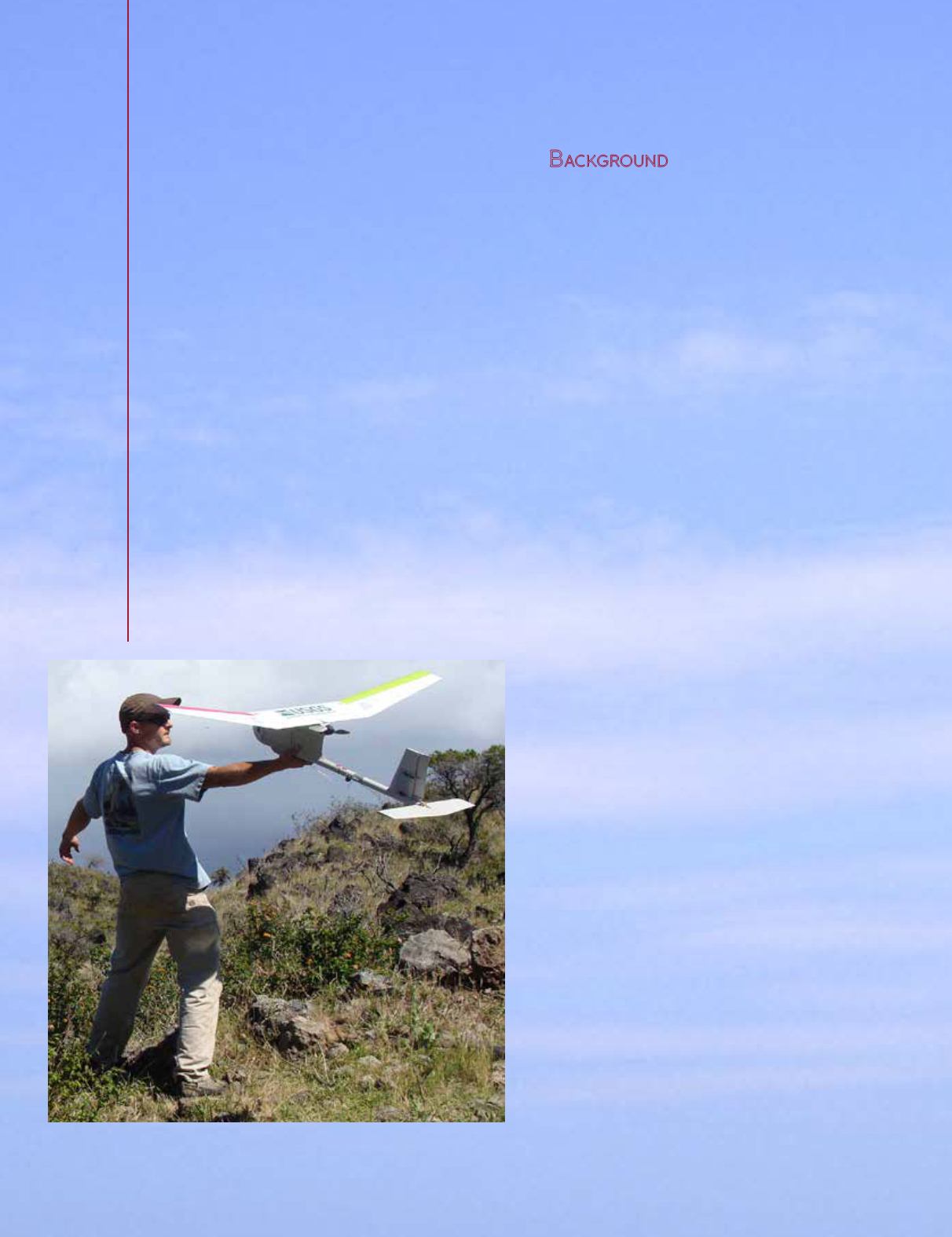
the U.S. Army resulting in access to a fleet of Ra-
ven sUAS (Figure 1). This allowed even more rapid
progress, with proof of concept missions that sup-
ported the development and testing of approval
procedures, operational processes, and cost benefit
information (Department of the Interior, 2013).
Figure 1. Launching the Raven during a mission in the Haleakala Nation-
al Park, Maui, Hawaii (USGS).


