stands, while the once-dominant cottonwood trees are now
rare or in rapid decline (Cao
et
al., 2012; Merritt and Poff,
2010; Nagler
et al
., 2004b; Nagler
et al
., 2005; Silván-Cardenas
and Wang, 2010). However, the sparse distribution of cot-
tonwood provides a great opportunity for its separation from
saltcedar stands since many studies have already shown that
dispersed, individual tree crowns can be accurately delineated
using high spatial resolution images (Bunting and Lucas, 2006;
Hay
et al
., 2005; Wang
et al
., 2004). Moreover, scattered cot-
tonwood trees usually are the tallest plants in the floodplain
with a height of 4 to 6 m or more (Nagler
et al
., 2004b), which
allows them to be paired with their own shadows in high
spatial resolution images. Shadows were also proved very
useful for feature extraction in many remote sensing applica-
tions (Huang and Zhang, 2012; Peng and Liu, 2005; Sahar and
Krupnik, 1999). Therefore, we hypothesize that the including
both crown shape and shadow information of scattered cotton-
wood in the classification can solve the problem of discrimi-
nating saltcedar from cottonwood using remote sensing images
when the spectral reflectance of these two species are similar.
The objectives of this paper are: (a) to test the feasibil-
ity of discriminating saltcedar (
Tamarix ramosissima
) from
scattered cottonwood (
Populus euphratica
) using QuickBird
image acquired during the summer in Inner Mongolia, China,
where saltcedar is a native species, and (b) to explore how
shape and shadow information associated with dispersed cot-
tonwood can be incorporated to improve classification results.
Study Area and Data
The study area is located in the Ejina Cottonwood Nature
Reserve, east of Ejina in Inner Mongolia, China. It has a typi-
cal desert climate. Most precipitation falls between June and
August, and the average summer temperature range is 18°C° to
34°. The Heihe River, which originates in the Chi-lien Moun-
tains in northern Tibet, flows northward and splits into sev-
eral branches in the reserve. All branches are ephemeral rivers
and none remains saturated year round. Water is released only
by the dams upstream and flows in late March or early April.
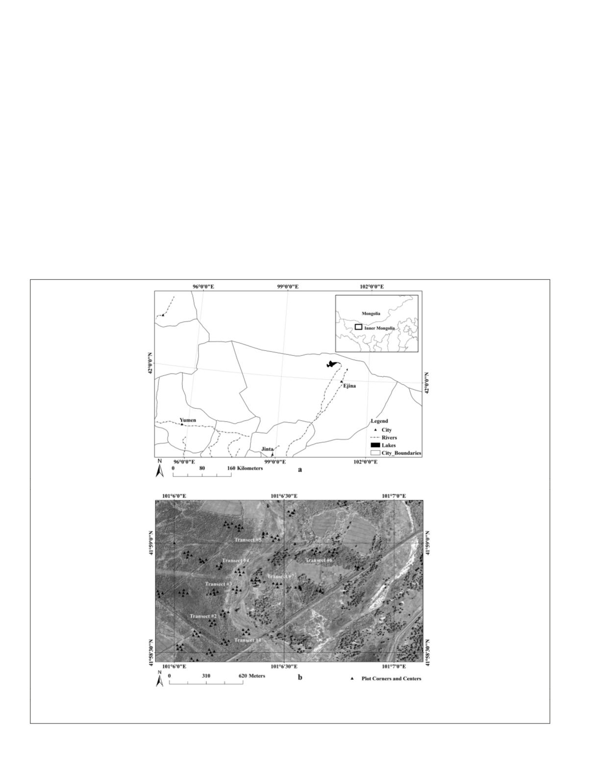
Our study was conducted along a small reach of the third
river branch, about 5 km east of Ejina (Figure 1). On this area,
saltcedar is the dominant species and has formed a monocul-
ture on the west side of the riverbed. In contrast, cottonwood is
sparsely distributed and the trees are closer to the river chan-
nel. However, there are two dense stands of cottonwood trees
about 200 m from the riverbed next to two crop fields along the
(a)
(b)
Figure 1. (a) Location of the City of Ejina, and (b) Panchromatic QuickBird image of the study area (about 5 km east of Ejina) and the
transects along the river.
796
October 2015
PHOTOGRAMMETRIC ENGINEERING & REMOTE SENSING


