80
February 2016
PHOTOGRAMMETRIC ENGINEERING & REMOTE SENSING
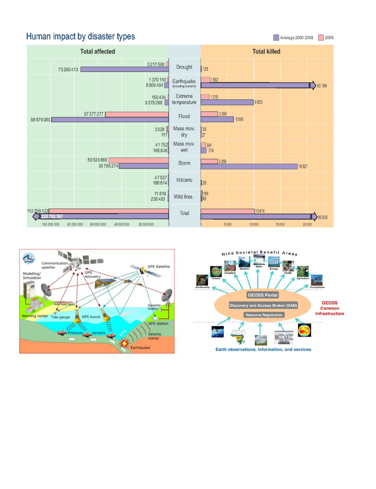
Figure 1. Human Impact by Disaster Type, UN SPIDER, 2013.
Figure 2. Sensors activated during an earthquake. Source:
.
Figure 3. High level GEOSS architecture and GEOSS Common
Infrastructure (GCI-GEO, 2014).
The Group on Earth Observations (GEO) was created in
Johannesburg, South Africa (UN, 2002; UNISDR, 2005;
RIO+20, 2012), and represents a worldwide intergovernmen-
tal initiative promoting and collaboratively international di-
saster mitigation and management activities for disaster risk
reduction and increased resilience. GEO is defined as “a vol-
untary organization and depends on the interest and energy
of the international Earth observations and geospatial com-
munities to reach its goals” (GEO, 2015). GEO aims at the
creation of a technological infrastructure (called Global Earth
Observation System of Systems or GEOSS) to be able to con-
nect different types of information. GEO fosters collaboration
between governments, public, and private organizations, for
mutual sharing of applications, tools, and Earth observation
data. Figure 3 shows that GEOSS activities have been struc-
tured within nine Social Benefit Areas (SBAs): agriculture,
biodiversity, climate, disasters, ecosystems, energy, health,
water, and weather.


