PHOTOGRAMMETRIC ENGINEERING & REMOTE SENSING
May 2016
317
W
elcome to the inaugural column of what, I hope
becomes, a semi-monthly feature. The purpose
of the “GIS Tips and Tricks” is to highlight some
of the common GIS functions that many users may have
either forgotten, never used, or just plain never new existed.
The column is rooted in a few 15 minute GeoBytes and
instructional videos that we use at the Southwest Florida
Water Management District to help new GIS users. I will
be expanding the scope of these tips to include tips for some
common GIS softwares, focusing on the Esri ArcGIS suite,
but also including tips for GlobalMapper, and, on occasion,
QuantumGIS. While my intent is not to make this a “Help
Forum”, if readers have a particular problem or are searching
for a “GIS Trick”, I welcome suggestions for future “Tips and
Tricks” and I can always ask around my Mapping and GIS
Section for new tricks and tips. For now, I’ll start with basic
GIS functions that we use on an everyday basis.
Feedback that I received on one of the short GeoBytes
that I offered in 2015 indicated some were not aware of Esri
Map Packages. Although this functionality has been part of
ArcMap since 2010, I only recently began making widespread
use of it for sharing complete maps. I found this to be an ideal
vehicle for students in my GIS classes to send me their work
and for people around the SWFWMD to share data without
going through the ArcServer environment. The Map Package
contains a copy of all of the actual data along with how the
student/user symbolized the data, as well as, the Layout view
for the map, as they wanted it to be produced. The package
is compressed and very portable between computers, and it
forces the student/user to construct some simple metadata
before the package is created. Map Packages can be shared as
e-mail attachments, FTP files, and even uploaded to ArcGIS.
com. Of course, there are several Esri Resources and Esri-
related Blogs on making and sharing Map Packages, and I
advise a reader to simply “google” Esri Map Package to find
these resources. There is also an Esri Web-based training
course (cost $32 USD) for those seeking additional detail.
Steps to Constructing and Exporting a Map
Package
STEP 1 —
Construct an MXD. Add and symbolize the data
exactly as you want it to appear. I recommend working in a
single directory for this process. Make a Sub-Directory (I like
to call it \GISDATA) and place copies of all of the vector data
and image data into this directory. When you make your
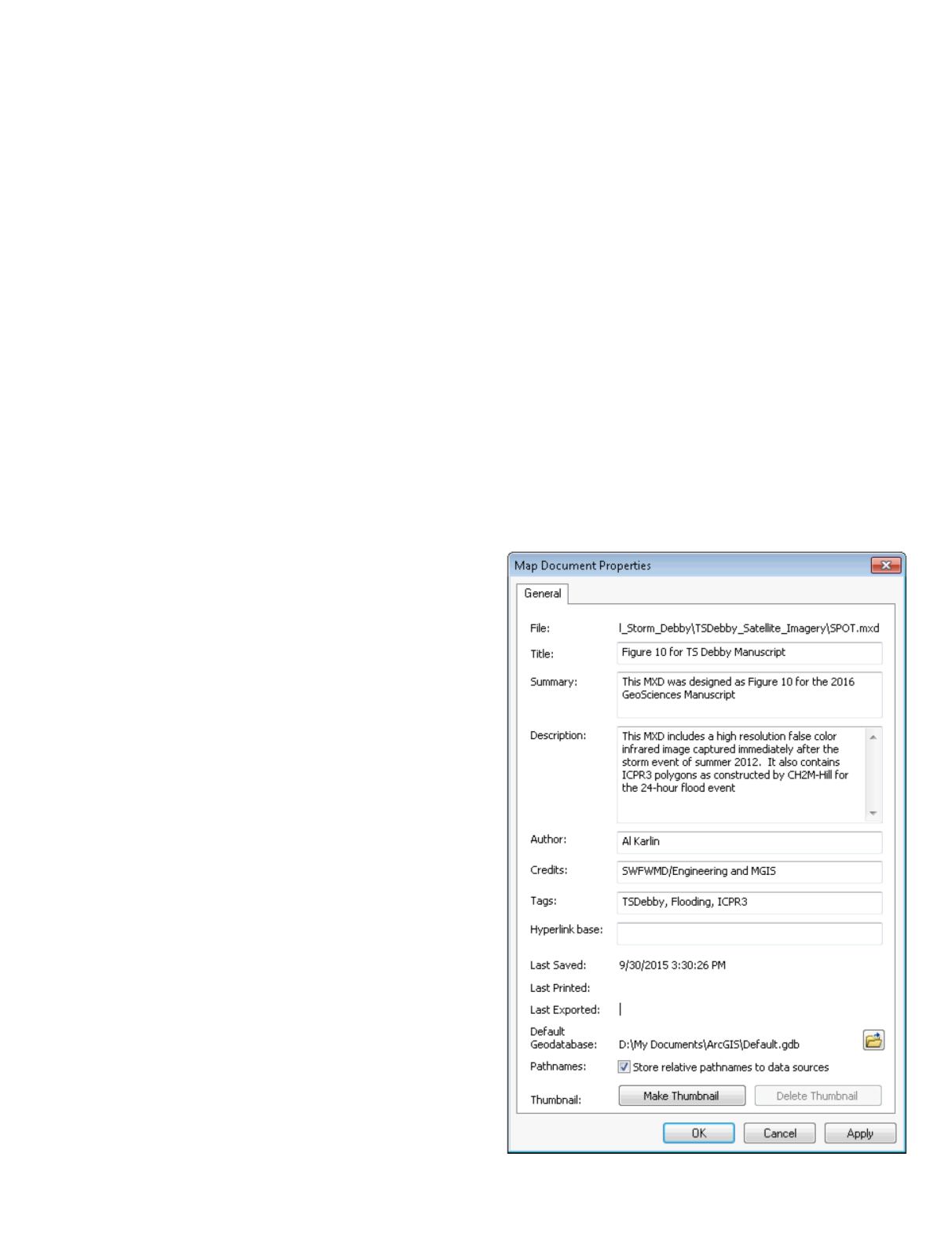
MXD, be sure to use the File | Map Document Properties
tab and check the “Pathnames: Store relative pathnames to
data sources” checkbox. (This is also a good time to add some
metadata to your MXD; just fill in the fields on the screen
and these data fill be attached to your MXD.) Save your MXD
to the parent folder.
GIS
&
Tips Tricks
By Al Karlin, Ph.D.,CMS, GISP


