PHOTOGRAMMETRIC ENGINEERING & REMOTE SENSING
May 2020
267
R
esults
and
D
iscussion
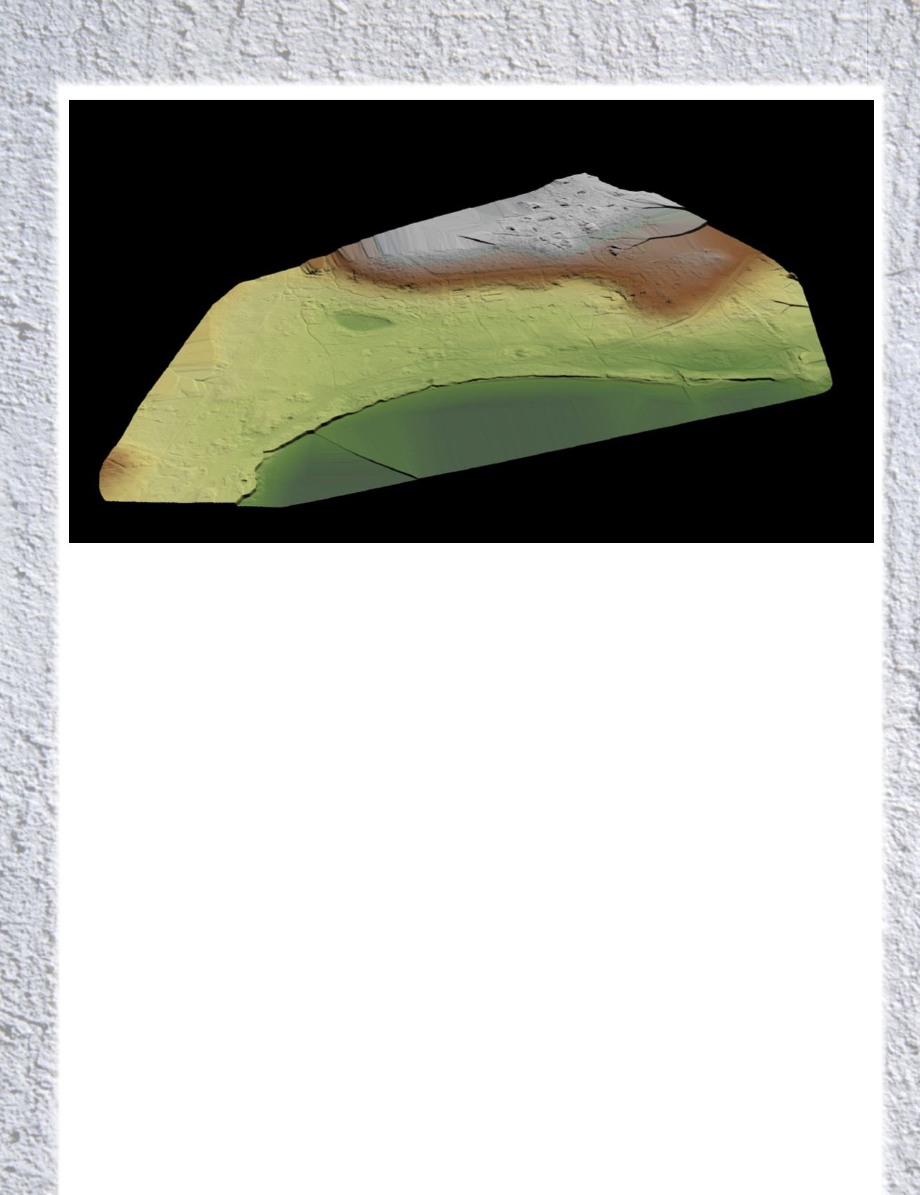
Photogrammetry provided a detailed view of the area;
but it was the UAV lidar that was able to penetrate the
layers of vegetation and to reveal the location and details
of the buildings’ foundations. They were clearly visible on
the Digital Terrain Model. By matching this to old RAF
reconnaissance photographs taken of the area during the
war it was possible to digitally reconstruct a 3D model of
the prison camp for the Smithsonian documentary.
The lidar survey found building foundations, barracks, a
canteen, the prisoner compounds, the location of fencing
surrounding the camp, and four machine gun posts. The
team was also able to identify possible mass gravesites
suspected to contain more than 1,000 bodies, according to
the documentary.
However, due to local government opposition, no further
investigation of the potential graves was permitted at
this time.
Professor Sturdy Colls said, “The lidar and photogramme-
try UAV surveys that Flythru completed on Alderney as-
sisted us greatly in our research. The overgrown vegetation
and the size of the sites that we were investigating made
ground-based surveys difficult and using UAV was the
obvious choice. The results were better than we could have
hoped for. At SS concentration Camp Sylt many additional
structural elements were identified in the lidar survey that
were previously hidden behind dense vegetation. This al-
lowed us to complete, for the first time, a digital reconstruc-
tion of this important site.”
A
bout
the
A
uthor
Gert Riemersma, CTO of Routescene, has 20 years
experience as a hydrographic surveyor and a private
pilot since 1986. He worked with lidar since 2008 and
UAV lidar since 2013. He is the CTO and founder of
Routescene. Being used for such historically and socially
important work, the system has proven to be ideal
due to its portability and ease of use on such difficult
and inaccessible sites. Combined with its high level of
accuracy, the ability to penetrate vegetation and process
the data on-site are real advantages.
R
eference
Alex. 2019.
Adolf Island
(Documentary),
Alderney bare earth view.


