292
April 2014
PHOTOGRAMMETRIC ENGINEERING & REMOTE SENSING
Web-enabled Soil Database Access and Utilization
Soil resource inventories are some of the most complex geospa-
tial databases in the world. Linked spatial and tabular data,
one-to-many hierarchical relationships, and coding conven-
tions can help users effectively utilize soil data to support en-
vironmental decision-making. Soil geographic data-bases are
moving toward digital format and being linked to mobile de-
vices connecting individuals and communities locally and glob-
ally. This would require improved methods for accessing, ana-
lyzing and visualizing soil data and information. Advances in
web-enabled technologies have stimulated the general aware-
ness, use, and visualization of soil properties readily available
in sophisticated soil geographic databases (Soil Survey Staff,
2014). In order to accommodate the widest possible spectrum
of potential soil data users, flexible interfaces to these resourc-
es (web-based APIs, web-mapping clients, data-streams, etc.)
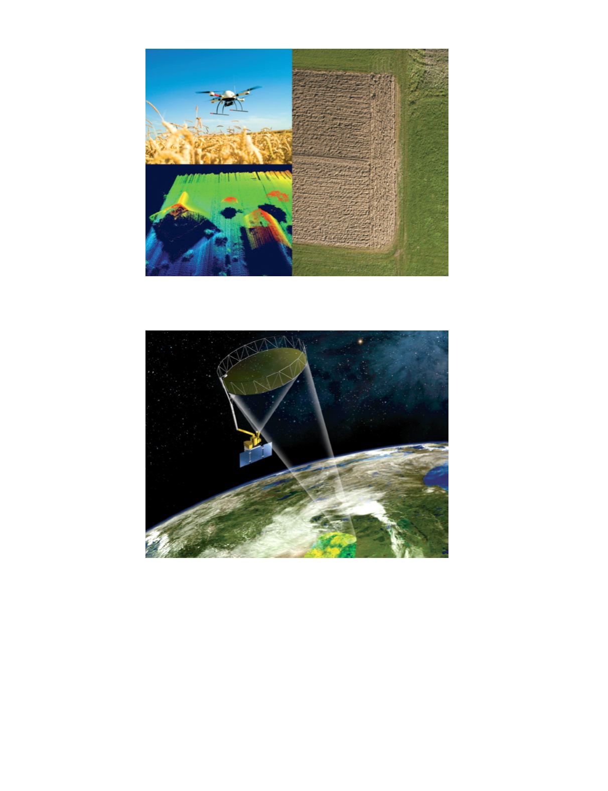
Plate 3
. The small Unmanned Aerial System (sUAS) shown here has three sensors: a high-resolution radiometer; a ther-
mal camera used to monitor plant temperature and hydration; and a laser scanner which measures individual plant height
in centimeters (Images courtesy Dr. Bruno Basso, Michigan State University).
Plate 4
. Artist conception of the SMAP observatory in Earth orbit. SMAP’s two instruments, an L-band radiometer and an
L-band radar, share a single 6-m rotating mesh reflector to produce conically-scanned data at a constant incidence angle
of 40°. The SMAP configuration enables global maps of soil moisture to be obtained every 2-3 days.


