1092
December 2014
PHOTOGRAMMETRIC ENGINEERING & REMOTE SENSING
al procedures and processes. The DOI has collab-
orated with other Federal agencies, such as the
National Oceanic and Atmospheric Administration
(NOAA) and the National Aeronautics and Space
Administration (NASA), universities, and private
industry on many of these missions. Collaboration
has been essential in the OT&E phase and has al-
lowed evaluations of a wider range of UAS and sen-
sors to meet DOI mission requirements.
Investigations performed during the execution of
these proof of concept missions have been crucial in
addressing many questions and concerns, and have
clearly demonstrated that UAS can cost effectively
meet scientist’s requirements and provide safe, low
risk support in areas such as wildlife management
and environmental research.
D
iverse
A
pplications
UAS technology is being used by the DOI to moni-
tor environmental conditions, analyze the impacts
of climate change, respond to natural hazards, un-
derstand landscape change rates and consequenc-
es, conduct wildlife inventories and support related
land management and law enforcement missions.
The Department’s field-level staff are driving the
investigations of UAS technology. The innovation
and dedication of DOI scientists and resource man-
agers are apparent as they turn to UAS and asso-
ciated remote sensing tools to perform traditional
tasks more cheaply and create new uses for the
technology. Wildlife biologists were the first to im-
plement the technology (monitoring and inventory-
ing wildlife), followed by hydrologists (monitoring
shoreline erosion and stream temperature gradi-
ents), ecologists (habitat mapping), and geologists
(landslide monitoring).
DOI’s public safety professionals are interested
in using UAS to support their activities, including
search and rescue, monitoring pipelines and wild-
land firefighting. In general, if an observation can
be obtained with a manned aircraft today, DOI is
investigating doing it with a UAS in the future.
The underlying information technology to pro-
cess, export and disseminate the UAS data is also
being evaluated to meet the goal to efficiently pro-
cessing these robust data sets into actionable in-
formation. Using a sUAS, the DOI is able to tailor
solutions to meet project requirements and obtain
very high-resolution video, acquire thermal imag-
ery, detect chemical plumes, and collect point cloud
data at a fraction of the cost of conventional survey-
ing methods. UAS technology is allowing the DOI
to do more with less and in the process enhance
our ability to provide unbiased scientific informa-
tion to better enable resource managers and policy
makers to make informed decisions. The results of
two of the many OT&E missions are provided be-
low as examples of UAS technology benefiting the
DOI mission.
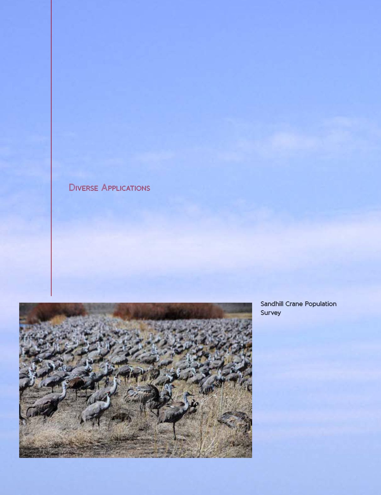
Sandhill Crane Population
Survey
One of the earliest UAS missions
occurred during March 2011 at the
Monte Vista National Wildlife Ref-
uge (NWR) near Monte Vista, Col-
orado. This mission was performed
in cooperation with the U.S. Fish
and Wildlife Service (FWS) to study
the feasibility of using UAS to sur-
vey Sandhill cranes (Figure 3). The
FWS, mandated by the Migratory
Bird Treaty Act, is responsible for
performing periodic surveys of the
Sandhill crane population. Sand-
hill cranes are migratory birds that
travel from Texas to Idaho (or as far
as Siberia) annually and the Monte
Figure 3. Sandhill cranes (USGS).


