1094
December 2014
PHOTOGRAMMETRIC ENGINEERING & REMOTE SENSING
C
onclusions
Not since the invention of the airplane or global po-
sitioning system (GPS) has a technology had such
a disruptive and transformational impact on the
remote sensing community. Tully (2013) has called
it the rise of “personal remote sensing” where more
and more people will have access to the technolo-
gy. Others have heralded the UAS ability to let the
science questions drive the remote sensing data ac-
quisitions, rather than the data driving the science.
UAS technology has the potential to enable the
DOI to be a better steward of the land by:
•
Improving natural hazard forecasting and the
analysis of the impacts.
•
Improving our understanding of climate change
to better plan for likely impacts.
•
Developing precipitation and evaporation fore-
casting to better manage water resources.
•
Monitoring Arctic ice change and its impacts on
ecosystems, coasts, and transportation.
•
Increasing safety and effectiveness of wildland
fire management.
•
Enhancing our search and rescue capabilities.
•
Broadening our abilities to monitor environ-
mental or landscape conditions and changes.
•
Better understanding and protecting the Na-
tion’s ecosystems.
The initial operational testing and evaluations
performed by the DOI have proven that UAS tech-
nology can be used to support many of the Depart-
ment’s activities. UAS technology provides sci-
entists a way to look longer, closer and more
frequently at some of Earth’s most remote
areas—places that were previously too dan-
gerous or expensive to monitor in detail. The
flexibility of operations and relative low cost to
purchase and operate sUAS enhances the abil-
ity to track long-term landscape and environ-
mental change. The initial testing indicates
the operational costs are approximately 10% of
traditional manned aircraft. In addition, users
can quickly assess landscape-altering events
such as wildland fires, floods and volcanoes.
UAS technology will allow the DOI to do more
with less and in the process enhance the De-
partment’s ability to provide unbiased scien-
tific information to help stakeholders make in-
formed decisions. It will also provide a digital
baseline record that can be archived and used
when monitoring future events or conditions.
One possible future scenario has scientists carrying
sUAS into the field allowing quick deployment and
operation to observe the environment or for emer-
gency response. This scenario could also include a
persistent monitoring capability provided by a UAS
that can stay airborne over a small geographic area
for days or weeks, or possibly longer.
While the DOI focus is on sUAS, the Department
recognizes that larger UAS systems will also play
a role in meeting its mission. The Department an-
ticipates meeting long-dura-
tion or specialized acquisition
commitments, such as state or
national aerial photography,
by collaboration with other
agencies or through commer-
cial contracts.
Even though the DOI con-
tinues to evaluate UAS and
sensor technology to meet the
Department’s mission, some of
its bureaus are already moving
towards an operational capa-
bility. We fully anticipate that
by 2020 UAS will emerge as
one of the primary platforms
for DOI remote sensing appli-
cations.
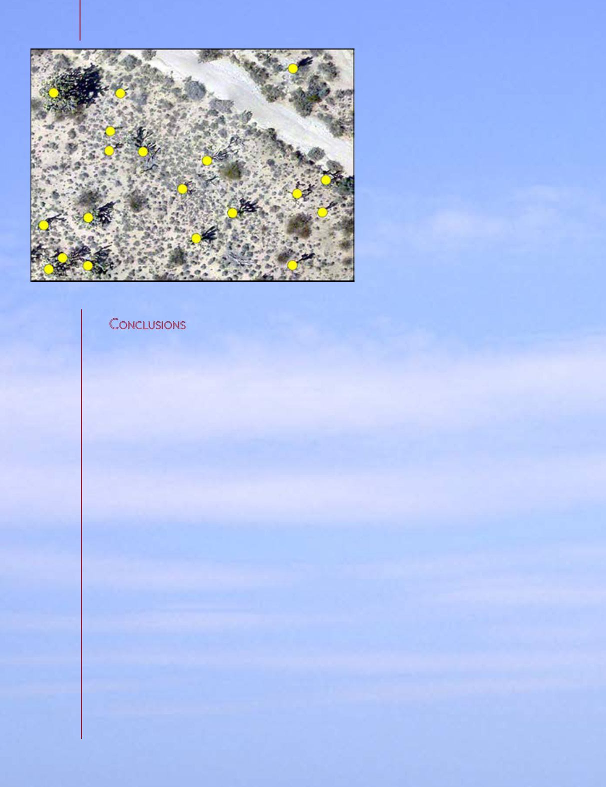
Figure 6. Feature extraction of Joshua trees, indicated by yellow dots, collected for
vegetation inventories (USGS).
“Not since the
invention of
the airplane or
global positioning
system (GPS) has
a technology
had such a
disruptive and
transformational
impact on the
remote sensing
community.”


