260
April 2015
PHOTOGRAMMETRIC ENGINEERING & REMOTE SENSING
The quadcopter was flown multiple times over each site, at
an altitude of 100 m. At this flying height, Camera 2 had a
field of view (FOV) height of 64 m and width of 85 m, resulting
in still photography with a horizontal image resolution of 2.13
cm at nadir. However, in our evaluations of the imagery, we
calculated an image resolution range of 2-4 cm, due to slight
variations in flying height and view angle. A photo collection
rate of 2 frames per second resulted in about 800 photos per
0.1 km², with a forward overlap of greater than 80% and a
sidelap of approximately 60%. Utilizing a wide-angle lens
on Camera 1 to collect video resulted in a wider FOV height
and width (102 m and 256 m, respectively) but a lower image
resolution (Figure 3).
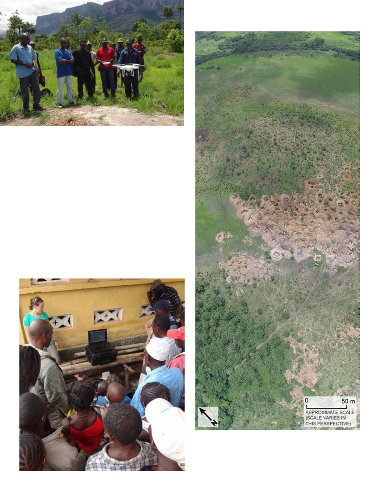
Figure 2. A PRADD team member flying the UAS at an artisanal diamond mining
site.
Figure 3. A mosaic of several oblique images of the Siratoumany site in the
Forecariah Prefecture study area in western Guinea captured from video
collected using the wide-angle lens camera.
Courtesy of Peter Chirico (USGS).


