PHOTOGRAMMETRIC ENGINEERING & REMOTE SENSING
April 2015
259
observations, to successfully identify ASM activities and
estimate the production in diamond mining zones throughout
the region (Chirico and Malpeli, 2013; Kauffmann et al., 2013).
While a useful tool, satellite imagery has its limitations, such
as atmospheric constraints (cloud cover, haze, smoke, etc.),
temporal resolutions that fail to capture the dynamic nature
of ASM sites, and spatial resolutions that can be inadequate
for identifying fine-scale features. With the advent of small,
low-cost, and user-friendly UAS, the USGS and USAID
recently began collaborating to explore the application of this
technology for mapping and
monitoring ASM. Specifically,
the team is using UAS
technology to support USAID’s
Property Rights and Artisanal
Diamond
Development
(PRADD) project’s efforts to
formalize ASM in Guinea.
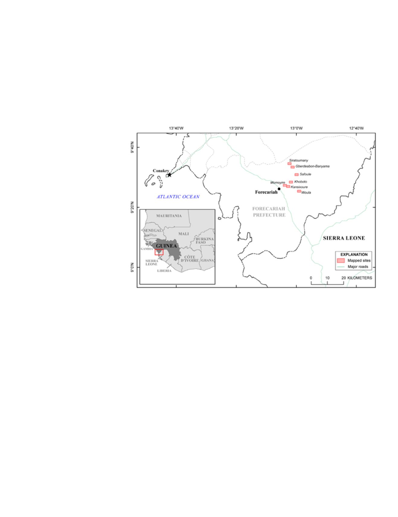
In June 2014, a USGS and
USAID team used a small
UAS to map artisanal diamond
mining sites in the Forecariah
Prefecture of western Guinea
(Figure 1). Building on a
previously completed country-
scale assessment of Guinea’s
diamond deposits in 2012
(Chirico et al., 2012), this
current effort seeks to create
detailed site maps and generate
very-high resolution digital
elevation models (DEMs) of the
region to better informdiamond
production evaluations.
UAS
for
E
nvironmental
R
esearch
While the development of UAS technology has been driven
largely by military requirements, it is increasingly being
employed for civilian applications (Hardin and Jensen, 2011).
Researchers began investigating the development of remotely-
piloted vehicles for environmental applications in the 1980s.
Early research encountered numerous challenges such as
navigation and aircraft control difficulties, limited payload
capacities, and difficulties in ensuring complete target
coverage (Tomlins, 1983). Many of these challenges have
since been addressed, and within the past 7 to 8 years small
UAS technology capable of environmental data collection has
become widely available. Today, researchers are using UAS
for a variety of environmental purposes including precision
agriculture, soil assessments, and vegetation, habitat, and
biodiversity monitoring (Hardin and Hardin, 2010).
While numerous types of UAS are now available, most
environmental research employing this technology is carried
Figure 1. Map of the Forecariah Prefecture study area in western Guinea.
out with small, lightweight aerial vehicles that have short
flight ranges and limited flying altitudes (Paneque-Gálvez et
al., 2014; Hardin and Jensen 2011). Such UAS can only carry
light payloads, so small consumer-grade (non-metric) digital
cameras are the most commonly used sensors. However,
UAS technology is continually evolving, and infrared,
multispectral, thermal, hyperspectral, LiDAR, and Synthetic
Aperture Radar (SAR) systems are also being tested on UAS
(Hardin and Jensen, 2011).
U
sing a
UAS
to
M
ap
A
rtisanal
M
ining
A
ctivities
in
G
uinea
In June 2014, a joint USGS/USAID team employed a small
(350 mm x 350 mm; 670 g) battery-powered rotary-wing
quadcopter to collect data at seven artisanal diamond mining
sites in the Forecariah Prefecture of western Guinea (Figures
1 and 2). Two lightweight (74 g) non-metric digital cameras
were tested on the quadcopter. The first camera (Camera
1) had a 2.5 mm wide-angle lens (101.96° horizontal Angle
of View (AOV), 84.6° vertical AOV) and was used to collect
nadir, oblique, and reverse oblique videography at a rate of 30
frames per second. The second camera (Camera 2) had a 7.5
mm low distortion lens (44.72° horizontal AOV, 33.39° vertical
AOV) and was used to collect nadir still frame photography at
a rate of 2 frames per second. The quadcopter was powered
with 2200 milliampere-hour (mAh) or 2600 mAh lithium-
polymer (LiPo) batteries, which enabled a flight time of 8-12
minutes per battery.


