PHOTOGRAMMETRIC ENGINEERING & REMOTE SENSING
February 2020
75
GIS
&
Tips Tricks
By Dave Maune, Ph.D., CP, GS, PS,
and
Al Karlin, Ph.D, CMS-L, GISP
No Mouse needed: Keyboard Shortcuts
For many of us, it is hard to recall the days of desktop
micro-computers before the mouse, Graphic User Interfaces,
and “the Ribbon”. But now, there is now an entire generation
of GIS-users who have never used a command-line interface
to GIS software. However, as many of the currently used GIS
packages have their roots in those pre-Windows/GUI days,
many of those ancient lines of code remain in the software
programs. Among the most useful tips for most GIS software
packages is that many “keyboard” shortcuts are still avail-
able, if you just know where to look for them.
Prior to the ribbon, in the Microsoft™ Windows environ-
ment, some shortcuts were advertised every time you use
a drop-down menu. For example, from the FILE dropdown,
you could use the combination of the Control Key + the “S”
key (Ctrl+S) to save your file. Similarly, from the EDIT drop-
down, if you select an area on the screen and then use the
Ctrl + C to COPY the selection, you can paste it elsewhere
with the Ctrl+V combination. Then, of course, if you want to
“undo” an edit, the Ctrl+Z combination does that. By the way,
the Ctrl+Z combination still works in many programs.
The Keyboard shortcuts in GIS programs are not as obvi-
ously advertised, and sometimes difficult to find, so here are
some tips.
In GlobalMapper ™ (v19 and above), some of the keyboard
shortcuts are advertised as in pre-Ribbon Microsoft and a full
list can be retrieved from the HELP dropdown.
We have three favorite GlobalMapper™ shortcuts that we
use routinely when looking through Lidar data.
Al Karlin, Ph.D, CMS-L, GI P, and
Siddharth Pandey, CS
Pan and Zoom—
Using the Pan and Zoom tools from the
navigation toolbar or from the TOOLS dropdown always
works, but these locations are sometimes inconvenient
especially when you are panning around and also want
to zoom-in to get a better look at a feature. The keyboard
shortcuts Alt+Z (Zoom) and Alt+G (Grab and Drop) tog-
gle between the tools. Then, if you want to return to the
entire extent, just use the HOME key.
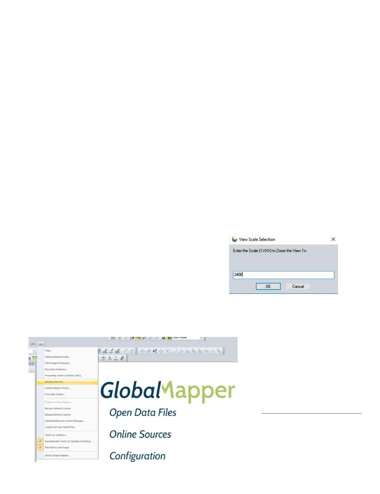
Map Scale—
For several workflows, we will want to pan
to some area of a map and then zoom to a specific map
scale to uniformly evaluate features. While you could use
the Zoom-in and Zoom-out tools on the Navigation Toolbar
while keeping watch on the numeric display of the map
scale, it is faster to zoom to the area-of-interest and use
the keyboard shortcut Shift+Z to bring up a dialog box:
Type in the absolute scale you require and press <OK> to
zoom to that map scale.
File Management
—As with most all
Microsoft™ Windows programs, the
Ctrl+S will save your file (the current
workspace), and Ctrl+O will open a new
data file (invoke a File Explorer for you
to use for navigation). However, with
GlobalMapper™ , the combination of
Ctrl+W will open a Globalmapper™
Workspace, and Ctrl+U will UNLOAD
all loaded data files in a current map and
let you start building a new workspace.
Photogrammetric Engineering & Remote Sensing
Vol. 86, No. 2, February 2020, pp. 75–76.
0099-1112/20/75–76
© 2020 American Society for Photogrammetry
and Remote Sensing
doi: 10.14358/PERS.86.2.75


