Who Should Submit Abstracts? Who Should Submit Abstracts?
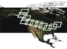
You – U.S. and Canadian participants involved in cross-border mapping and imaging activities, who can share current experiences, advance and develop plans for U.S./Canadian collaborations, and highlight Canadian remote sensing and geospatial technology and applications.
Who Should Attend?
All of the above plus managers and decision makers, security specialists, data users, and data providers – resource managers, land use planners, engineers, technologists and others in the imaging, mapping and GIS community who are interested in sharing cross-border activities and programs.
Topic Areas
Submission of abstracts is encouraged on the following topics relevant to this conference. Please indicate, from the list below, which topic area is most appropriate for your presentation. Poster and video presentations are also highly encouraged and will be featured throughout the conference. These presentations are for technical work only and are not intended for commercial displays.
- Group on Earth Observations (GEO)/Global Earth Observation System of Systems (GEOSS)
1.1 International GEO/GEOSS activities
1.2 Canadian and U.S. contributions to the nine GEOSS Societal Benefit Areas, including reducing
losses from natural and human-induced disasters; improving water resource management;
improving weather information, forecasting and warning; management and protection of terres-
trial, coastal and marine ecosystems; and understanding, monitoring and conserving biodiversity.
- Integrated Ocean Observation System (IOSS) – (U.S.)
2.1 Great Lakes Observing System – GLOS
2.2 Gulf of Maine Ocean Observing System – GOMOOS
- Cross-Border Environmental Activities
3.1 U.S. Environmental Protection Agency (EPA)
3.2 International Joint Commission (IJC) Boundary Water
3.3 Environmental issues for both countries
- Treaty Compliance
- Homeland Security
5.1 Public Security Technical Program (PSTP) – (U.S./Canada)
5.2 Maritime Domain Awareness (U.S./Canada)
5.3 Common Operating Picture
5.4 Cross Border and Homeland Security Infrastructure Programs (CBIP and HSIP) – U.S./Canada
5.5 Geographic Information System (GIS) for the Nation – U.S.
- Committee on Earth Observation Satellites (CEOS)
6.1 Canadian and U.S. contributions to the CEOS programs
6.2 CEOS Technical Work Group Meetings (may be organized as part of the conference)
- Data Development Activities
7.1 IJC Boundary Commission Mapping
7.2 Orthoimagery – including cross U.S./Canadian border initiatives
7.2.1 U.S. National Digital Orthophoto Program (NDOP), Imagery for the Nation, and State
efforts
7.2.2 Ontario Ortho Programs
7.2.3 Digital Imagery Calibration & Validation
7.2.4 Digital Image Processing
7.3 Land Use/Land Cover (LU/LC) – including cross U.S./Canadian border initiatives
7.3.1 U.S. National Land Cover Data (NLCD)
7.3.2 Ontario LULC Programs
7.3.3 GLOS LULC
- Spatial Data Infrastructure (SDI)
8.1 Global SDI
8.2 Canadian SDI – GeoConnections, Geomatics Canada
8.3 U.S. National Spatial Data Infrastructure (NSDI) – Federal Geographic Data Committee (FGDC),
National Map, Geospatial One Stop
- Standards and Policies Related to Geospatial Data
Across North America
10. Technology
10.1 Lidar
10.2 RADARSAT
10.3 Inertial Measurement Units
10.4 Web-based Data Services and Sharing
10.5 Monitoring Technology
10.6 Simulation
Submission of Abstracts
Abstracts should be submitted electronically only, using the form shown on the conference web site, HERE. Presenters will be asked to select their category and topic area from a list provided on the web site.
Abstract final deadline has been extended. New deadline is: March 6, 2007
Notice of acceptance: May 31, 2007
Proceedings deadline: September 4, 2007
Abstracts are limited to 250 words and must include:
- Paper Title
- 3 - 5 key words
- Author Name(s)
- Proposed Presenter(s)
- Affiliation(s)
- Mailing Address
- Phone, Fax, and E-mail for ALL authors and presenters
NOTE: Those that cannot use the on line abstract form should send abstracts to the Technical Program Co-chairs:
Carolyn Merry
The Ohio State University
merry.1@osu.edu
or
Monique Bernier
Institut national de la recherche scientifique
Monique_Bernier@ete.inrs.ca
Please include ASPRS/CRSS in the subject line of all e-mail communications.
|