PHOTOGRAMMETRIC ENGINEERING & REMOTE SENSING
February 2016
93
T
he City of Santa Fé de Bogotá was founded
in 1538, the region Gran Colombia (modern
Panamá, Colombia, Venezuela, and Ecuador)
achieved independence from Spain in 1819 and
reorganized as a republic in 1886. The Instituto
Geográfico Militar was founded in 1935 and later
renamed in 1950 as the Instituto Geográfico
“Agustín Codazzi” - IGAC, the national mapping
agency of Colombia that is responsible for all civilian
and military mapping. The cartographer, Agustín
Codazzi, produced early nineteenth century maps
of Gran Colombia. In fact, these famous maps have
even appeared on Venezuelan postage stamps.
Furthermore, IGAC provides training services in
the mapping sciences for many Latin American
countries, a service previously provided solely by
the U.S. Inter American Geodetic Survey (IAGS).
The first classical geodetic datum established in Colombia
is the Bogotá Datum of 1941. The defining parameters are
referenced to the International ellipsoid (also called the
Hayford 1909 and the Madrid 1924) where
a
= 6,378,388
meters,
1
/
f
= 297, with an origin of φ
o
= 4° 35´ 56.57˝ N, λ
o
=
74° 04´ 51.30˝ W, and h
o
= 2,633.6 meters, corresponding to the
National Astronomic Observatory in Bogotá as of 1935. The
azimuth to station Suba, α
o
= 359° 30´ 10.0˝, and the initial
defining adjustment of the datum included 5 invar baselines,
133 geodetic stations, 12 astro stations, and “the ellipsoid
normal is coincident with the direction of the plumb line.”
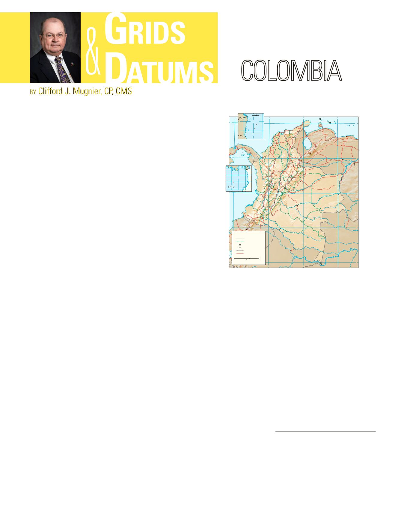
In 1946, the country was divided into four tangent
meridian belts, each belt three degrees wide as measured
from the observatory. For each belt, the False Eastings and
False Northings are equal to 1,000 kilometers each at the
intersections of the central meridians (λ
o
) and the latitude of
the observatory. The belts are lettered as “B” (Bogotá), “Ec”
(East central or Este central), “E” (East or Este), and “O” (West
or Oeste). There may be a new belt “OO” (Western West or
Oeste Occidente) to cover
Isla del Malpelo
in the Pacific Ocean
and
Isla de San Andrés
in the Caribbean Sea. The projection
system used in Colombia by definition is the Gauss Conform
Transverse Mercator, a particular truncation of the Gauss
Schreiber which was used in the U.S. for the North American
Datum of 1927.
The boundary treaty between Colombia and Panamá was
REPUBLIC OF
ratified and mutually exchanged on 31 January 1925. There is
no indication of the geodetic datumused to provide the geodetic
coordinates listed to a tenth of an arc second. Fortunately,
the fourteen boundary points are physically marked and are
presumably recoverable.
The boundary history between Colombia and Brazil is
considerably older, dating back to 1494. The latest treaty with
Brazil was signed in 1928, but the coordinates of the boundary
markers were not published until 1946, presumably on the
Bogotá Datum of 1941.
The land boundary with Venezuela is apparently stable; it
is straddled largely by a continuous chain of quadrilaterals.
However, the territorial limits of the sea seem to be in dispute,
particularly with respect to fishing rights.
Other datums that exist in Colombia (at least theoretically)
include the Provisional South American Datum of 1956 (PSAD
56) and the South American Datum of 1969 (SAD 69). Both
Aruba
Curaçao
Bonaire
Cauca
Río
dal
Mag
Río
Meta
Río
Río
Orinoco
Orin
Río
Ca
si
qui
are
Río
Río
Guaviare
Río
Gu
ai
nía
Río
Napo
Amazon
Rio
Rio
Rio
Negro
Río
Vaupés
Uaupés
A
m
a
z
o
n
Rio
NORTH
PACIFIC
OCEAN
CaribbeanSea
Içá
Japurá
Río
Caquetá
Juruá
Rio
Golfode
Venezuela
Lagode
Maracaibo
ena
Río
Arauca
Meta
Río
Apure
Río
oco
Río
Ja
vari
Río
Putu
mayo
Atrato
Río
Río
Mag
dal
ena
Río
Cau
ca
76
72
68
4
0
4
8
12
12
8
4
0
4
72
76
80
68
Equator
BRAZIL
PERU
PANAMA
VENEZUELA
ECUADOR
(NETH.)
Antilles
Netherlands
(NETH.)
Aruba
LAGUAJIRA
ATLANTÍCO
CESAR
BOLÍVAR
SUCRE
CÓRDOBA
NORTE
DE
SANTANDER
ANTIOQUIA
ARAUCA
SANTANDER
CALDAS
BOYACÁ
CHOCÓ
RISARALDA
CUNDINAMARCA
CASANARE
VICHADA
QUINDÍO
TOLIMA
VALLEDELCAUCA
META
CAUCA
GUAINÍA
HUILA
GUAVIARE
NARIÑO
CAQUETÁ
VAUPÉS
PUTUMAYO
MAGDALENA
AMAZONAS
Bogotá is also thecapitalofCundinamarcaDept.
DISTRITO
CAPITAL
DEBOGOTÁ
Pico
Cristóbal
Colón
5,775m
(18,947 ft)
Base 803338AI (R00820) 1-08
SantaMarta
Barranquilla
Maracaibo
Cartagena
Valledupar
Barquisimeto
Valencia
Colón
Sincelejo
Montería
Yaviza
Cúcuta SanCristóbal
Barrancabermeja
Bucaramanga
Arauca
Medellín
PuertoCarreño
Paz deRío
Tunja
Quibdó
Puerto
Yopal
Ayacucho
Manizales
Pereira
Santa
Rita
Armenia
Ibagué
Villavicencio
Buenaventura
Inirída
Cali
Neiva
San José del
Guaviare
Popayán
SanVicente
delCaguán
Florencia
Pasto
Mitú
Mocoa
Cucuí
Esmeraldas
SãoGabriel
daCachoeira
Iquitos
Leticia
Tabatinga
Caracas
Willemstad
Panama
Bogotá
Quito
San
Fernando
deAtabapo
Cerrejon
San
Lorenzo
Tumaco
Puerto
Bolívar
Ipiales
PuertoAsís
Calamar
Maracay
Oranjestad
In
te
Am
er
ic
an
Hi
gh
way
r-
Highway
American
Pan-
American
Pan-
Highway
Amer
Pan-
way
American
Pan-
Highway
Ríohacha
Larandia
Tres Esquinas
San
Miguel
Turbo
Covenas
Tulua
Tolemaida
SantaAna
Puerto
Salgar
Puerto
Berrío
Carepa
ElAmparo
Barinas
Coro
San
Carlos
San
Fernando
Flor de
Agosto
Vidal
Pantoja
Yauareté
Fonte
Boa
Nueva
Loja
VilaBittencourt
(coalmine)
American
Pan-
Highway
ican
High
Puerto Leguízamo
Pan-American
Highway
Pan-American
Highway
LaPedrera
La Tagua
Puerto
Santander
El Encanto
Puerto
Cabello
Tulcán
Cabruta
San Juan de
losMorros
San
Felipe
Trujillo
Mérida
Puerto
Páez
Morganito
Caicara de
Orinoco
Guanare
BarrancoMinas
International boundary
Road
Railroad
Department boundary
TransverseMercatorProjection,CM71W
National capital
Colombia
Department capital
100
200Miles
0
0
100
200Kilometers
4
6
8
82
80
78
0
100Miles
0 100Kilometers
Islade
Malpelo
NORTH PACIFIC
OCEAN
2
PANAMA
COLOMBIA
12
14
84
82
80
0
100Miles
0
100Kilometers
SanAndrés
(department capital)
HONDURAS
NICARAGUA
COSTA
RICA
Islade
Providencia
Islade
SanAndrés
SanAndres y
Providencia
'
Caribbean
Sea
Photogrammetric Engineering & Remote Sensing
Vol. 82, No. 2, February 2016, pp. 93–94.
0099-1112/16/93–94
© 2015 American Society for Photogrammetry
and Remote Sensing
doi: 10.14358/PERS.83.2.93


