PHOTOGRAMMETRIC ENGINEERING & REMOTE SENSING
May 2020
273
Geográfico do Exército (IGeoE) (The Army Geographic
Institute) on 01 July 1993 upon order of the Ministry
of Defense, thus becoming the heir to the longstanding
Portuguese military cartographic traditions. IGeoE became
the organization responsible for the production of Military
cartography under the aegis of the Logistic Command.
The Lisboa Datum to WGS84 Datum transformation
parameters are ∆X = –302.581m ±0.49m, ∆Y
= –61.360m±0.65m, and ∆Z = +103.047m ±0.49m. The
Datum 73 to WGS84 Datum transformation parameters
are ∆X = –223.116m±0.11m, ∆Y = +109.825m ±0.15m, and Z
= +36.871m ±0.11m. The European Datum of 1950 (EU50)
to WGS84 Datum transformation parameters (my ten-point
solution) are ∆X = –85.858m±0.19m, ∆Y = –108.681m ±0.26m,
and ∆Z = –120.361m ±0.19m. The National Imagery and
Mapping Agency (NIMA) published a mean solution of 85
points in Europe that are ∆X = –87m ±3m, ∆–98m ±3m, and
∆Z = –121m ±5m. The Porto Santo Datum of 1936 for Ilha de
Madeira to WGS 84 Datum parameters (my six-point solution)
are ∆X = –542.544m±0.31m, ∆Y = –235.514m ±0.31m, and ∆Z
= +285.877m ±0.31m. NIMA published a two-point solution
in 1991 where ∆X = –499m ±25m, ∆Y = –249m ±25m, and
∆Z = +314m ±25m. The Sâo Brás Datum on Ilha Sâo Miguel
to WGS84 Datum parameters (my 4 point solution) are
∆X = –203.584m ±0.26m, ∆Y = +96.902m±0.26m, and ∆Z
= –62.965m ±0.26m. NIMA published a two-point solution in
1987 where ∆X = –203m ±25m, ∆Y = +141m ±25m, and ∆Z
= –53m ±25m.
Thanks go entirely to Jorge Teixeira Pinto, director of
Geodetic Services, Instituto Portugués de Cartografia e
Cadastro.
U
pdate
Portugal has adopted a new map projection, based on the
ETRS89 datum, as a national coordinate system for topo-
graphic mapping purposes. This new map projection is desig-
nated as PT-TM06
). The Portuguese Geographic
Institute
) has observed with GPS more than 1000 points
of the national geodetic network and provides their
Older reference systems are still in use, in particu-
lar Datum 73
) and Datum Lisboa
,
both based on the Hayford ellipsoid. Usual projections of
these datums are identified with epsg codes
(D73)
and
(DLisboa). Coordinates of more than 8000
points (1st, 2nd and 3rd order points of the geodetic network
are
) as well as Bursa-Wolf
to con-
vert from these to ETRS89. Coordinates in these projections
can be transformed to ETRS89 using PROJ.4 command cs2cs.
The RMSE of coordinates transformed using these parame-
ters are of approximately 0.40 m (for D73) and 1.50 m (for
DLisboa).
Using around 900 of the points provided by IGP, datum shift
grids were calculated, using standard kriging interpolation,
for the differences: Datum 73 to ETRS89 (
and
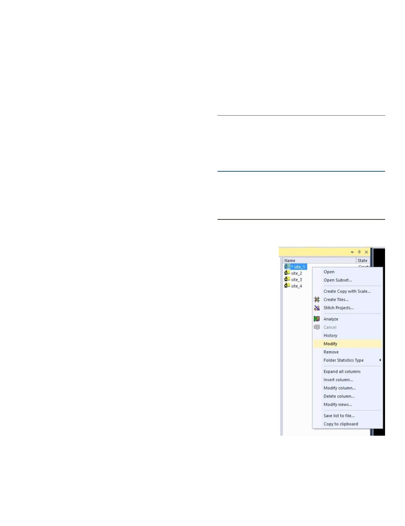
5. Your data will
now be divided
into individual
projects which
then can be
used and ref-
erence. In this
example, an
eCognition™
project
was
created
the
data from each
site. You can
review or mod-
ify the infor-
mation in each
project folder
by right click-
ing and select
modify project.
Rebecca Lemons, Ph.D.
and
Al Karlin, Ph.D., CMS-L,
GISP
are with Dewberry’s Geospatial and Technology Ser-
vices group in Tampa, FL. Rebecca is a Geospatial Analyst
III and works with utilizing Lidar and remote sensing for
vegetation analysis. As a Senior GIS Professional, Al works
with all aspects of Lidar, remote sensing, photogrammetry,
and GIS-related projects.
GIS Tips & Tricks
Datum Lisboa to ETRS89
). These files are in
format NTv2 and can be placed in the directory pointed to by
environment variable PROJ_LIB.
Tests made with a set of around 140 points not involved in
the generation of the grids provided RMS errors of 5 cm in
the case of Datum 73 and 8 cm for Datum Lisboa.
The grid files can be also easily configured in ArcGIS (as a
Custom Geographic Transformation) and other commercial
and open-source GIS programs.
Gonçalves, J., 2009.
Conversões de Sistemas de Coordenadas
Nacionais para ETRS89 Utilizando Grelhas
. Paper
presented at the 6th National Conference of Geodesy and
Cartography.
The contents of this column reflect the views of the author, who is
responsible for the facts and accuracy of the data presented herein.
The contents do not necessarily reflect the official views or policies of
the American Society for Photogrammetry and Remote Sensing and/
or the Louisiana State University Center for GeoInformatics (C
4
G).


