of
VI
adaptations demonstrating a major limitation of the
VI
approach (Qi
et al.
, 2000; Breda, 2003; He and Guo, 2006).
Similar sentiments have been noted in biomass estimation
using radar backscatter (Pairman
et al.
, 1999). Additionally,
many remote sensing studies that mapped biomass with opti-
cal vegetation indexes found that the live biomass component
dominantly influences the
VI
variance (Huete
et al.
, 1999; He
et al.
, 2007; Vogelmann
et al
., 1993; Ramsey
et al.
, 2014).
Even though remote sensing
VI
indexes are broadly useful,
the implication is that the mapping success to some degree is
dependent on the relationship of the live biomass component
to the total biomass. In addition, it infers that canopy structure
remains consistent enough throughout the mapped spatial
extent so that the biomass composition and canopy reflectance
relationship remains substantially unaltered. While evidence
indicates these two criteria often are realized, a more robust
remote sensing estimator of the canopy structure would ensure
more complete and timely accounting of changes in the marsh.
Canopy Structure Profiling
The representation of a vegetative canopy in terms of structure
as the “spatial arrangement of plant’s aboveground organs in
plant communities” (Campbell and Norman, 1989) has a long
history. Watson (1947) first standardized
LAI
as one component
of structure describing the total one-sided leaf area per ground
area (m
2
/m
2
). Since then numerous review articles have docu-
mented limitations and advantages of direct and indirect mea-
surement of
LAI
(e.g., Breda, 2003; He and Guo, 2006; He
et al.
,
2007; Rakocevic
et al.
, 2000; Juarez
et al.
, 2009; Weiss
et al.
,
2004) and provided summaries of ranges reported (Scurlock
et al.
, 2001). Some of those articles as well as study-specific
articles have reported values for the visible-light extinction
coefficient (
KM
) that is related to the orientation structure
of the vegetative canopy elements, dominantly leaves and
stems (e.g., Wolf
et al.
, 1972; Lindquist, 2001; Rakocevic
et al.,
2000). Most studies that report vegetation structure describe
forests and agriculture landscapes. Although advantageous for
proper monitoring and development of physical dynamics,
incorporation of canopy structure profile measurements into
terrestrial mapping strategy is lacking, particularly in grass-
lands, and within those, especially marshes.
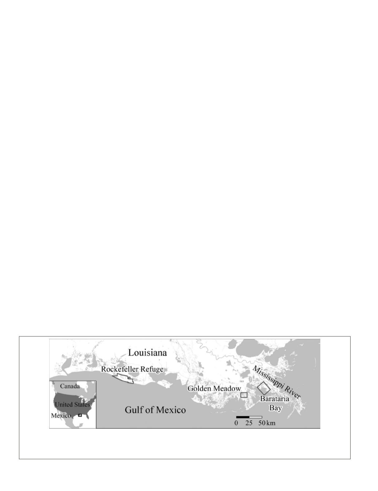
Coastal Description and Site Locations
Located in the deltaic plains of the north-central Gulf of Mex-
ico, the study region encompasses estuarine wetlands (Sasser
et al.
, 2008 and 2014) (Figure 1). These marshes are scoured by
hurricanes that push water with elevated salinity into inland
marshes where channels, levees, and impoundments impede
overland flow lengthening marsh exposure to elevated salinity
surge water and prolonged inundation promoting marsh alter-
ation and deterioration (Neyland, 2007; Ramsey
et al.,
2011).
Field sites are located in three dynamically diverse regions
of the coastal landscape (Figure 1). The furthest east sites lie
within Barataria Bay directly adjacent to the Mississippi River
delta that was heavily impacted by the Deepwater Horizon
oil spill in 2010 (Ramsey
et al
., 2011a). Further to the west
in the Golden Meadow region are located inland marsh sites
that although experiencing tidal water level variations are
not exposed to wave and storm energy as marsh in Barataria
Bay. Moving further west to the Rockefeller Refuge and closer
to the shoreline are located the remaining sites lying within
protected impoundments that while retaining a direct connec-
tion to the coastal ocean provide protection from wave ero-
sion. Both the Barataria Bay and Golden Meadow regions are
dominated by
S. alterniflora
marsh while different estuarine
marshes create a spatial patchwork of dominance throughout
the Rockefeller Refuge (Sasser
et al.
, 2014).
S. alterniflora
com-
prised 100% or nearly 100 percent of marsh at all seven sites.
As reported in Ramsey
et al.
, (2004), marsh canopy struc-
ture varies over time and from site to site, sometimes dramati-
cally. This occurs between different marsh species and also
within a single species. An added complexity and one core
reason for advancing marsh structure mapping is the often
abrupt changes in canopy density and orientation within the
canopy vertical profile associated with lodging. Lodging is
not as pervasive in
S. alterniflora
as in for example S.
patens
marshes (Ramsey
et al
., 2004), however, it does occur and
can be acute.
S. alterniflora
marshes also exhibit changes in
form (height, leaf width, density) dependent on province and
growth stage. While variation in form was not a differential
variable between the three physiographic regions used in this
study, marsh form (not including leaf width) and biomass
composition varied highly at each site and from year to year
(Table 1). High variability was associated with a regional die-
back centered on the Golden Meadow region (Ramsey
et al.
,
2014). Marsh composition expressed as live over dead biomass
ratio may exhibit a similar dieback response pattern across all
three regions, however, this single communality is not clearly
supported by the remaining biophysical and structure vari-
ables (Table 1). What was clearly observed was high variability
in marsh height, density, composition, and the vertical distri-
bution of these measures from site to site and year to year.
Light Recording Equipment
The conditions existent in the marshes studied offered two
possible solutions for workable and accurate measurement
Figure 1. The coastal marsh region of Louisiana located in the north-central Gulf of Mexico. The rectangle boxes locate Barataria Bay,
Golden Meadow, and Rockefeller Refuge study regions. Golden Meadow and Rockefeller Refuge
S. alterniflor
a field sites were occupied in
2010 to 2012 and Barataria Bay field sites in 2011 and 2012. NASA PolSAR and field data collections were coordinated. PolSAR collec-
tions in Barataria Bay occurred from 2009 to 2012.
808
October 2015
PHOTOGRAMMETRIC ENGINEERING & REMOTE SENSING


