528
August 2017
PHOTOGRAMMETRIC ENGINEERING & REMOTE SENSING
Capture Area and
Resolution
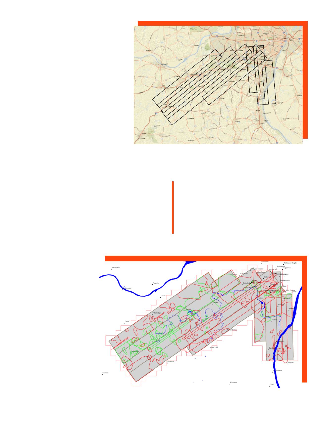
In the case of the Meramec flooding, local media
coverage combined with local knowledge of the
historically problematic area was sufficient to
define the area of capture. Surdex chose to acquire
approximately 620 square miles of imagery,
including coverage from the mouth at the Missis-
sippi River near Arnold, Missouri, out to St. Clair,
Missouri. This final flight plan included eight
flight lines at a resolution of 1’/30cm.
Weather Challenges
With concerns that weather, principally scattered
cloud cover, would interfere with creating a useful
product, Surdex determined that at least two over-
flights of the flight plan would be executed, with the
belief that the combined acquisition would result in
data largely free of cloud/cloud shadow. The first mission was
flown from approximately 12:00 pm to 1:30 pm and a second
mission from approximately 3:30 pm to 4:30 pm.
Expedited Data Processing
For quick response situations, a revised process is utilized
to expedite data production:
•
Ground control is not introduced into the aerotriangula-
tion unless it is readily available.
•
Only existing elevation model
data is utilized with no up-
date/edit of the existing data.
•
Automated seamlines are
used with little or no editing.
•
Radiometric balancing is per-
formed to a large degree, but
localized modifications are not
done.
•
All technicians work under
emergency response condi-
tions, supplying a steady
work force with a target com-
pletion of 24 hours or less.
Production steps include:
•
Image processing from source
imagery to raw imagery
•
ABGPS/IMU processing
•
Imagery inspection
•
Aerotriangulation
Flight plan covering the Meramec River from St. Clair, Missouri to confluence with the
Mississippi River near Arnold, Missouri. Total coverage was approximately 620 square
miles at 1’/30cm resolution.
Notations illustrating cloud/cloud shadow cover for the first (red) and second (green) flight missions.
“
During very poor weather
conditions, Surdex provided
emergency service agencies with
before-and-after flood imagery
within 24 hours.”


