PHOTOGRAMMETRIC ENGINEERING & REMOTE SENSING
August 2017
523
PHOTOGRAMME TR I C ENG I NE ER I NG & REMOT E SENS I NG
The official journal for imaging and geospatial information science and technology
August 2017 Volume 83 Number 8
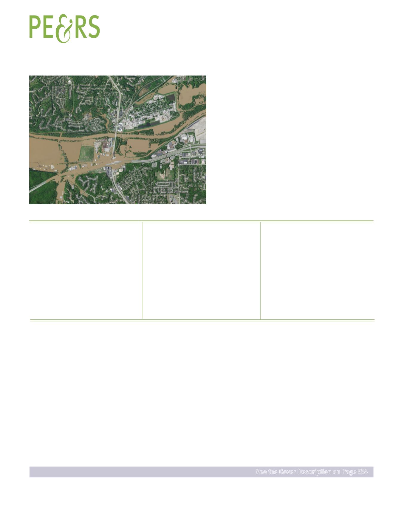
Craig Molander and John Boeding (CP, PLS), Surdex Corporation
Surdex Corporation of Chesterfield, Missouri, has responded
to several natural disasters with aerial data acquisition missions over the last
decade. We discuss a recent response to the Meramec River flooding in the St.
Louis metropolitan area as a case study.
FEATURES
PEER-REVIEWED ARTICLES
Di Shi
and
Xiaojun Yang
The performance of random forests for land cover mapping is evaluated relative to
several popular classifiers.
Binbin He, Xingwen Quan, Dasong Xu, Changming Yin, Zhanmang Liao, Shi Qiu, Jinsong Ge,
and
Zhijun Zhang
A method to simultaneously consider the spectral information from neighboring pixels
and the spatial dependency among these pixels for the improvement of grassland canopy
water content retrieval.
Yansheng Li, Xin Huang,
and
Hui Liu
A deep feature learning method for the detection of urban villages, the informal
settlements in China.
Orrin Howard Thomas, Charlie E. Smith,
and
Benjamin E. Wilkinson
Determining if aerial data collection companies can collect data more economically using
small unmanned aerial systems.
COLUMNS
The Column of the Student Advisory Council.
This month we look at the Republic of Korea.
ANNOUNCEMENTS
Join us in welcoming our newest members to ASPRS.
DEPARTMENTS


