526
August 2017
PHOTOGRAMMETRIC ENGINEERING & REMOTE SENSING
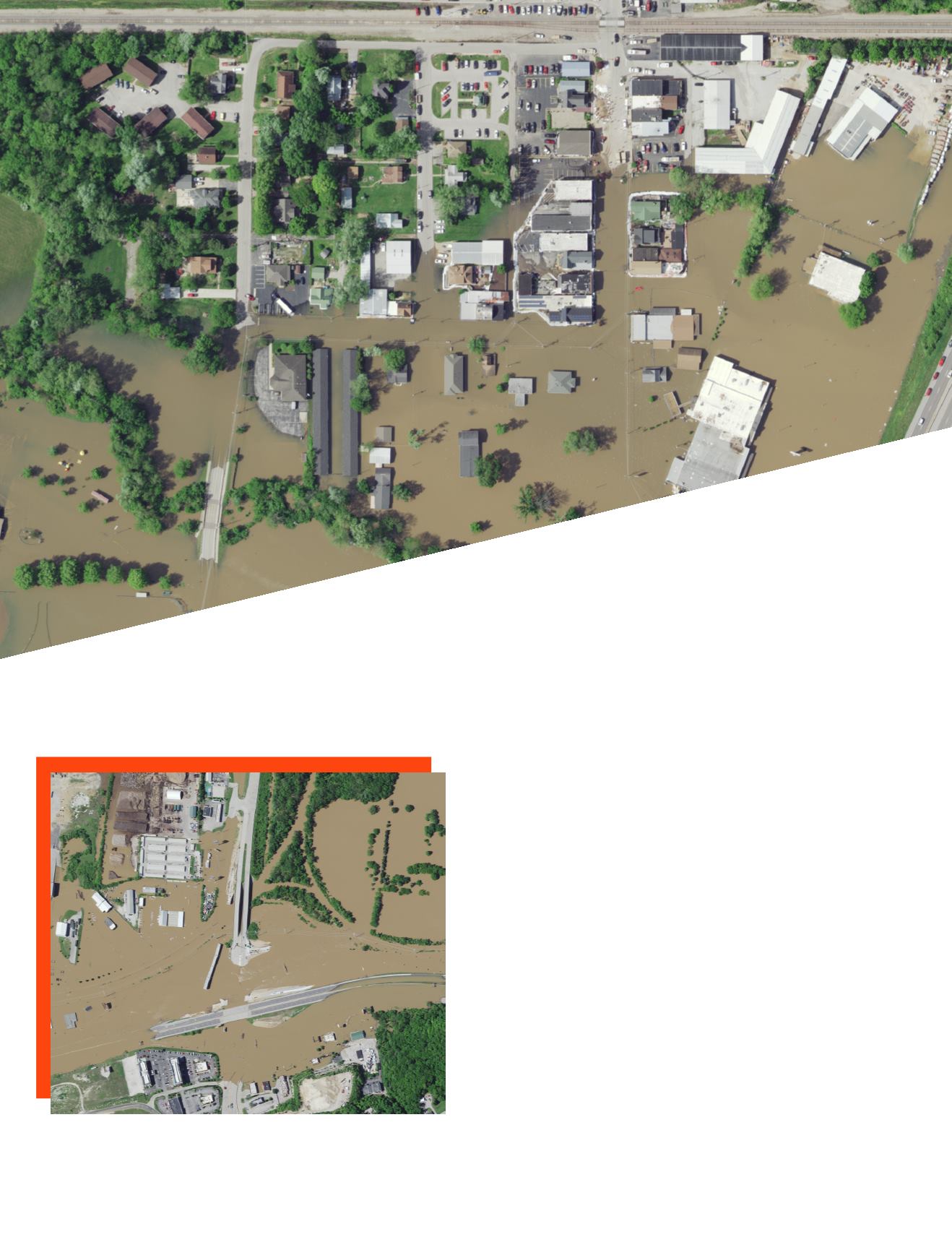
The Meramec River Flood Area
Missouri’s Meramec River is one of the largest free-flowing
waterways in the state. Its source is southwest of St. Louis,
in Dent County, and its mouth at the Mississippi River in
Arnold, some 20 miles south of St. Louis. Its meandering
220 miles drains nearly 4,000 square miles in a watershed
covering six Missouri counties. It is used extensively for
fishing, boating, and canoeing and is surrounded by exten-
sive hiking and biking trails.
In late April 2017, the St. Louis region experienced excep-
tionally heavy rains. In Sullivan, Missouri, nearly 7 inches
of rain fell from April 29 through May 1. Local authorities
watched with concern as the rivers swelled beyond capacity.
Surdex Corporation in nearby Chesterfield, Missouri, mon-
itored the situation and was able to conduct aerial imagery
acquisition – despite the exceptionally cloudy and rainy con-
ditions – to pull together a complete coverage of the flooded
area for local communities and disaster recovery officials.
W
ith the projection that the flood would crest early on
Wednesday, May 3, Surdex acquired aerial imagery on May
2, processed the images, and provided web services contain-
ing the orthoimagery within 24 hours.
The Meramec crested on Wednesday, 3 May, at 36.52’,
2017 Flooding of
Missouri’s Meramec River
Flooding at the intersection of Missouri Highway 141 (top to bottom)
and Interstate 44 (left to right) in Valley Park, Missouri.


