596
October 2020
PHOTOGRAMMETRIC ENGINEERING & REMOTE SENSING
And there you have it, two LAStools
Python scripts that produce the same
results, but with the arguments in a
different order.
Matt Bauld
and
Al Karlin, Ph.D.,
CMS-L, GISP
are with Dewberry’s
Geospatial and Technology Services
group in Tampa, FL. Matt is a Geo-
spatial Analyst who works primarily
with processing topobathymetric lidar
and constructing lidar-derived DEMs
and breaklines. As a Senior Geospatial
Scientist, Al works with all aspects of
Lidar, remote sensing, photogramme-
try, and GIS-related projects.
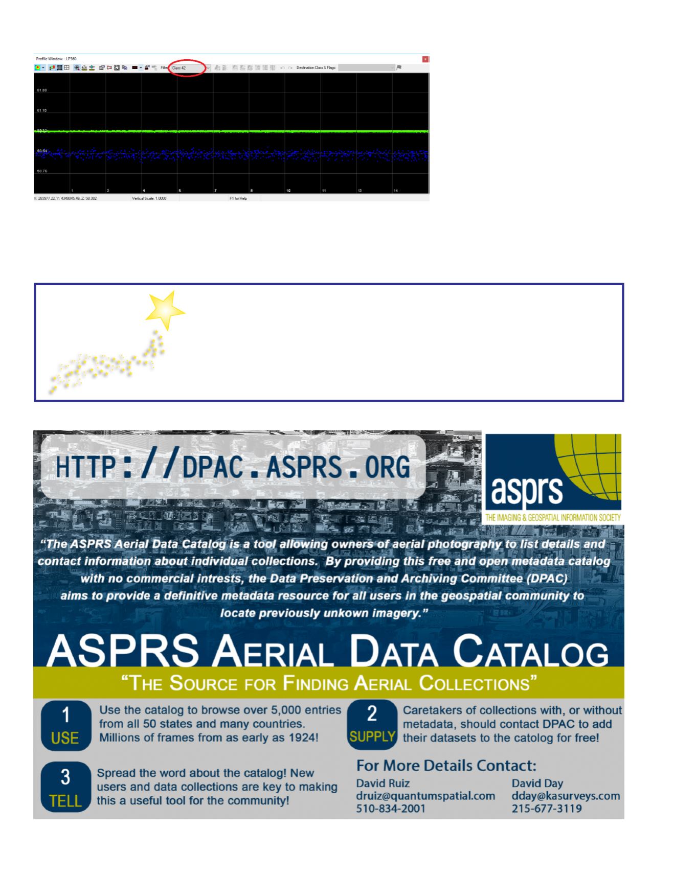
Figure 2. After running the aforementioned LAStools command, Return number zero points have been prop-
erly reclassed to ASPRS Class 42- Synthetic Water Surface (Green points) in this profile showing ONLY Class
42. The Terrascan suite does not currently support reclassification by return number, but this operation is
supported in LAStools.
Rising Star
ASPRS
PROGRAM
The Rising Star program is focused on mentorship of tomorrow’s leaders within
ASPRS and the geospatial and remote sensing community. Geospatial companies,
agencies, and ASPRS regions can all benefit by participation in the program through
the advancement and professional development of their employees or associates
through the process of sponsorship.
For more information go to
.


