PHOTOGRAMMETRIC ENGINEERING & REMOTE SENSING
October 2020
595
GIS
&
Tips Tricks
By Dave Maune, Ph.D., CP, GS, PS,
and
Al Karlin, Ph.D, CMS-L, GISP
Matthew B ld and Al Karlin, Ph.D.
CMS-L, GISP
Order Does Not Matter for LAStools
For most of us with any programming experience, especially
us old FORTRAN programmers, we know that program-
ming languages are carefully structured and the order of
instructions in a program really matters. Getting things out
of order may produce unexpected results. Rules, like using
parenthesis around operators, as in converting angular coor-
dinates into their decimal equivalents:
Latitude = ((Degrees)+(Minutes/60)+(Seconds/3600))
to ensure that operations are performed and grouped in
the expected order are typically observed. Arguments for
instructions are expected to follow a certain order otherwise
the instruction may error (or go into that infinite loop). The
same is generally true for Python scripting.
Here at Dewberry, we make use of a several commercial, off
the shelf software tools when processing lidar data, but we
usually customize them to our specific needs. The customi-
zation usually entails calling them from custom scripts, most
of which are written in the Python programming language.
Because LAStools (rapidlasso GmbH::
contains numerous independent executable
files, LAStools presents Dewberry the ideal opportunity to
construct custom lidar processing Python scripts.
We have noticed that LAStools uses a syntax structure for
Python scripting that is less demanding than most that we
have previously encountered. Unlike Python interpreters,
such as Arcpy (packaged with the Esri ArcGIS/ArcGISPro
suite) which expects arguments to be given in a set order and
separated by commas, LAStools accepts arguments in essen-
tially any order and separated by spaces. While this feature
of LAStools is well documented on the University of North
Carolina LAStools page
it is a bit difficult to find. So, below is an example
of a LAStools command from a recent project that reclasses
points with return number 0 from any ASPRS point class to
ASPRS Class 42.
lastoolspath\las2las -i *.las -keep_return 0 -filtered_
transform -set_extended_classification 42 -odix _re-
class -olas -cores 8
Without previous knowledge, the code above doesn’t make a
ton of sense. This statement specifies the following:
Las2las -i *.las: call the las2las executable for each input
files with the .las extension and do the following:
–
keep_return 0: Filters point records with a return
number of 0
–
filtered_transform: Sets the filtered point records as the
points to be manipulated
–
set_extended_classification 42: Reclassifies the filtered
points to ASPRS Class 42
–
odix_reclass: Sets the output file name as the input
name plus “_reclass”
–
olas: Output file as LAS
–
cores 8: use 8 computer cores for processing
The above code could also be input and successfully run as
follows:
lastoolspath\las2las -i *.las -filtered_transform -olas
-set_extended_classification 42 -cores 8 -keep_return 0
-odix _reclass
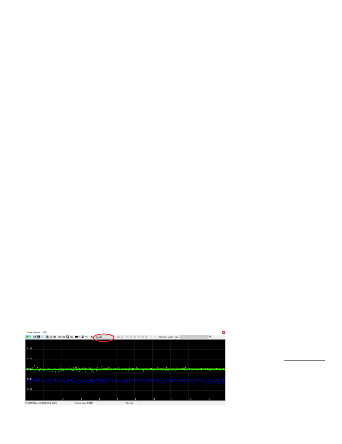
Figure 1. Synthetic (Return number zero) points have been erroneously assigned to ASPRS Class 45- (Green
points) in this profile showing ONLY Class 45 points)
Photogrammetric Engineering &
Remote Sensing
Vol. 86, No. 10, October 2020, pp. 595–596.
0099-1112/20/595–596
© 2020 American Society for
Photogrammetryand Remote Sensing
doi: 10.14358/PERS.86.10.595


