8
January 2017
PHOTOGRAMMETRIC ENGINEERING & REMOTE SENSING
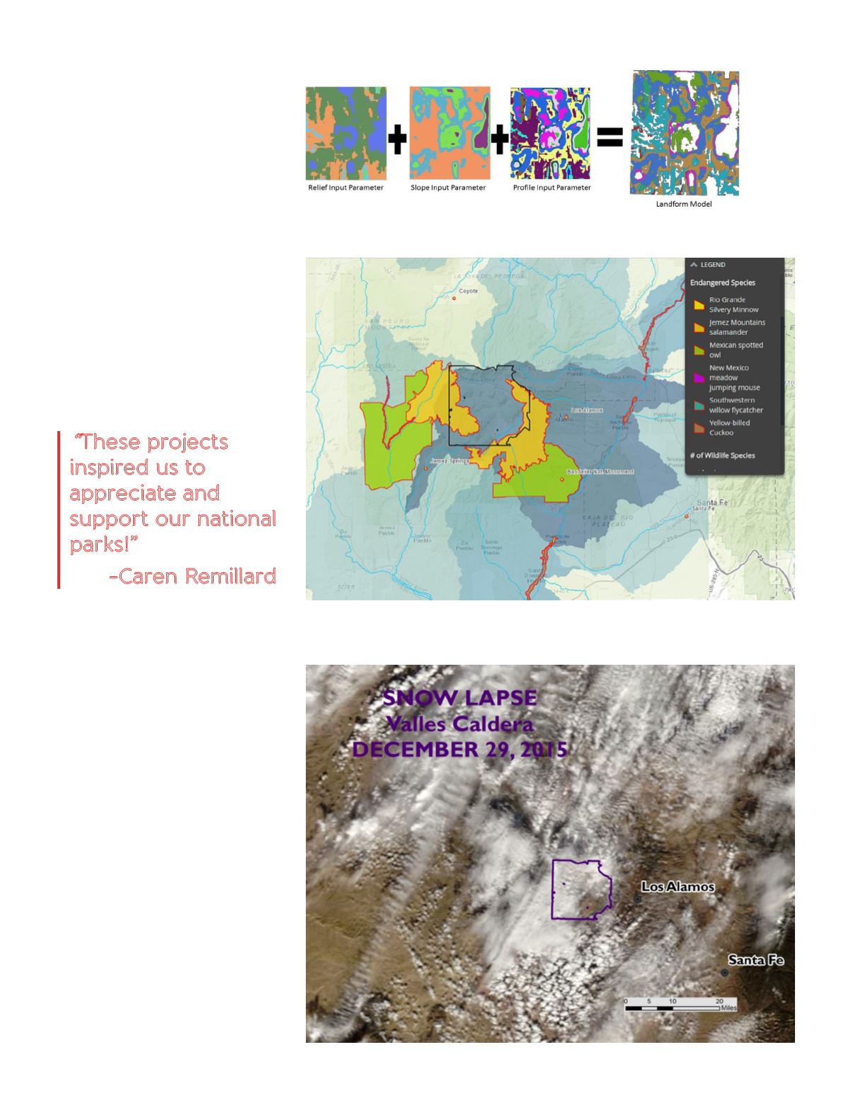
Landform Delineation: Zakiya Shivji
(Figure 3)
•
Download DEM, Hammond’s
Landform Delineation
•
Produce Slope, Relief, & Profile
Parameters to yield Landform Model
•
Spatial Analyst tools used
•
Tools – Raster Calculator, Focal
Statistics, Slope, Reclassify
Wildlife: Elisa Abeyta (Figure 4)
•
Define Project” for undefined
coordinate system, “Project” for all
others
•
Geoprocessing – Clip
Snow Laspse: Renea Roberts
(Figure 5)
•
D
ownloaded MODIS True Color
Reflectance satellite images and
SNOTEL data
•
Maps produced in ArcMap, Exported,
data summarized
•
Adobe Premiere for time lapse videos
“
These projects
inspired us to
appreciate and
support our national
parks!”
-Caren Remillard
Figure 3. Simple Landform Delineation process model (DEM from NM RGIS).
Figure 4. Map of endangered species in and around the Valles Caldera (layers from Nature
Conservancy in New Mexico).
Figure 5. Satellite image from December
29, 2015 of the snow for the Valles Caldera
collected from the National Snow and Ice Data
Center (NSIDC). This is a MODIS True Color
Reflectance image.


