PHOTOGRAMMETRIC ENGINEERING & REMOTE SENSING
January 2017
7
Exploring Valles
Caldera National
Preserve through GIS
Zakiya C. Shivji, Renea Roberts, Randall Dongo-Olsen, Elisa Abeyta,
Daniel Hernandez, Daniel Grondin, and Joseph Zebrowski
By
The team produced several geospatial
products to highlight the preserve’s
unique features. They constructed a 3D
model to reflect the relief and topography
of the terrain and a landform delineation
to classify the different structures that
make up the surrounding caldera area. To
illustrate the recreational activities during
the winter, they created a time-lapse video
displaying snowfall for the 2013-2016
winter seasons using satellite imagery.
Climbing and biking trails were exposed by
maps that show locations for these types
of activities. A description of the wildlife
that inhabits the caldera and surrounding
areas was portrayed on a map alongside
ecoregions. These ecologically driven
maps bring to light the array of wildlife
and the endangered species that reside
inside the caldera.
Methods
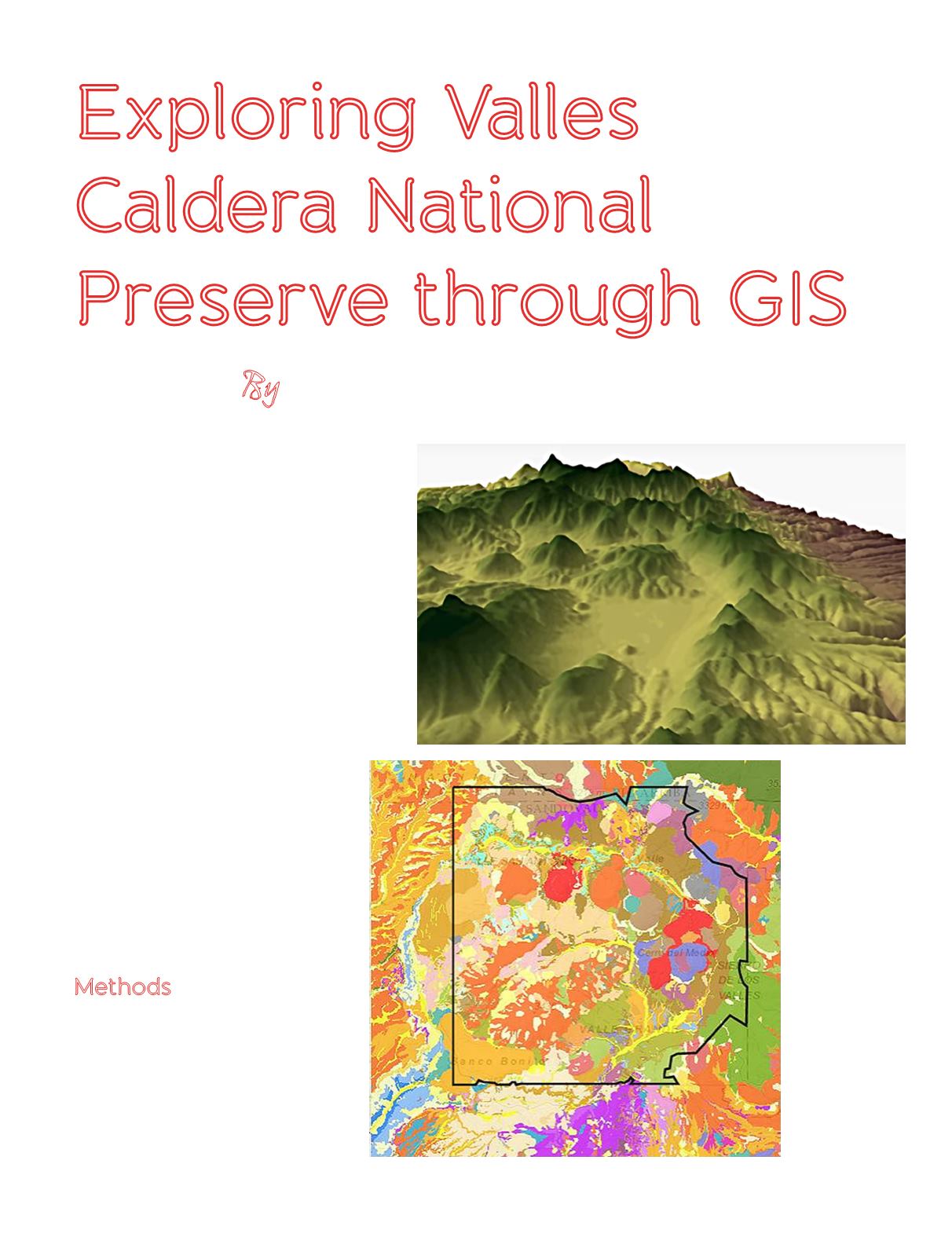
Geology: Daniel Grondin (Figure 2)
•
Data downloaded (12 quad DEMs,
geology layer)
•
Uploaded into ArcMap (projected,
mosaicked)
•
ArcScene for 3D model (1:1.1
exaggeration)
Figure 2. Above is
an image of the 3D
Flythrough (USGS
DEMs downloaded
from New
Mexico Resource
Geographic
Information
System – NM RGIS)
and to the left is
the geological
map of the Valles
Caldera (geology
layer from New
Mexico Bureau of
Geology & Mineral
Resources).


