PHOTOGRAMMETRIC ENGINEERING & REMOTE SENSING
August 2015
603
H I GHL I GHT ART I C L E
Becky Morton
F EATURE ART I C L ES
Karen Schuckman
Karen Schuckman
PE ER - REV I EWED ART I C L ES
Phil Wilkes, Simon D. Jones, Lola Suarez, Andrew Haywood, William Woodgate, Mariela
Soto-Berelov, Andrew Mellor,
and
Andrew K. Skidmore
Vegetation structure metrics were derived from a range of lidar pulse densities,
simulated from data captured across diverse forest types, to assess metric sensitivity
and provide advice to land mangers when acquiring airborne ALS over large areas.
Su Ye
and
Dongmei Chen
An unsupervised procedure for urban change detection by combining
image differencing, T-point threshold, Bayes fusion strategy, and Markov
Random Fields from multispectral remotely sensed images
John Loomis, Steve Koontz, Holly Miller,
and
Leslie Richardson
A survey of downloaders of Landsat images found benefits to US users for
the 2.38 million scenes downloaded is $1.8 billion.
F.J. Ariza-López
and
J. Rodróguez-Avi
Statistical basics and examples for the use of the International Standards
ISO 2859-1 and ISO 2859-2 to control the positional quality of spatial data
669
Bioenergy Crop Identification at Field Scale Using VHR Airborne
CIR Imagery
Muhammad Abdullah Sohl, Patric Schlager, Klaus Schmieder,
and
H.M.
Rafique
A study aimed at developing a methodology to extract maize, a
predominant energy crop, and efficiently map its spatial distribution in a
Natura 2000 region of northern Germany.
PHOTOGRAMME TR I C ENG I NE ER I NG & REMOT E SENS I NG
The official journal for imaging and geospatial information science and technology
August 2015 Volume 81 Number 8
APPLICATIONS
PAPER
COLUMNS
ANNOUNCEMENTS
DEPARTMENTS
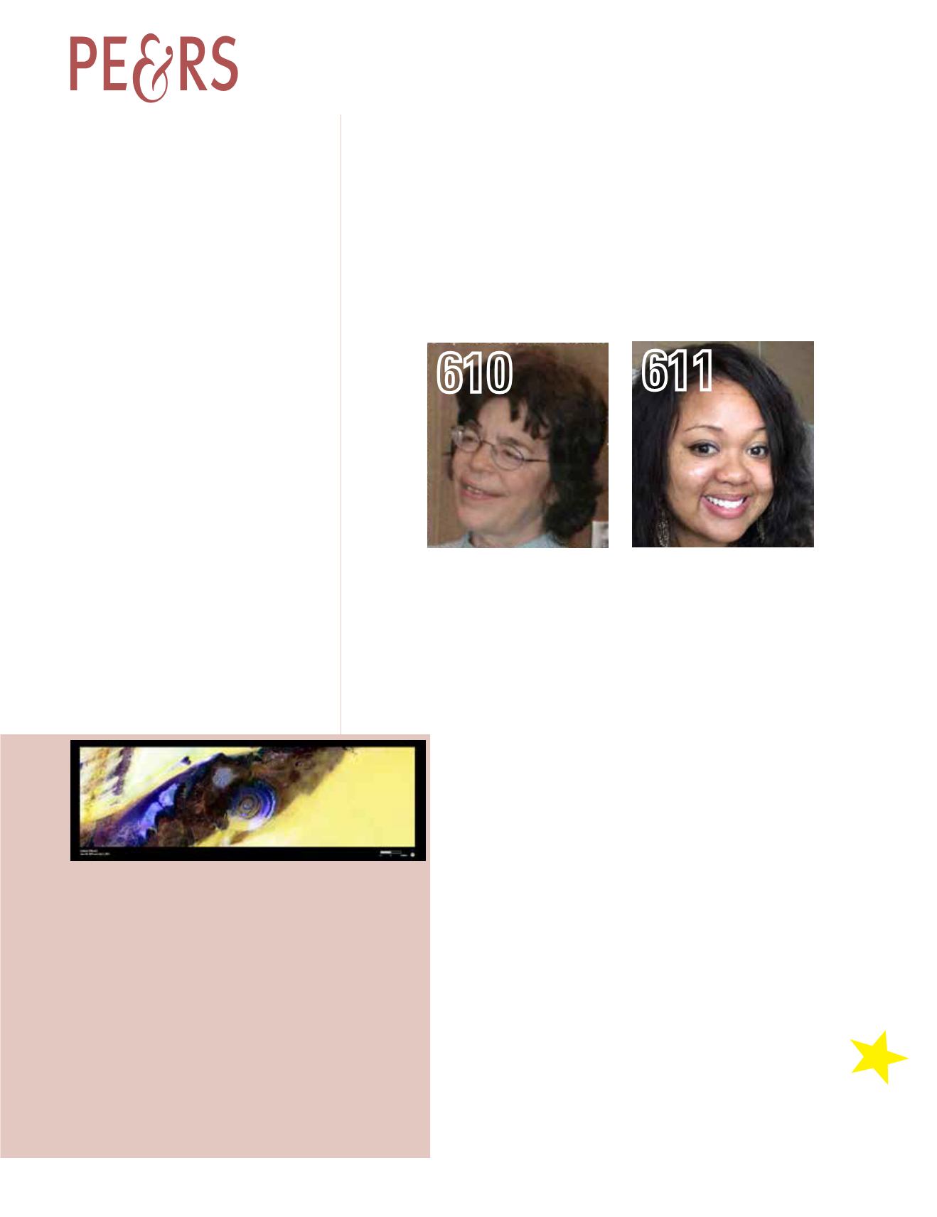
Near the western edge of the Sahara Desert is a feature that resembles a large
eye when viewed from space. The Eye of the Sahara, also known as the Richat
Structure or Guelb er Richat, is a symmetrical dome of eroded sedimentary and
volcanic rock. The outermost rings measure approximately 40 km (25 miles)
across. Persistent northeasterly winds keep much of the dome free from sand,
exposing the various layers of rock. The circular feature was initially interpreted
to be an asteroid impact structure, but most scientists have now concluded that
it was caused by geologic uplift.
This Landsat mosaic of four different scenes shows the geologic feature in
false color. By blending visible and infrared wavelengths (bands), scientists can
enhance the visibility of the various rock layers in contrast to the surrounding
sand (yellow to white).
The Eye of the Sahara is featured along with many other selected images in
the USGS Earth as Art series. The cover image has been cropped and rotated. To
view the full image, visit
.
Eye of the Sahara, Mauritania
Sensor: L8 OLI
Acquisition Date: June 28 and July 5, 2015
Path/Row: 202, 203/45, 46
Lat/Long: 20.983/-11.459


