PHOTOGRAMMETRIC ENGINEERING & REMOTE SENSING
February 2017
71
PHOTOGRAMME TR I C ENG I NE ER I NG & REMOT E SENS I NG
The official journal for imaging and geospatial information science and technology
February 2017 Volume 83 Number 2
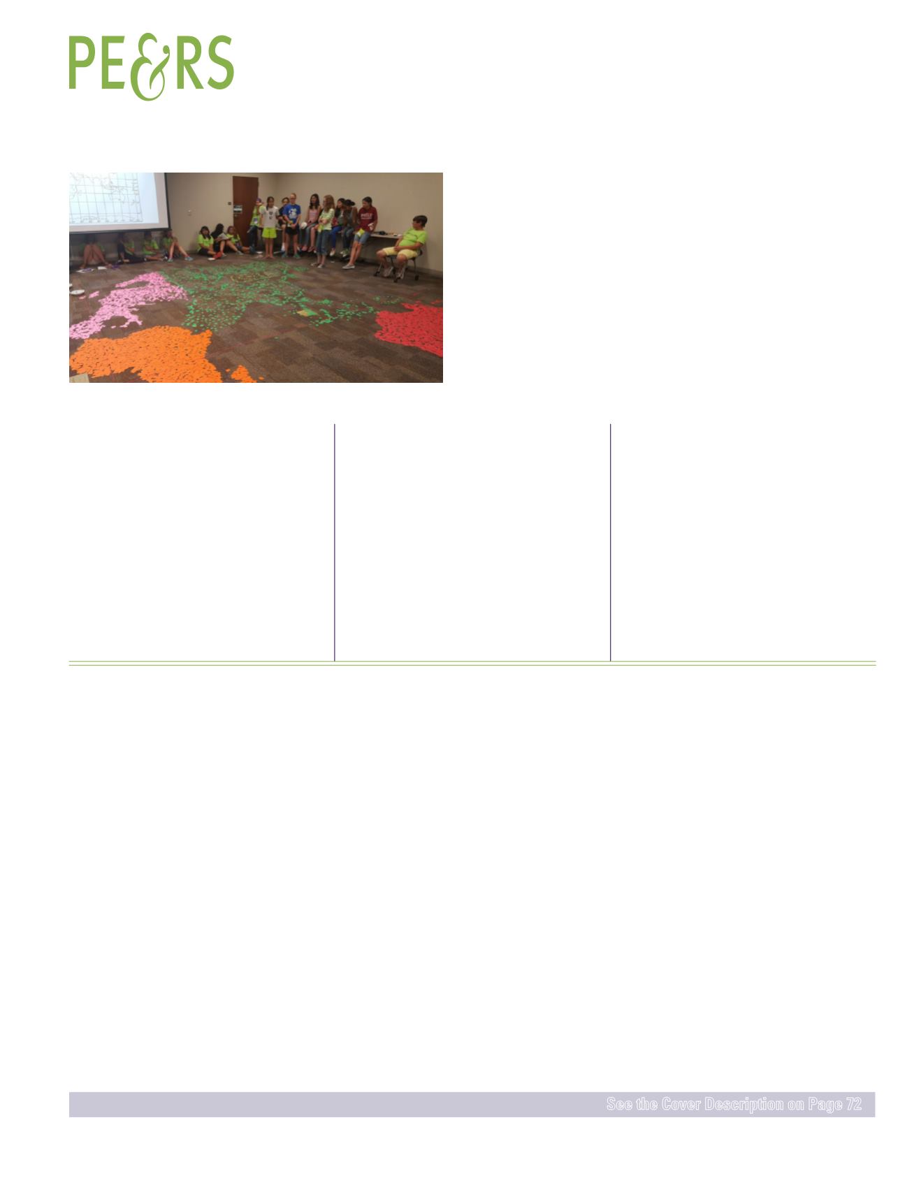
manda D. Aragón, Melissa J. Rura, and Rebecca Morton
Amanda Aragón led a hands-on geospatial science learning experience, where sixty girls
from the state of New Mexico were interviewed and selected for the week-long learning
accelerated experience on the campus of New Mexico Institute of Technology in Socorro,
New Mexico. In addition to robotics, computer science, biology and other areas of research,
they participated in the “Pixel Matrix,” an interactive, youth, group learning activity to
promote understanding and cognitive skills by integrating remote sensing and geography
skills with a hands-on learning experience.
FEATURES
Y. Mostafa
and
A. Abdelhafiz
A novel index with automatic threshold to classify satellite images into shadow, water,
and non-shadow pixels.
Liying Wang, Yan Xu,
and
Yu Li
A binary voxel-based data (BVD) model is proposed to reconstruct aerial lidar point cloud
and based on the constructed model 3D ground filtering is developed for separating
ground points from not-ground points.
Qingyu Li, Xin Huang, Dawei Wen,
and
Hui Liu
A multi-texture change detection method integrating macro- and micro-texture features.
Madhurima Bandyopadhyay, Jan A.N. van Aardt, Kerry Cawse-Nicholson,
and
Emmett
Ientilucci
Details of the accurate and spatially consistent detection of vegetation and building
in urban environments using a fusion-based approach, by combining complimentary
characteristics of Lidar and aerial color (RGB) imagery.
Ravi Ancil Persad
and
Costas Armenakis
A novel approach for the automatic alignment of 3D point cloud surfaces by matching
keypoint surface descriptors.
Wenlin Yan, Luísa Bastos, Sérgio Madeira, Américo Magalhães,
and
José A. Gonçalves
A simple and inexpensive POS for the application of light airborne platforms was
developed, and a new Kalman Filter was designed to integrate GNSS/IMU/Image,
which is using the relative orientation information to improve the accuracy of exterior
orientation parameters.
PEER-REVIEWED ARTICLES
COLUMNS
This month we look at the Republic of Ecuador.
ANNOUNCEMENTS
ASPRS announces candidates for vice-president, new
corporate member GeoWing Mapping, new advertising/
exhibit sales representative, and February to April 2017
GeoBytes.
Join us in welcoming our newest members to ASPRS.
DEPARTMENTS
Stand Out From the Rest! Newly certified and re-certified
professionals.


