PHOTOGRAMMETRIC ENGINEERING & REMOTE SENSING
July 2018
413
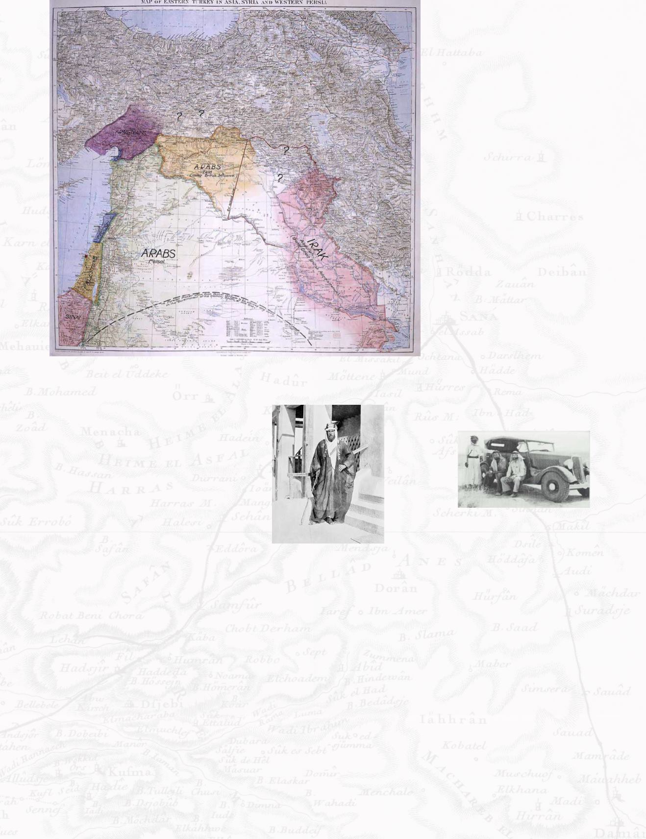
Figure 5. By T. E. Lawrence - British National Archives, Public Domain,
One of the difficulties of mapping large
areas is the ability to not only mea-
sure distances but accurately convey
bearings of measurement. The mod-
ernization of the theodolite, the first
instrument to obtain both vertical and
horizontal angled measurement, al-
lowed these measurements to be taken
in the field. By the late 1880’s, this
surveying tool along with later manifes-
tations of the William Burt Solar Com-
pass, allowed Lawrence and Philby, to
map large areas of northern, western
and southern Arabia around the time of
the first world war. However, accurate
distance remained allusive, and often
needed to be equated from camel hours
or as the French Voyagers did, by the
time it took to smoke a complete pipe
full of tobacco.
The Oil Boom
Following the oil shortages of WWI and
the burgeoning economics of the au-
tomotive century, the western powers
were increasingly interested in discov-
ering and monopolizing new sources.
Given the many naturally occurring oil
seeps in western Persia, the Gulf sepa-
rating the Arabian Peninsula and what
is now Iran, became a hot bed for ex-
ploration. In May 1932, Standard Oil of
California (SoCal) struck oil in Bahrain,
which immediately brought the interest
of exploring (and mapping) the here-
tofore unexplored Eastern Province of
Arabia. Both the Americans and British
(Iraq Petroleum Co), each with their own
concessions in the region, were eagerly
vying for the right to do so. The British,
with their WWI governmental liaison
Harry St. John Philby acting as the sole
western advisor to King Abdul-Aziz
ibn Saud, thought that they already
had the upper hand. However, because
of Philby’s resentments over Britain’s
broken promises to the Arabs with the
Sykes-Picot Agreement, he treacherous-
ly handed the concession to the Ameri-
cans on May 29, 1933. (Figure 6).
Within a year, the Americans had sent
geologists, engineers and surveyors to
the region, to explore, map and locate
the most opportune sites for drilling
test wells. Although they could ship
all the most modern equipment, the
first Americans were ill prepared for
the realities of mapping in the extreme
heat, humidity and sand conditions of
the Eastern Province. A number of local
Bedouin guides were provided by the
Amir of Dammam, these men became
known as the ‘relators’ and they pro-
vided a living geographic encyclopedia
which allowed Arabia to be mapped.
Even so, going was a slow slog through
sandy dunes even in vehicles with over-
sized tires.
To speed up the process significantly,
the Americans convinced the King that
the best way to find areas of potential
oil, was to map the peninsula by air.
Dick Kerr, an ex-US Navy pilot operat-
ing one of the first aerial mapping busi-
ness’ in the US (located in Los Angeles)
was asked to take on the contract of
obtaining aerial photography and pro-
viding air support for ground surveyors.
Deeming that a smaller plane would
fare better in landing among the
sinuous salt flats between high desert
dunes, the company specially ordered
a Fairchild 71 from the Hagerstown,
Maryland factory. A hole was built into
the belly of the aircraft behind the pilot,
Figure 6. Image from The heart of Arabia, a
record of travel and exploration (London:
Constable and Company, 1922) by H. St.
J. B. Philby:
Figure 7. Image from The Search Began In
1933
/ 9 March 2007).


