PHOTOGRAMMETRIC ENGINEERING & REMOTE SENSING
July 2018
415
Arab culture towards anyone with the
blessing of the King, ensured that the
men were always near help. Innovation
was also the hallmark of survival, when
a ground crew needed to communicate a
move of their camp to the airplane, they
would mark out the direction of travel
with tire tracks and provide a bearing
with a shovel. By burning pools of petrol
in the grooves, the scorched sand writing
could be seen for miles.
In total, the Fairchild, known locally
as the ‘Magic Carpet,’ flew over 35,000
miles (56,327 kilometers) of aerial
photography over the 320,00 square
kilometers that made up the initial oil
concession. This work was done primar-
ily in the cooler fall and winter months,
with occasional breaks to visit Lebanon
and Syria.
After four years of mapping and drill-
ing, the oil prospectors were about to
give up, when they struck success on
March 3, 1938 at well ‘Dammam No.7.’
The pride of success was soon over-
shadowed however by the beginnings
of WWII. The next few years proved
to be lean ones for the Americans with
few supplies and amenities available.
However, it was not until the evening
of October 19, 1940 that the war finally
came to them. Italian bombers, based
on the African Coast of Eritrea, tra-
versed the Arabian Peninsula, and then
dropped nearly 50 bombs in Dhahran
and another 80 in Bahrain. Although
little was damaged, both the British in
Bahrain and the Americans in Dam-
mam, evacuated all non-essential staff.
By late 1943 the tide had turned in
Europe and the American Government
was beginning to explore the need for
more fuel in the fight against Japan.
More workers were brought to the
operations, and a new refinery in Ras
Tanura was built. Over the next several
years the company would grow beyond
recognition, going through a variety of
ownership and name changes. The last
transition occurred in 1980, when the
Saudis took 100% ownership.
Aerial Mapping to the
Forefront
Following the success of the first aerial
photography of the Saudi Peninsula,
with the Fairchild 71 in 1934, Aramco
has always had an aerial photography
platform. In the 1990’s the company
acquired its largest and last film format
photogrammetric camera, a Leica
RC30. In 2000 the company moved this
to a newer Citation CJ2 Jet aircraft,
flying higher and faster than Dick Kerr
and Charley Rocheville could ever have
dreamed.
Although the ability of capturing more
detailed aerial data and ground control,
has advanced beyond expectations,
flying conditions remained the same.
Morning flights continued to prove to be
the most effective for obtaining preci-
sion imagery. In addition, the aircraft
are flying further than ever before, in
support of not only petroleum projects
in the Eastern Province, but also for
other mega-Kingdom infrastructure.
The increase in ground surveying accu-
racy, with the introduction of GPS and
later AGPS, also significantly helped
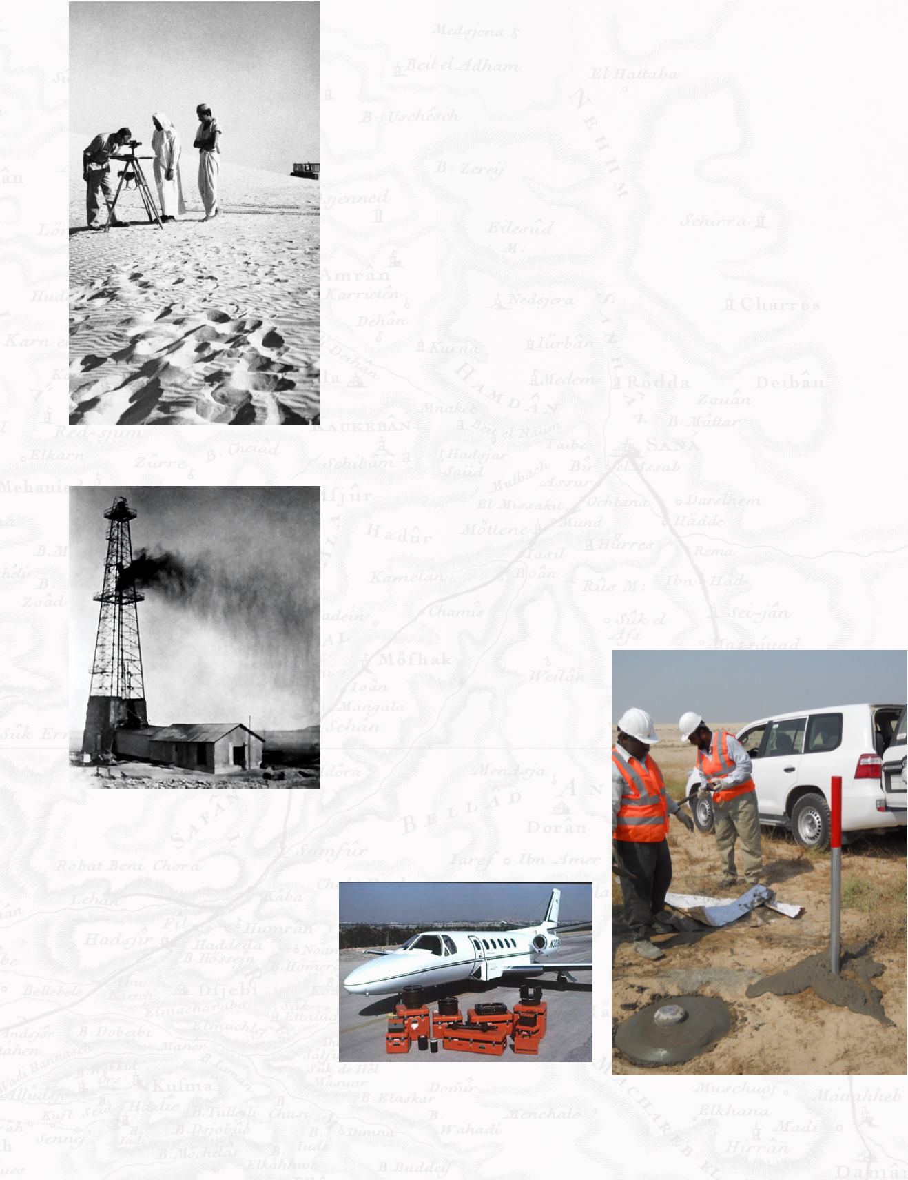
Figure 10. Saudi Aramco Surveyor (circa 1951)
AP Photo.
Figure 11. Dammam Well No. 7, the first
commercial oil well in Saudi Arabia, March 3,
1938. Source Unknown.
Figure 12. Cessna Citation CJ2 with Leica
RC30 Aerial Camera and Equipment. By.
Cessna.
Figure 13. Establishing Survey Control Point,
Eastern Province, photo from author.


