410
July 2018
PHOTOGRAMMETRIC ENGINEERING & REMOTE SENSING
A Glimpse into Antiquity
The historical records of Arabia, like
those of any other region mapped
from a western perspective, have been
centered upon its resources, with only
an afterthought to its peoples’ and poli-
tics. The earliest recorded event was
in 323 BC, when Alexander the Great,
with the assistance of Archias of Pella
and the Greek Navarch Nearchus, at-
tempted to map (and conquer) its exte-
rior. However, like many intentions to
quantify Arabia, this was short lived,
ill planned and never completed.
The Hellenized Greek Eratosthenes
(276-194 BC) was the next to attempt
to fill the void that filled the ring of
coastal maps borne by Ageyptian trad-
ers and seafarers traveling between
Alexandria and India. He was the first
to coin the phrase geographia and was
one of the most astounding mathema-
ticians of his time. Using knowledge
gleaned as the Chief Librarian of
Alexandria, he was able to determine
the circumference of the earth within
10-15% of true accuracy (a difference of
only 44 to 66 km).
The next more earnest and hands-on
attempt was made at the command of
the Roman Emperor Gaius Octavius,
in the year 26 BC. Gaius Aelius Gallus,
the second Roman Prefect of Aegypt,
was given the audacious mission to
either conquer or bargain more directly
with, the purveyors of what was then
the rarest resource known to the Ro-
man Empire, frankincense or
al-lubān
(“that which results from milking”).
The aromatic tree sap gleaned from
rugged crags in the mountains of Ye-
men, was used throughout the empire
in nearly every religious ceremony
from birth until death. Although the
expedition of over ten thousand men
(an oversized Roman Legion), were
forced to turn back just short of their
intended goal, the detailed notes and
drawings as written down by Gallus’
friend and confidant a Romanized
Greek, Strabo of Amaseia in Pontus,
gave birth to the detailed mapping of
Arabia Felix. It was by his hands and
those who later referenced his works,
that most of the earliest known cartog-
raphy related to the Arabia peninsula
was founded.
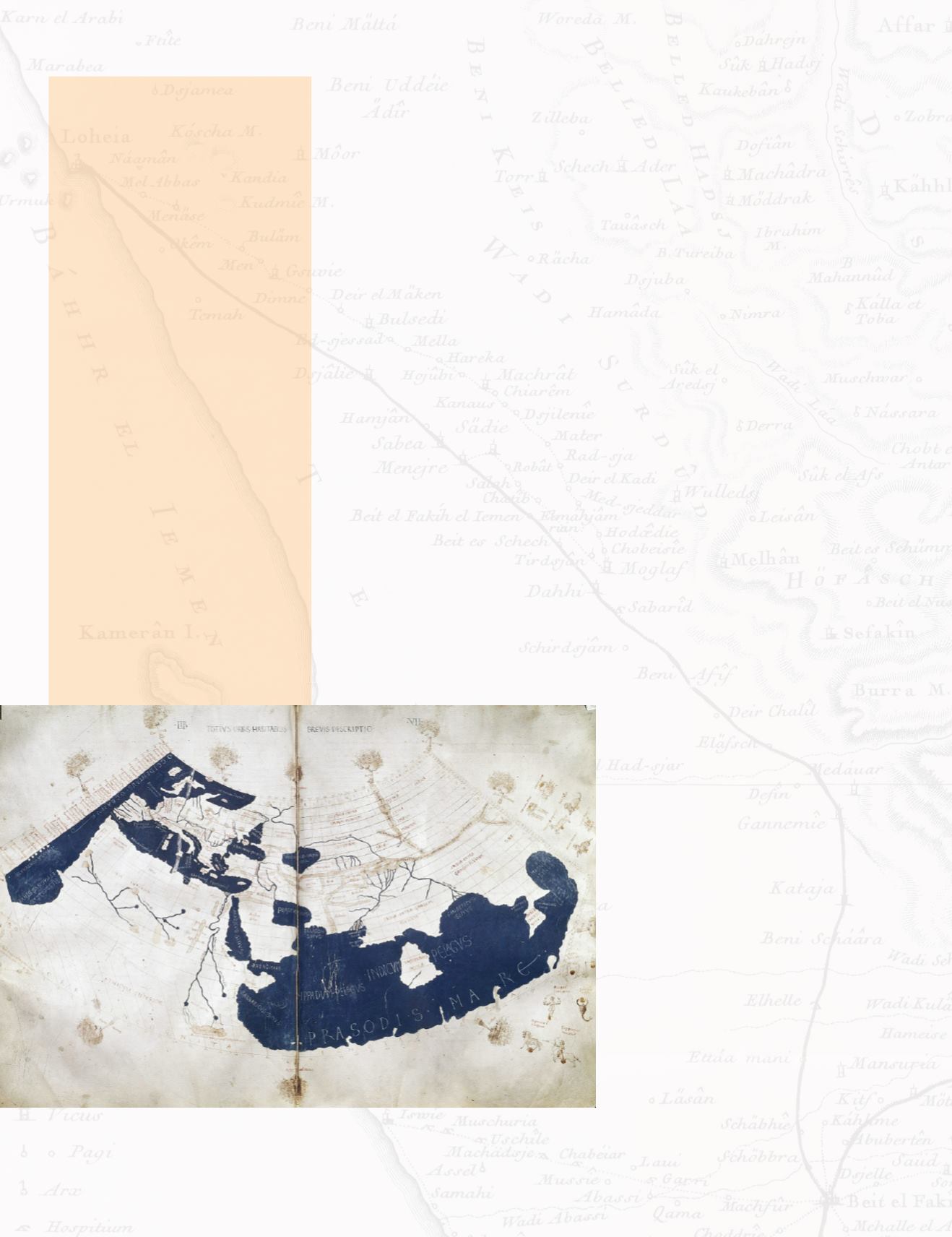
One of the most prolific of these later
adherents was Claudius Ptolemy, also
known as Batlamyus to the Arabs
(100-170AD). There is a dispute as
to his origins, the three most likely
claims were that he was either a Hel-
lenized Greek like Strabo, an Upper
Egyptian (Sudan), or as some prefer
from Arabia itself. In any case, he pro-
vided the greatest contribution yet to
filling in the towns and villages of the
Arabian Peninsula.
Another reference to Strabos came
from the renowned Arab Cartogra-
pher, Muhammad al-Idrisi (1100-1165
AD). Before leaving the instability in
Al-Andalus and coming to the Norman
court of King Roger II of Sicily, Al-Il-
drisi studied in Cordoba Spain. Whilst
there, he was commissioned to create
an atlas of the known world, combining
maps and data from throughout the
Mediterranean and Middle East. The
“Tabula Rogeriana” was completed in
1154 and was the most geographically
Figure 1. The towns and villages of the Arabian Peninsula in a sketch map of 100-170AD Cred-
ited to Francesco di Antonio del Chierico - Ptolemy’s Geography (Harleian MS 7182, ff 58–59),
Public Domain, ttps://commons.wikimedia.org/w/index.php?curid=193697.
The Arabian Peninsula, with its
more than 2.6 million square
kilometers of undulating terrain,
a land of oil and sand, has inhos-
pitable desert landscapes and rock
outcroppings. For more than two
millennia it has waxed and waned
in importance to travelers and ex-
plorers, but only in the past century
has its importance come to the fore-
front to a world-wide population.
During much of this long time, the
interior of the peninsula remained
an empty uncharted void, space
to be filled with imaginary water
ways or a cartographer’s cartouche.
Mapping, let alone surveying, in
such areas, is both difficult and
rewarding.


