210
April 2020
PHOTOGRAMMETRIC ENGINEERING & REMOTE SENSING
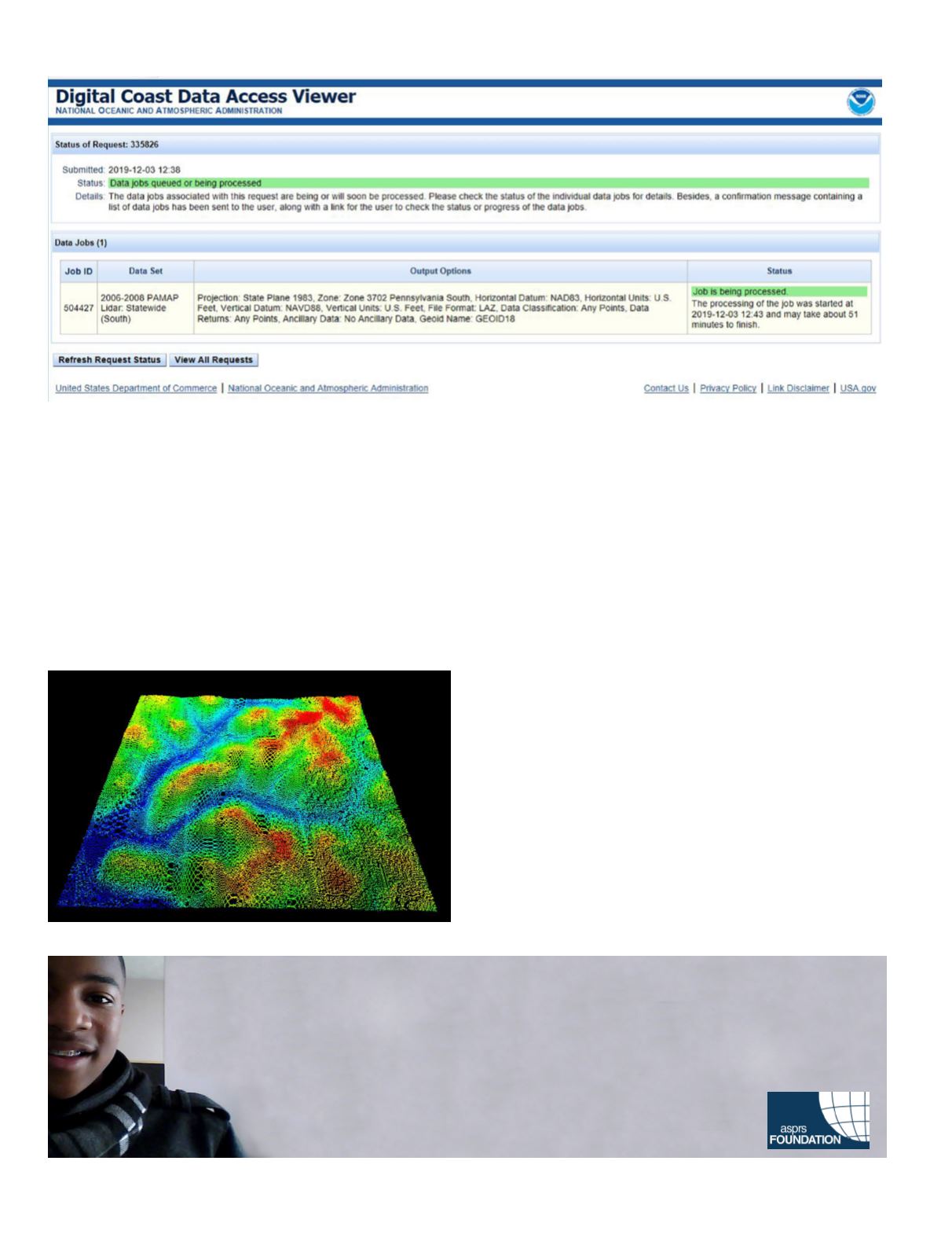
You should receive an e-mail message within a few minutes
with confirmation of your order and a link to check on the sta-
tus and progress of your data request. Clicking the link will
return a page like the image displayed above.
When the data are ready for download (you get a hint of how
long it will take), you will get another message with a link
to download the file. I specified the complete point cloud in
LAZ format (to shorten the download time). Download the file
(your data will be available for 10 calendar days), decompress
(if your software requires a LAS file) using a LASzip utility
) and you are ready to go.
One word of clarification, the NOAA Digital Coast Data View-
er is not the same as the US National Map (see below). Al-
though there are some overlapping datasets, the NOAA DAV
has been focusing on distributing data since 1999 and gen-
erally limits coverage to coastal states. Another difference is
that the NOAA DAV distributes both topobathymetric and
bathymetric lidar data which are not a part of the 3DEP. For
more tips on using the DAV, there is a GeoZone blog
) and search for “DAV” or “DAV
Tips”.
Just a final note, another great source of terrain data prod-
ucts is the US National Map Download
. Lidar point cloud data are available for
a fee through the Amazon Public Dataset
.
Stoker, J. 2007. The need for a national LIDAR dataset.
PE&RS
. 74:1066-1068.
Al Karlin, Ph.D., CMS-L, GISP
is with Dewberry’s geospa-
tial and technology services group in Tampa, Florida. As a
senior GIS professional, Karlin works with all aspects of lidar,
remote sensing, photogrammetry, and GIS-related projects.
Many thanks to Kirk Waters (NOAA/Applied Sciences Pro-
gram) for helpful hints on this column.
Too young to drive the car? Perhaps!
But not too young to be curious about geospatial sciences.
The ASPRS Foundation was established to advance the understanding and use of spatial data for the betterment
of humankind. The Foundation provides grants, scholarships, loans and other forms of aid to individuals or
organizations pursuing knowledge of imaging and geospatial information science and technology, and their
applications across the scientific, governmental, and commercial sectors.
Support the Foundation, because when he is ready so will we.
asprsfoundation.org/donate


