PHOTOGRAMMETRIC ENGINEERING & REMOTE SENSING
April 2020
207
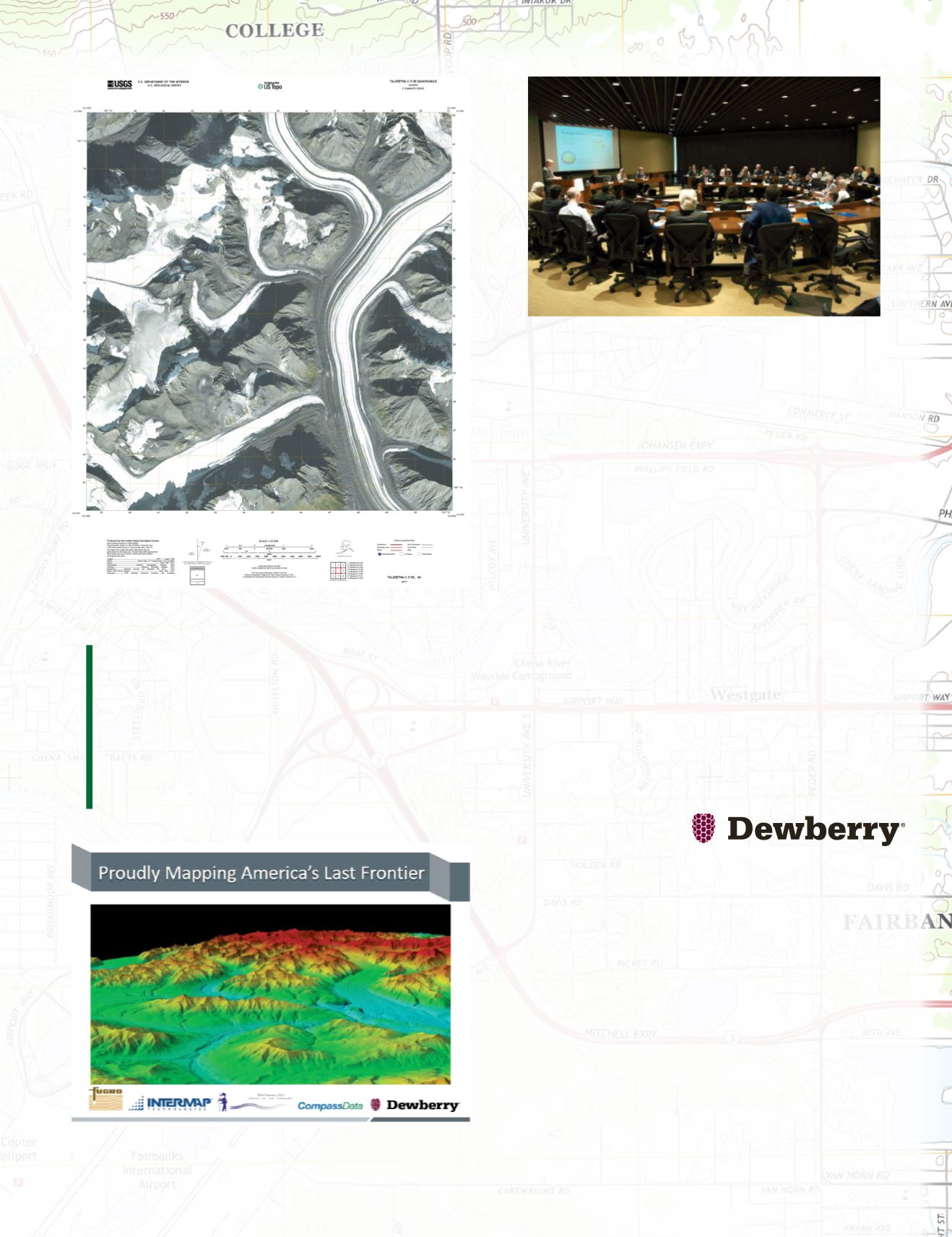
Figure 15. Glaciated US Topo with orthoimagery layer turned on.
Figure 16. the proud Dewberry team includes Fugro, Intermap, JOA Surveys and
CompassData.
Lastly, it gives me great joy that America’s Last Frontier was
mapped with such outstanding teamwork, not just by the
Dewberry team but by numerous federal and state stake-
holders. In addition to organizing Skybreaking events that
showcased the SAR aircraft and technology, Nick Mastrodica-
sa of AK DOTPF arranged for OMB and over 20 other federal
agencies to meet for the first Alaska Mapping Roundtable
in Washington, D.C. in 2012 (Figure 17). After briefings by
Alaska’s Lt Gov Mead Treadwell, Dave Maune, Nick Mast-
rodicasa and briefers from USGS, agency executives unan-
imously agreed on the urgent need for accurate mapping of
Alaska which holds major natural resources and is becoming
more vital each year as marine navigation routes are opening
through the Arctic and as the search expands for mining of
critical minerals for USGS’ Earth Mapping Resources Initia-
tive (Earth MRI). Ultimately, $66.3M in funding was received
from USGS, the State of Alaska, NRCS, BLM, NPS, DOD,
USFS, and FWS. Senator Lisa Murkowski led the effort to
obtain needed funding at the federal level. Project success
can be attributed to collaboration by all involved. This was a
total team effort and its major reason for success.
Dr. Dave Maune, is an
Associate Vice President
at Dewberry Engineers,
Inc., headquartered in Fairfax, Virginia, with more than 50
locations and 2,000+ professionals nationwide. Dave is best
known as the editor and principal author of all three editions
of The DEM Users Manual published by ASPRS in 2001,
2007 and 2018, and as the author of the National Enhanced
Elevation Assessment (NEEA) that provided the blueprint for
USGS’ 3D Elevation Program (3DEP) based on QL5 IfSAR
of Alaska and QL2 lidar elsewhere in the U.S. Dewberry is
a full-service A/E firm that specializes in geospatial technol-
ogies, products and services, including remote sensing data
acquisition and processing, data analytics, digital ortho-
photography, emergency response, geospatial benefit-cost
analyses, GIS, topographic and hydrographic mapping and
surveying, and independent QA/QC of geospatial data provid-
ed by others.
Figure 17. Lt Gov Mead Treadwell briefing the Alaska Mapping Roundta-
ble on June 28, 2012 inWashington D.C. Image courtesy of USGS.
“This data and information is provided to the world, license-free, in
the public domain, for its use and application in all areas previously
mentioned as well as recreation and scientific research. These maps
are easily downloaded electronically and used for a wide variety
of applications from recreational, to city planning, to emergency
response. Lastly, data layers such as hydrography, roads, trails,
boundaries and other data layers will be enhanced because of the
new, more detailed elevation data.” By Kevin T. Gallagher, USGS.


