PHOTOGRAMMETRIC ENGINEERING & REMOTE SENSING
April 2020
209
GIS
&
Tips Tricks
By Dave Maune, Ph.D., CP, GS, PS,
and
Al Karlin, Ph.D, CMS-L, GISP
Al Karlin, Ph.D, CMS-L I P
Looking for Topographic Terrain or Bathymetric Lidar Data? Look to the NOAA Digital Coast
It was over 10 years ago, in 2007, that the US Geological Sur-
vey (USGS), the National Aeronautics and Space Administra-
tion (NASA), and the Association of America State Geologists
(AASG) cited the need for a national lidar (light detection and
ranging) dataset (Stoker, 2007). In the years since the incep-
tion of the USGS 3D Elevation Program in 2012, the USGS,
in cooperative projects with federal, state and local agencies,
has funded the collection of over 2 million ASPRS LAS tiles;
that equates to approximately 12 trillion lidar point cloud re-
cords and not to mention the IfSAR data collected for Alaska.(
. Since 1999, the National Ocean-
ographic and Atmospheric Administration (NOAA), through
the Digital Coast Partnership has been collecting and distrib-
uting lidar data. The lidar (and derived products) are available
from several sources. Without getting too much into the weeds
regarding the technical aspects, here is my favorite source.
The NOAA Digital Coast Data Section
stores and distributes lidar (and other) data
sets for coastal states (note: if you know that you are only looking
for lidar data, you can go directly to the Digital Coast Data Ac-
cess Viewer (DAV) and bypass the other data available (https://
coast.noaa.gov/dataviewer/#/lidar/search/). The lidar data are
searchable through either a geo-interface, i.e. draw a box and
the search returns available datasets, or through a simple two
parameter (what type of data are you searching for, and where in
the US) search interface. Alternatively, you can browse through
the available datasets (Elevation, Land Cover, Weather/Cli-
mate, Imagery, and Economics/Demographics) by category.
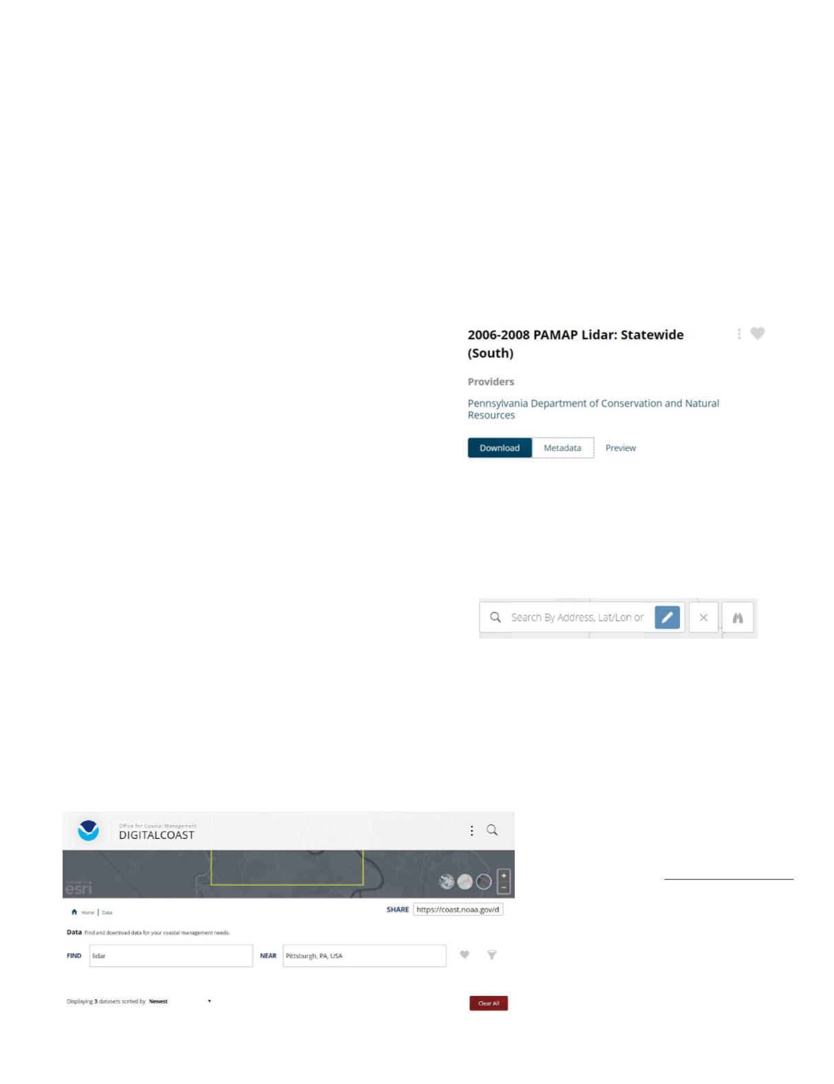
In this example, I chose to find “lidar” data (Find box) near
“Pittsburgh, PA, USA” (Near box) and the search returned
three (3) datasets.
One of the nice features of this search utility is that you can
preview the geographic extent of the dataset (Preview) and
read the Metadata (Metadata button) before you go to the
Download button to get the data.
Finally, when you go to the Download button and click on “Cus-
tom Download” you get a map in a new window showing the
footprint of the dataset. You can zoom/pan to find your area of
interest, and use the “Draw Search Area” tool (pencil draws a
box), or enter an address, or enter the Lat/Lon to find the data.
Once you have completed the search, to download the data,
put it into your cart and select, from dropdown choices, the
Projection & Datum, Geoid Model (in Advanced options),
Output options (points, rasters, derived products such as con-
tours and/or intensity images) and file format (LAS, LAZ, AS-
CII). Enter you e-mail address, review your order, and wait.
You will receive your “order number” and confirmation for
your order on the last screen.
Photogrammetric Engineering &
Remote Sensing
Vol. 86, No. 4, April 2020, pp. 209–211.
0099-1112/20/209–211
© 2020 American Society for
Photogrammetry and Remote Sensing
doi: 10.14358/PERS.86.4.209


