PHOTOGRAMMETRIC ENGINEERING & REMOTE SENSING
January 2016
13
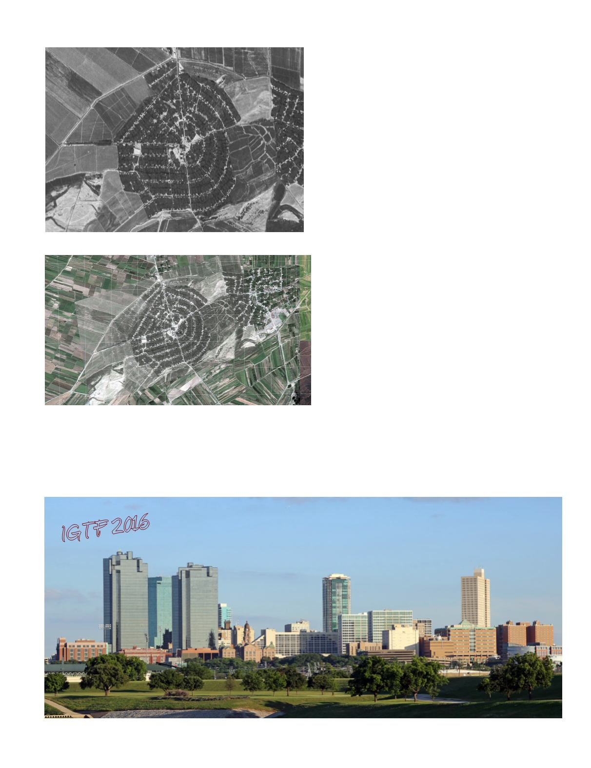
Figure 13. Distorted Corona original (excerpt).
After distortion correction of the full strip, the area shown
in Figure 13 was superimposed on Google Earth Pro, along
with an overlay of a UTM-WGS 84 grid in Figure 14.
I
n
C
onclusion
The data in the Corona imagery forms a historical archive
for a large area of the world during 12 years of the Cold
War. When rectified to remove geometric distortion, it
may be compared accurately with current satellite data to
evaluate landscape and other changes after five decades.
A
uthors
Irwin Scollar
Cologne University, Germany.
Nikolaos Galiatsatos
Royal School of Military Survey, UK
Clifford Mugnier
Louisiana State University, USA
Figure 14. Nalbandyan, Armenia, Corona KH-4B image overlay
Google Earth Pro plus UTM WGS84 grid, 500 meter squares.
IGTF 2016
HTTP://CONFERENCES.ASPRS.ORG/FORT-WORTH-2016/BLOG
S
ee
page
1
for
conference outline
.


