PHOTOGRAMMETRIC ENGINEERING & REMOTE SENSING
January 2016
17
T
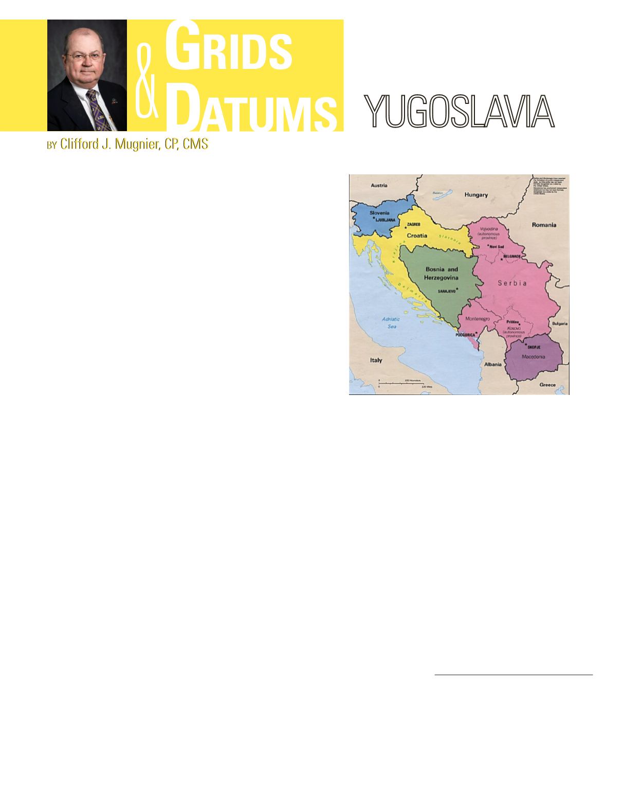
his month’s topic is about Eastern Europe
and specifically the former country of
Yugoslavia. Upon the collapse of Austria–
Hungary the Kingdom of Serbs, Croats, and
Slovenes was proclaimed in 1918. The name was
changed in 1931 to Yugoslavia and divided into 9
republics not based on racial lines. The principal
Yugoslav mapping agency became the 1920
Geografski Institut Jugoslovenske Narodne Armije
(GIJNA) Geographic Institute of the Yugoslav
Peoples’ Army, formerly the 1888 Vojni Geografski
Institut (VGI) Military Geographic Institute. Prior
to that, the land survey had been carried out by
the Viennese Military Geographic Institute (1851-
1908) for Serbia and by the VGI in 1871 for Croatia
and Slovenia.
Between the two World Wars, the Italian Istituto Geografico
Militare produced topographic series of the then Italian
territories of Venezia Guilia and Istria. During World War II
both the German Generalstab des Heeres (General Staff of the
Army) and the British Directorate of Military Survey, War
Office (Geographical Section, General Staff) reprinted and
revised many Yugoslav and Italian maps.
The coordinate systems that have been used for Yugoslavian
lands have been quite diverse through history. Geographic
coordinates have been based on the Prime Meridians of Paris,
France; Ferro, Canary Islands; Greenwich, England; and also
some temporary usage of the Vienna University Observatory
where: Φ
o
= 48° 12´ 35.50˝ N, Λ
o
= 16° 22´ 49.98˝ E (later offset
to Paris).
The names of the classical horizontal datums found in the
former Yugoslavia include Hermannskogel 1871, K.U.K. VGI
Vienna University System 1892, Pulkovo 1942, and European
1950. The Vienna University System 1892 used the now
obsolete Zach 1812 ellipsoid and the Hermannskogel 1871
datum used the Bessel 1841 ellipsoid of revolution where the
semi-major axis (
a
) = 6,377,397.155 meters and the reciprocal
of flattening (
1
/
f
) = 299.1528128. The “Parisian” system of
mapping (based on the Prime Meridian of Paris, where the
offset from Greenwich is accepted as λ = 2° 20´ 13.95˝ E ) was
cast on the polyhedric projection from 1878 to 1959.
The polyhedric projection is aphylactic in that it is not
equal-area (authalic). Also, it is not azimuthal, and it is not
THE FORMER
conformal (orthomorphic). The aphylactics used for large
scale topographic mapping (and grid systems) were adopted
because of their ease of construction.
For a historical perspective of howmaps were produced before
photogrammetry, consider that a century ago, a mapping party
would leave the capital city some weeks
after
the departure
of the triangulation parties. Since the lay of the land to be
mapped was largely unknown, there was little opportunity
to plan where control would be established and mapping
could proceed. Based on where triangulation stations were
established, the topographer would then proceed to interpolate
between those stations and map the topography with plane
table and alidade. Since there was no prior knowledge of what
and where mapping was to be accomplished, no graticules were
prepared in advance. The result was that the manuscripts had
to be prepared first at the base camp. Aphylactic projections
were developed so that with a simple book of projection
tables, the topographer could draft the graticule on a sheet of
starched linen in a tent. Although we can be critical of such
Photogrammetric Engineering & Remote Sensing
Vol. 82, No. 1, January 2016, pp. 17–18.
0099-1112/16/17–18
© 2015 American Society for Photogrammetry
and Remote Sensing
doi: 10.14358/PERS.83.1.17


