PHOTOGRAMMETRIC ENGINEERING & REMOTE SENSING
May 2019
335
Advanced Errors Modeling Capabilities
Most processing software used for UAS-based
imagery employs sophisticated error modeling
algorithms to compensate for the shortcomings
of the consumer grade cameras and the low-
cost GPS and IMU devices. Performing camera
self-calibration during the bundle block
adjustment solution is crucial to the success
of any UAS mapping mission. Modeling errors
in sensor position due to the low-grade GPS
receivers used with many low-cost UAS is
of no less importance than the camera self-
calibration process. Camera self-calibration is
a well-known technique developed during the
last few decades within the photogrammetric
community and is adopted by the new UAS
image processing software. Developers of these
new software need to adopt the techniques
developed by the photogrammetric community
to model GPS and IMU shifts and drifts.
UAS and ASPRS
Mapping Standards
Many times, I am faced with the question of
whether I should accept mapping products from
UAS. My answer is always yes, as long as you
consider the following common-sense practices:
A. Make sure that the data provider follows a
stringent photogrammetric workflow and
is aware of the four criteria listed above for
producing accurate mapping products.
B. Always remember that the derived
product will never be as accurate or more
accurate than the ground control points
used in the photogrammetric process to
generate the product.
C. Demand that the products meet an
industry mapping accuracy standard. For
this, I suggest specifying the new “ASPRS
Positional Accuracy Standards for Digital
Geospatial Data”
2
in the contract. This
is the only standard designed for digital
geospatial data. The new ASPRS mapping
accuracy standards simplify the process
while providing legal protection in case
the data producer fails to meet the data
quality requirements specified in the
contract. Once you specify the accuracy
for the final products in the contract, the
new standards set the required accuracies
that need to be achieved during the various
phases of product generation. For example,
the standards set the required accuracy for
the ground control points and the accuracy
of aerial triangulation without specifying it
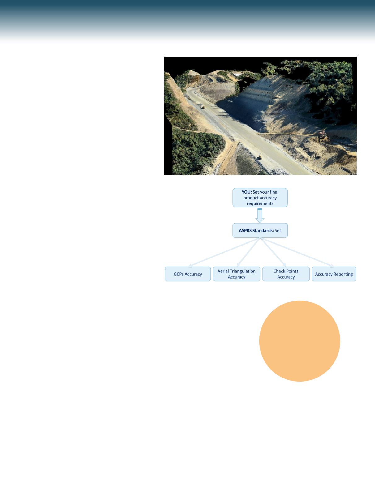
in the contract, see Figure 6.
In addition to setting the accuracy of the ground
control points required for the project and the
accuracy of aerial triangulation, the standards
also specify the accuracy of the check points to
be used to verify the delivered product accuracy
and will dictate a formal accuracy statement to
be provided by the data provider.
Although some of the drone-based product
providers advocate the new ASPRS standards
when marketing their products, they pay little
attention to the meaning of product accuracy as
specified by the ASPRS standards. Frequently
Figure 5. High quality points cloud from consumer grade camera imagery.
Figure 6. The new ASPRS standards and products accuracy criteria.
3
“Offering the
capability of
processing UAS-
derived imagery is a
huge service to the
mapping-by-drones
community, when
practiced correctly
and professionally.”


