486
June 2014
PHOTOGRAMMETRIC ENGINEERING & REMOTE SENSING
LARS – T
he
L
aboratory
for
A
gricultural
R
emote
S
ensing
In early 1965, Purdue University researchers in the Botany and
Plant Pathology Department learned that faculty in Electrical
Engineering were doing work in an area of research referred to
as “pattern recognition”. Meetings between Drs. Shay and Hof-
fer and an electrical engineer, Dr. Roger Holmes, developed into
a plan to form an interdisciplinary team to attempt to apply pat-
tern recognition techniques to this multispectral scanner data.
A proposal to NASA from Drs. Hoffer and Holmes was funded
for the purpose of “establishing methods whereby various soil
and agricultural crop parameters may be determined remotely,
through a program of comparative multispectral sensing. Crop
and soil parameters to be studied include species identification,
state of maturity, disease conditions, soil types and soil moisture
conditions.” A companion proposal from Dr. Shay to the USDA
Agricultural Research Service was also funded, and these two
grants enabled the Laboratory for Agricultural Remote Sens-
ing, or LARS, to be established in February 1966. In addition
to Drs. Hoffer, Holmes, and Shay, the key early researchers at
LARS included Dr. David Landgrebe, Philip Swain and Terry
Phillips, from the Department of Electrical Engineering, who
formed the core of the data processing analysis team. Mr. Rob-
ert MacDonald came from IBM to become the Director of LARS,
and Drs. Marion Baumgardner, Chris Johannsen, and (later)
Marvin Bauer of the Agronomy Department provided agricul-
tural expertise. From the beginning, LARS was a very interdis-
ciplinary team, and by working together in a single laboratory
setting, faculty, research scientists and graduate students from
different disciplines were able to learn from each other and con-
tribute to the common goals in a very effective manner. The ba-
sic goal of the LARS team, initially, was to develop techniques
to digitally analyze multispectral scanner data of agricultural
crops. In 1969, LARS was renamed the “Laboratory for Applica-
tions of Remote Sensing” in order to better reflect the broadened
research activities of the group in forestry, geology, hydrology
and geography, as well as agriculture (Estes and Jensen, 1998)
E
arly
R
emote
S
ensing
A
ctivities
T
hroughout
the
C
ountry
At the same time that LARS was being established at Purdue
University, NASA also funded Dr. Colwell in the Department
of Forestry at the University of California to pursue the use
of remote sensing technology for forestry applications. Given
Dr. Colwell’s expertise in photo interpretation, the research
efforts at the University of California concentrated on the use
of multi-band photography and manual interpretation tech-
niques for forestry applications. Another grant was given to
the University of Michigan to continue to develop multispectral
scanning systems and to pursue the use of analog methods of
data analysis. Research at the University of Kansas on the in-
terpretation and applications of radar data was also supported
by NASA. Key people in this effort were Drs. Richard Moore,
Figure 5. The DC-3 of the Institute of Science and Technology (IST), Univer-
sity of Michigan (later, ERIM – Environmental Research Institute of Michi-
gan), used for many early multispectral scanner experiments.
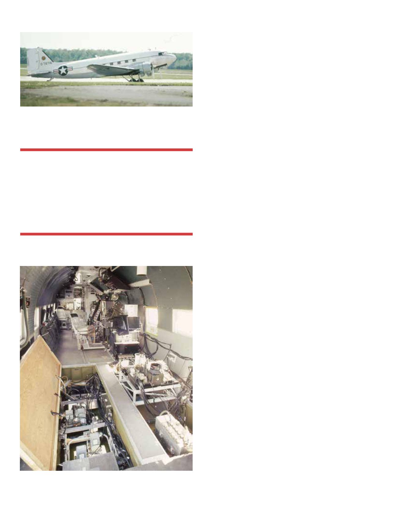
Figure 6. Interior of the DC-3, outfitted with multispectral scanners and
analog tape recorders, cameras and other equipment.
“Computer monitors or display devices of any
sort did not exist at that time, so to display the
data, a line printer and different alphanumeric
symbols were used to represent different levels
of reflectance or emittance in a particular
wavelength band, thus providing a rough gray-
scale map of the area.”


