Antarctic Meteorological Research Center (
AMRC
) and the
AWS
program (
AMRC
and
AWS
, 2014). To date, 133
AWS
s have been
built in the Antarctic as part of this program. The locations
of these
AWS
s are shown in Plate 1, marked by green triangles
and red dots. In this Plate, the red dots and red star represent
the stations considered in this study, and the corresponding
data were used as references for the method validation.
Experimental Data Selection
Only data acquired from the ice shelf were used in the experi-
ments, since the
MOD
29 and
MOD
35 products are available for
the polar sea ice, Greenland, and the ice shelf in the Antarctic,
but unavailable for the Antarctic ice sheet. The Ross Ice Shelf
is one of the biggest ice shelves in the Antarctic. The pixels in
satellite images covering this region can therefore be regarded as
pure pixels. Taking this factor into account, comparisons were
conducted using
AWS
data from the Ross Ice Shelf. In the experi-
ments, 165 cloud-free scenes from December 2004 to December
2013 were chosen, with several instances shown in Figure 1
.
Additional experiments were conducted using the weather
station data from Zhongshan Station. In this part, 33 scenes
identified as cloud free by
MOD
35 during December 2004 and
December 2013 were chosen, six of which are shown in Figure 2.
Due to the particularity of the Antarctic climate and the
impact of the polar night, only images from the summer were
used to retrieve the
IST
.
The
AWS
data are sometimes uncertain. Under clear sky
conditions, the temperature sensor can overheat when the
downward solar irradiance exceeds 240 Wm
-2
and the wind
speed is less than 4 ms
-1
(Hudson
et al.
, 2005; Hall
et al.
,
2008; Shuman
et al
., 2014). Strong winds can, however, sup-
press this effect. Thus, in this research, the acquired air tem-
perature values were not considered if the wind speed was
less than 4 ms
-1
. It should be noted that all the
MODIS
-based
IST
values (retrieved results and
MOD
29 product) correspond
to the location and time of the
AWS
measurements.
Methods
The theoretical basis for satellite-image-based
LST
is that the
total radiance emitted by the ground increases rapidly with
the increase in temperature (Qin
et al.
, 2001). Although much
effort has been devoted to retrieving
LST
from remotely sensed
imagery, this study proposes an effective approach for Antarc-
tic
IST
retrieval. The flowchart of the proposed
MODIS
-based
IST
retrieval method is shown in Figure 3.
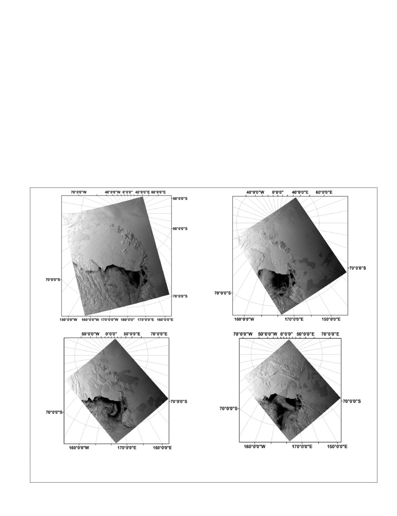
(a)
(b)
(c)
(d)
Figure 1. Four scenes of the MOD021KM data from the Ross Ice Shelf. The number of each scene consists of two parts, the year and the
Julian Day Number: “2013” is the year; “339,” “335,”“342,” and “358” are the Julian Day Numbers: (a) 01 December 2013 (No. 2013-
335), (b) 05 December 2013 (No. 2013-339), (c) 08 December 2013 (No. 2013-342), and (d) 24 December 2013 (No. 2013-358).
PHOTOGRAMMETRIC ENGINEERING & REMOTE SENSING
November 2015
863


