836
November 2016
PHOTOGRAMMETRIC ENGINEERING & REMOTE SENSING
E.
Remember to return the LAS file to Read Only
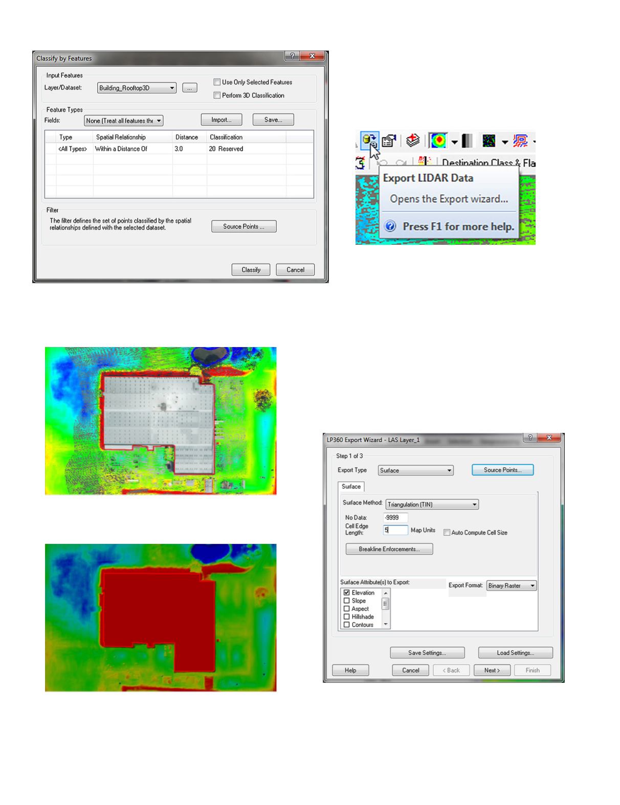
At this point, there are no LAS ground points within the
building rooftop polygon or within 3’ of it,
So… when you TIN the points, and enforce the MaxZ of the
rooftop as a breakline, you should get:
Notice the hydro-flattened pond to the North-East of the
building as a result of enforcing the WATERBODY breakline
feature class.
Step 4.
RebuildtheDTMintheareaofthebuilding
From the LP360 Main Toolbar, use the Export LiDAR
Data tool, to construct a DTM of the area around the
building.
UsingLP360,rebuildtheDTMintheareaofthebuilding,
making sure to enforce HYDROGRAPHICFEATURE,
WATERBODY, SOFTFEATURE and other breaklines
as necessary to hydro-flatten and hydro-enforce the DTM. Be
sure to include the Building_Rooftop3D feature and use the
MaxZ field as the elevation.
The District maintains its DTMs as 5000’ x 5000’ tiles, but
there is no need to rebuild the entire tile. In Step 2 of 3 on
the LP360 Export Las Data Wizard, simply choose the “Draw
Window in Map” option and use the Draw Window Tool to
draw a box around the building. Make sure to have some
“extra” around the building.
In Step 1 of 3, remember to set the Source Points (and
Flags) to Class 2 (and set the Withheld and Overlap flags if
necessary). Use the Breakline Enforcement button as below:


