
BETHESDA Md. December 22 2014 – The Pecora 19 Symposium in conjunction with the Joint Symposium of ISPRS Technical Commission I and IAG Commission 4 was held November 17 – 20 2014 at the Renaissance Denver Hotel in Denver Colorado with great success for all involved and in attendance.
 The Symposium welcomed over 480 attendees from more than 25 countries around the globe for a unique and thought provoking two and a half days of technical sessions. All industry segments were well represented with 39% of the attendee base from the Commercial side 29% from Academia and 32% from Government. More than 190 speakers presented in 35 sessions ranging in topic from “UAS and Data Analysis” to “Landsat and Sentinel” “Land Cover Change” “Mobile Mapping Technologies” and many more. “The caliber of sessions at this symposium has been the best I’ve experienced …” said one attendee.
The symposium theme Sustaining Land Imaging: UAS to Satellites carried throughout and particularly with the opening plenary session where Tom Holm Pecora Steering Committee Chair U.S. Geological Survey EROS,; Charles Toth President ISPRS Technical Commission I ISPRS/IAG Commission Committee Chair The Ohio State University and Dorota A. Grejner-Brzezinska President IAG Commission 4 The Ohio State University welcomed all attendees for an opening plenary titled “Landsat: A Vision Realized!” with Dr. Berrien Moore III. Moore gave a brilliant presentation on the importance of the Landsat Program to the Nation and the world.
The morning of Wednesday November 19th brought in a full room of eager attendees to hear the latest news from a panel of experts in the second plenary session titled “UAS to Satellites: Platforms Sensors Technology and Systems”. This esteemed panel included Dr. Kevin P. Price EVP Research and Technology Development with RoboFlight Systems LLC; Dr. Gary Wick Physicist NOAA Earth System Research Laboratory Physical Sciences Division (ESRL/PSD) on detail to the NOAA Unmanned Aircraft Systems Program; and Mr. Anthony Carfang Ph.D. candidate at the University of Colorado’s Research and Engineering Center for Unmanned Vehicles.
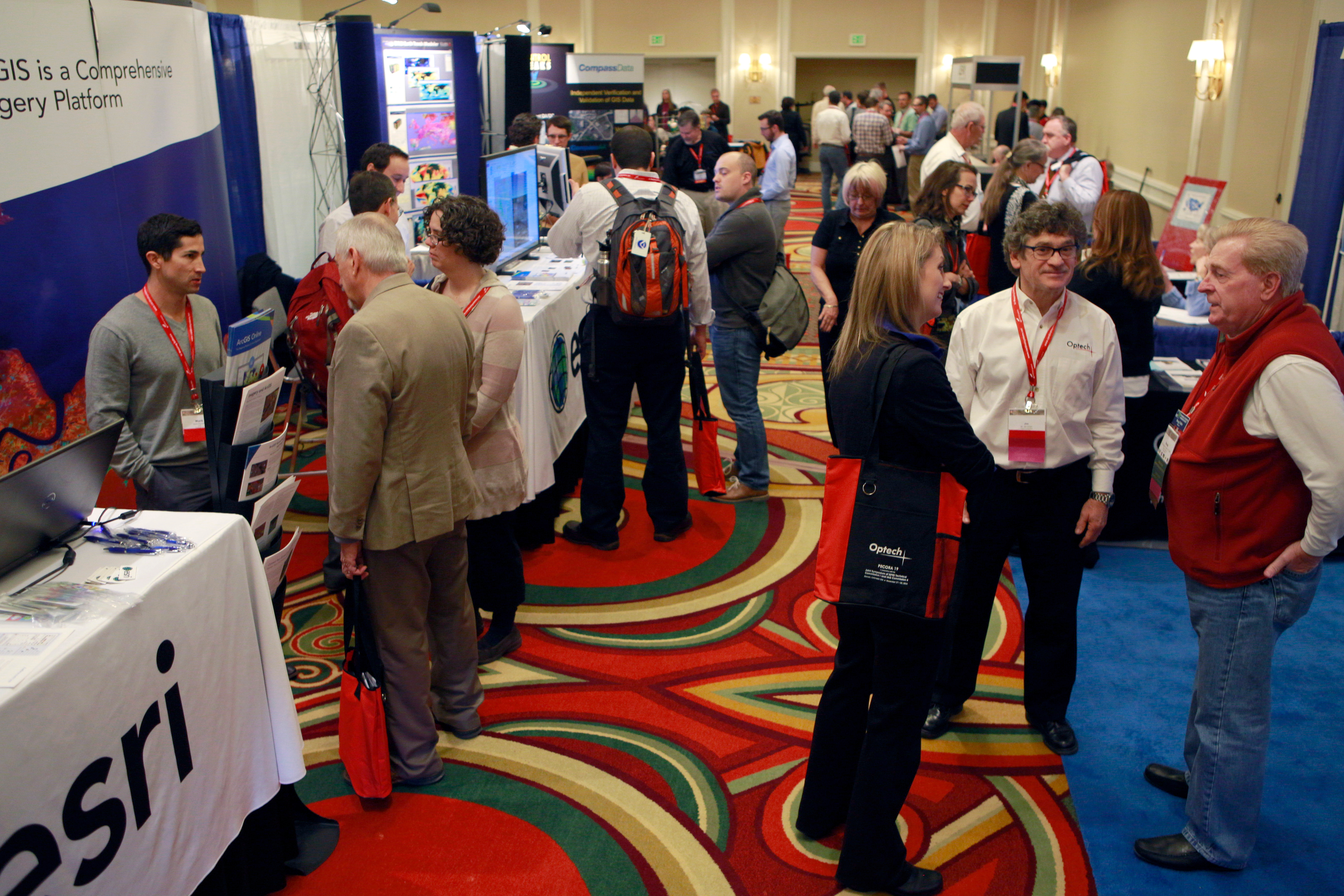
The symposium Technology Floor was also a bustling area of activity throughout the week. With industry developers 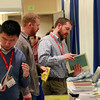 manufacturers government agencies survey/mapping firms agriculture firms and companies from UAS-related industries the Technology Floor held two lunches for the attendees and the always popular Exhibitors’ Reception. Over 35 Poster presenters also filled the Technology Floor and foyer with large format technical posters depicting research in areas such as “Access Efficiency and User Engagement of Remote Sensing Data Services at EROS USGS ” “Development and Processing of Landsat TM and ETM+ Imagery to High-Level Products” and “Understanding Spatio-Temporal Mobility Patterns Among Senior Child/Student and Adult Using Smart Card Data”.
 Wednesday afternoon included another respected panel of experts for a session titled “Land Change Science: User Perspectives Panel Discussion” focusing on the remarkable progress over the last several decades towards developing data sets that characterize the Earth’s land surface properties ranging from local to global scales. Mr. Jim Irons NASA moderated this session for an active and engaging discussion between Professor Chris Justice Department of Geographical Sciences Chair University of Maryland; Dr. Alan Belward Land Resource Management Unit European Commission Joint Research Centre; and Dr. Tom Loveland U.S. Geological Survey.
The closing plenary session on Thursday November 20th “Petapixel Computing for All: Transforming Remote Sensing in 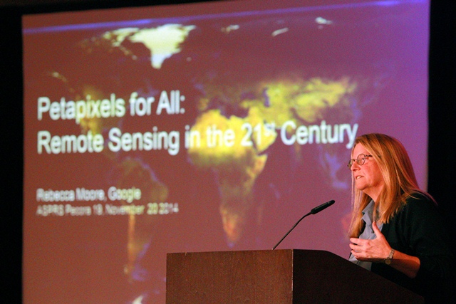 the 21st Century” brought in a crowd for standing room only and a fascinating presentation from Ms. Rebecca Moore Founder of the Google Earth Engine & Earth Outreach Google Inc.. Moore demonstrated some of Google’s most recent mapping tools to showcase some of the world’s most pressing problems in environmental conservation human rights and cultural preservation.
The leadership and commitment of the United States Geological Survey (USGS) National Aeronautics and Space Administration (NASA) the International Society for Photogrammetry and Remote Sensing (ISPRS) the International Association of Geodesy (IAG) the American Society for Photogrammetry and Remote Sensing (ASPRS) and all symposium sponsors especially the Technical Program Committee Chairs – Bruce Cook Tom Holm Jim Voglemann and Charles Toth created this fantastic program incorporating industry leading presentations and fascinating plenary discussions for a resoundingly successful symposium.
Recordings of the plenary sessions will be available on the ASPRS website at https://www.asprs.org/ASPRS-Past-Events.html and proceedings are available at https://www.asprs.org/Conference-Proceedings.html. Photos from the symposium are available for public purchase at http://creationize.smugmug.com/buy/46000249_J776Jk/.